Quick! Now that school is on break!
You’ve got a bit of time to gather the tribe of kids, family and friends to get out west and see a part of North Dakota that’s easily missed. The best part is, the biggest cost will be your gasoline because there’s plenty to do in Western North Dakota that will build memories. Here are five free things to finish out your summer memories.
#5 Fort Union Trading Post

Fort Union Trading post — an authentic reproduction. Photo courtesy of Wikimedia Commons
If you and your family like regional history or Lewis and Clark experiences, then head to the northwestern part of the state, and get right up to the Montana border. About halfway between Sidney, Montana and Williston, North Dakota is the Fort Union Trading Post. Late summer, it’s a fairly quiet place for you to explore. In June the rendezvous brings the era of the early 1800’s to life. Decades before the Civil War, settlers, trappers, soldiers and tribes from the Northern Plains met here peacefully to trade goods.
This free stop on your late-summer tour of western North Dakota is best enjoyed by older children and adults. (But don’t worry, there are several other nearby sites such as Fort Buford and the Confluence Center that will keep the younger ones entertained. Or the best for all family members is nearby. It’s #1 in this list.)

Approaching from Sidney, take a gravel road north to the river to see how the trading post must have looked to trappers and tribes from across the river — minus the wheat fields.

From inside the Fort, looking back to the other side of the river, in the trees where the shot above was taken.
To keep the youngest members of your group entertained, you probably won’t stay here long, but there are two more stops nearby. Head around the bend to Fort Buford where you can camp (for a fee) or explore the Confluence Visitor Center and get three views of early Plains life.
#4 Wander Medora (but is this really free? Ice cream has a cost.)
It doesn’t cost anything to wander the streets of Medora. There are several good places to eat. If you’re an ice cream lover you’ll get surprisingly large servings. Ice Cream at Medora is actually a summer goal for many families. It’s easy to get to Medora, right off of I-94, about 25 miles from the Montana border.
If you and your family want to take advantage of the exercise opportunity, take your bicycles. It’s free to pedal the streets and trails nearby. Many families do. There’s no cost to bicycle the town, take the East River Road south of town, or take the recreation trail across the Little Missouri River to the west of Medora.
An option that is not free is to rent bicycles in town. Or bicycle in to the south unit of the Theodore Roosevelt National Park, you’ll have to pay the entrance fee. Its entrance is on the edge of Medora.

A family takes advantage of the paved bicycle trails around Medora and out in the country.

Pay the entrance fee and take a bicycle ride in to the South Unit of the Theodore Roosevelt National Park. Take supplies, though. You will need to carry plenty of water.
North Dakota’s legendary Maah Daah Hey trail is a mountain biker’s dream. Families can get access to as much or as little of it as they want — free. You don’t need a bicycle. Your feet go with you, right? Take them and use them.
Maps of the trail are available on-line, or buy the most comprehensive map from the U.S. Forst Service.
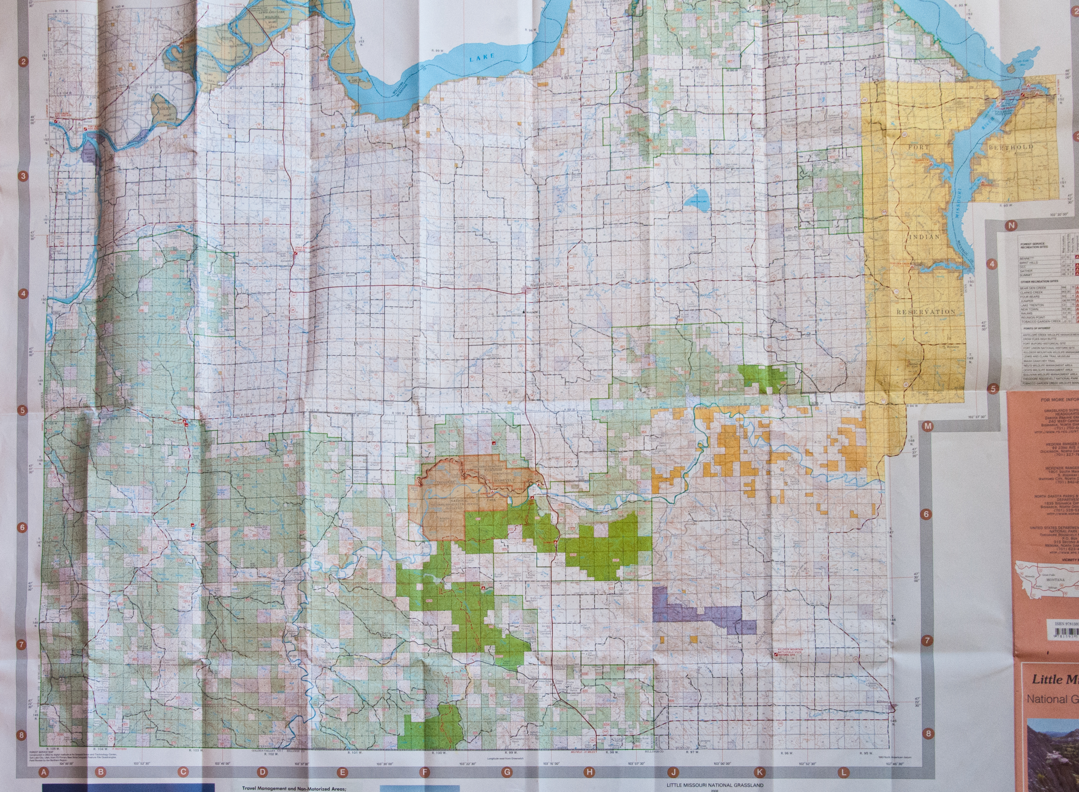
The U.S. Forest Service map costs about $13 and is the most valuable tool (other than your camera) that you can take.
#3 Hike the Maah Daah Hey — head to the Ice Caves
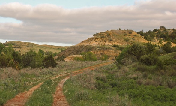
Even short little hikes will keep the youngest in your family entertained if they know the destination is right down the path. For a short hike with a rewarding destination, park at the Ice Caves Maah Daah Hey parking lot and take a half-mile hike to a cooling spot. The Ice Caves is part of the Maah Daah Hey trail. It’s about 10 miles south of Grassy Butte on Highway 85 and then 10 miles west on a gravel road #713. In the spring, snow run off melts in to the cave and freezes on the floor. This time of year, there’s no ice, but it’s a great place to climb inside to cool off.

Inside one of the Ice Caves

Hike around to the north of the Ice Caves to get a spectacular view of the North Dakota Badlands. The caves are directly below where I’m sitting on the edge.
The Maah Daah Hey trail is marked with the turtle-branded sign posts, so it’s easy to follow the route. Markers along the way give you information of different trails you can take

Hike the Maah Daah Hey to the Ice Caves. It’s a short jaunt, less than a mile from the Ice Caves Parking lot. From the Magpie Campround it’s about 3 miles, a full afternoon hike.
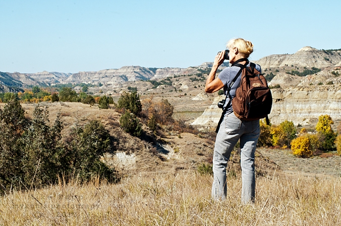
#2 North Dakota grasslands
A short hike in to the Long X Trail south of Watford City will open the valley to your family’s challenge. You can stay on the trail at the bottom of the valley, or pick a point and climb to the top.
Some of the best trails for a family are the Long X Trail south of Watford City on the southern edge of the Little Missouri River. Near Grassy Butte are the Beicegel Trail and the Bennett Creek Trail. Signs on Highway 85 direct you to both trails. They are easy trails, both give you a flat starting out point and provide hill-top challenges that reward you with a spectacular view. Tall wooden markers along the trail are easy to follow.

The best views are from up on high.
Climbing seems is a favorite passion of children, so pick a high point that matches their skills. Even the shortest of the tall bluffs and buttes gives kids a chance to build their muscles and their confidence.

A rest break is called for on the climb up a bluff off the trail.

Oliver, my 6-year old grandson likes the challenge of a good climb
Click here to Read more about the Maah Daah Hey south of Medora
#1 Fairview Lift Bridge and the Cartwright Tunnel
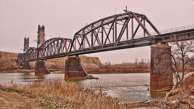
An autumn shot of North Dakota’s only lift bridge was retired from service before it ever lifted for a steamboat.
This free exploration will entertain the entire family. It’s on highway 200 at the North Dakota-Montana state line. To the west of the Fairview lift bridge, or on the right side of this above photo is the parking log and entrance to the fenced-off walkway across the bridge.

The safety fence gives families a safe place to walk the Fairview Lift Bridge. Children love the view from high above the water.
Once you start the walk across the bridge, you’ll get a great view of the well-maintained park below where you can enjoy a picnic in the shade of the trees.

Below the Fairview Lift Bridge is a park where you can fish.
The final reward of the Fairview Lift Bridge is the Cartwright Tunnel.
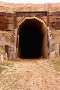
Built by hand, trains passed trough this tunnel until about 1986.
Until the mid-1980’s trains passed through the tunnel across the bridge. It’s a quarter-mile long pass through the hill and provides children with a memorable experience — but take a flashlight. It gets dark in there until you get close to the opposite end.

The Cartwright Tunnel has a slight bend in it. Flashlights illuminate the way.
Exploring the tunnel thrills youngsters, but oldsters will be impressed with the knowledge the tunnel was built by hand by local ranchers and farmers using picks, shovels, ox or donkey carts. It’s guaranteed that you will at some point utter one word: “wowl!” It’s more impressive than you would think of a bridge and tunnel.
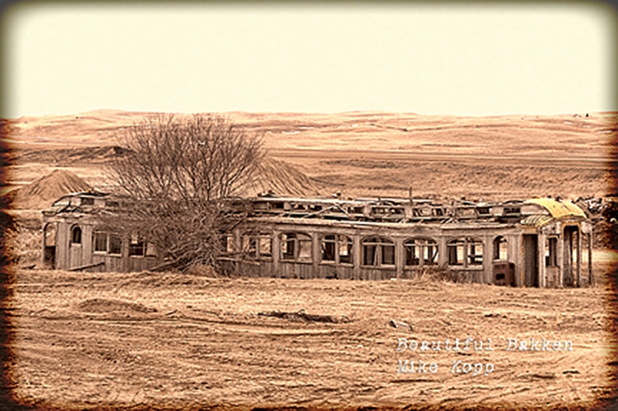
Click here to see the Facebook Page called “Beautiful Bakken” for more on the bridge and tunnel
The nearby Snowden Lift bridge is still in use. It’s downstream about 12 miles. You can see more about it here.

Downstream (north) of the Fairview Lift Bridge is the Snowden Lift bridge. Though it no longer lifts, trains still cross the river on the Snowden bridge.
Click here to see more about the Snowden Lift Bridge
Admittedly, these free family features are on the sparsely settled region of North Dakota. So, if you’re planning a visit, pack a picnic, or plan to stop in Sidney, Mt, Williston, ND, Medora, ND, or Dickinson, ND for a bite to eat and a break from your day of discovery. It’s all free, if you take a lunch, pack your bicycles if you want, and explore legendary North Dakota.