Here’s how to enjoy Lake Sakakawea for free at McKenzie County

This North Dakota county gives you nearly unlimited access to outdoor recreation — free!

Sunset over Lake Sakakawea at McKenzie County.

You don’t need a boat to enjoy Lake Sakakawea.  The magnificent lake is 180 miles long with 1,530 miles of PUBLIC shoreline.

Plenty of opportunities to wade in the water to cool off on a hot day hike.

As we found out, that means you can explore, hike, bike for days on end.  Find a bay or inlet and you can camp next to the water, or if it’s a hot day, dive in and cool off. It’s what we did, and here’s all you need to know to enjoy the Lake.

Hiking the shoreline north of Charlson along Lake Sakakawea


First, a little background:

The Army Corps of Engineers created and maintains the lake; it owns the immediate shoreline. It says the lake covers 382,000 surface acres making it the largest manmade lake in North America where the entire shoreline is open to the public. It is world-famous for its recreation, walleye fishing and its paddlefish snagging.

History

Without a ferry system, McKenzie County farmers struggled to get grain to a nearby rail line across the Missouri River.

Lake Sakakawea was formed in the 1950’s by damming the Missouri River. Even before it was a lake, the River was a transportation barrier. The river challenged McKenzie County farmers to get their crops to market, going north across the river to Williston.

Ferries such as those at the ghost town Banks on the Tobacco Garden Creek helped farmers move their grain.  Eventually, a bridge across the river at Williston helped ease transportation.

After WWII, the Army Corps of Engineers built a series of dams on the Missouri River, each one backing up on to historic tribal land and Indian Reservations. In 1956, the Garrison Dam swallowed up the largest amount of historic land in the new dam system.

Garrison Dam created Lake Sakakawea and flooded hundreds of thousands of farmland, and homes. Courtesy of State Historical Society of North Dakota (B8081).

The lake became a recreation attraction. It flooded some 150,000 acres, three towns, and several villages. It divided the Fort Berthold Indian Reservation so that two districts are south of the lake and three are north of the lake.  Lake crossings are about 70-miles apart at the dam itself or at the Mountrail County/McKenzie County crossing, Four Bears Bridge.

Some of the towns and villages flooded by the creation of Lake Sakakawea.


What to do

If life before the dam intrigues you. The Three Affiliated Tribes Museum on the eastern edge of McKenzie County has a full display of pre-lake years.   It’s that large A-Frame building inside a wrought-iron fence north of the Casino.  We discovered you will need to check ahead to see if it is open.  You can call 701-627-4477.  Generally, it is said to be open from 10:00 a.m. to 4:00 p.m.  That’s not always the case, though.  The last two times we attempted to visit were during those hours, but it was closed.

Admission isn’t free but close.  The last time we were there it was $3.00.

If you are successful, head to the second floor. That’s where we found the most interesting displays.  It’s an eye-opener to learn the history of the Mandan, Hidatsa and Arikara nation.  It will shape your views on the region.

If you are in to land-based activities, you’ve got hundreds of miles of opportunity.  Many locations are easily accessed by following two-track trails or no-maintenance roads.  The public access shoreline provides landlubbers the opportunity to hike and explore, swim, camp, view waterfowl and other birds. We like to drive north from Highway 23 on what is designated to be Highway 1806.  It’s a good idea to be in a pickup truck, or a high-clearance vehicle to access the lake. Turn off 1806 to the north and explore the two-track trails.  We’ve done it several times, but only when it’s dry enough that we won’t get stuck.  The dog gets excited about this time because we slow down to about 5 mph and weave our way through the hills and valleys to the shoreline.

In the winter, when the lake’s many bays and inlets freeze over, cross-country skiing is possible.  Snowmobilers often ride the ice and snow.

Pontoon and fishing boats are the most popular boats on the water. Up until about 1970, hydroplane boats raced on the lake, but floating trees and other debris made it too dangerous.

On the water, pleasure boats are commonly seen with passengers enjoying the vast expanse of water. In addition to swimming, water skiing, jet skiing, and scuba diving are just some of the favorite activities.

Fishermen travel from across the world to catch walleye, northern pike, and salmon. The waters also yield a good harvest of smallmouth bass, catfish, yellow perch, and trout.

For a few days in the spring, on the upper reaches of the lake, paddlefish snagging attracts thousands of people to the upper reaches of the lake on the northern edge of McKenzie County. The prehistoric fish lay on the bottom of the river where anglers snag them and harvest their eggs as caviar.

Click: The Williston Herald has a great story about paddlefish snagging.

 How to get there:

East of Watford City on Hwy 23, you access Lake Sakakawea at Four Bears. The mile-long Four Bears Bridge spans the Missouri River and Lake Sakakawea

Drive north or east of Watford City in McKenzie County. State Highway 1806 north or State Highway 23 east will take you to the shores of Lake Sakakawea.

If you use Google Maps, you’ll get something like this (the complete round trip with an extension to Four Bears is almost 3 hours.  But if you are just going to one spot, the drive is less than one hour):

Easy access from Watford City to Lake Sakakawea.

Our Recommendation

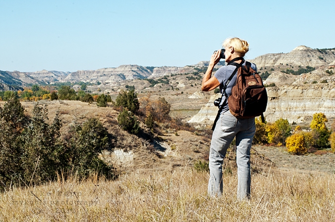
We were not boating when we explored the region.  We went northeast of Watford City and then north past the ghost town of Charlson.  We always take with us a U.S. Forest Service Map ($13) to see all the back roads and trails that got us down to the lake for a good day of hiking, sightseeing, and swimming.  Another useful tool is Google Earth that gives you a precise location and a view of what’s ahead on the trail.

Imagine the steep valley that drops down below this tributary to Lake Sakakawea. You can hike along the top, or take a canoe to explore the shoreline.

If you own a kayak or canoe, just about any road that goes up to the lake from McKenzie County will give you access. Again, a U.S. Forest Service Map is most helpful to find those access roads.

We have accessed the waterscape on canoe.  This summer we’ll do it with a kayak.  It allowed us to get up in to some of the tributaries.  Exploring the upper reaches scratches the curiosity itch.

A canoe or other smaller fishing boats gets up in to some of the tributaries of Lake Sakakawea so you can explore hidden riches.


If you want to get out on the water for little money (not free)– consider renting a canoe or kayak.  You can follow the shoreline, investigate bays and inlets, and get a sense of what it must have been like for the Thomas Jefferson’s Corps of Discovery.


Admittedly, it’s hard to find a canoe or kayak to rent.  Are there any in Williston or Minot? I don’t know any rentals. Do you?

East of Williston in Williams County (directly across the lake from Tobacco Gardens in McKenzie County)  is Lund’s Landing. You can rent a kayak or canoe there for the day.

http://www.lundslanding.com/fishingboatrentals.htm

People who drive up from Bismarck have a couple of places where they can pick up a canoe or kayak in Mandan. They have multi-day rates so you can rent one day and return the next.

http://0317f38.netsolhost.com/rentals.html

http://www.paddleonnd.com/rentals.html#kayak

If you have a boat, here are a couple of good points to consider: the first access point is the Four Bears Peninsula, on the far eastern edge of McKenzie County, is a popular access to the water. A boat ramp, bait shop and large parking area will let you get out on the water. It will introduce you to Native American history of the region. Go in August to take in the Little Shell Powwow.  The peninsula extends south of the Four Bears Casino where people camp, fish and picnic.

Others recommend

(The goal this summer is to check out this highly recommended McKenzie County location.)

The second access point is Tobacco Garden Creek Bay — 2 miles east of Watford City on ND Highway 23, then 25 miles north and east on ND Highway 1806. The resort is open year round and is pet-friendly. A full-service restaurant serving: Breakfast, Lunch, and Dinner – with Prime rib every Saturday Night.  A convenience store providing Groceries, camping supplies, off sale beer, bait and tackle shop, gas on the water, and everything in between.  There are over 100 camp sites, two log cabins, family picnic shelters, two playgrounds, wireless Internet and hiking on the Birnt Hills Trail – a certified Lewis and Clark site.

We’re always looking for other free or low-cost opportunities to explore Lake Sakakawea.  What do you recommend?

Here’s another free spot in McKenzie County to explore

Subscribe to this blog to get more ideas to explore in this great state of North Dakota

To get a free 22 page travelogue to plan your trip in McKenzie County, just type in the word “McKenzie” in the subject field and send.


Golden Valley – the town that met the rail company halfway

Incredible marketing and entrepreneurship in 1900 started the happy little town of Golden Valley. Out of nothing, the town started and grew – and to this day Golden Valley gives you a reason to pull off Highway 200 between Hazen and Killdeer.

The disappearing tribute to North Dakota's indigenous people -- the Indian Head State Highway Sign. Just one or two remain along Highway 200 near Golden Valley.

The disappearing tribute to North Dakota’s indigenous people — the Indian Head State Highway Sign. Just one or two remain along Highway 200 near Golden Valley.


We like stopping there because it has a peaceful and protected feel to it. Nestled in a valley, noise, weather and outside traffic is minimal.  Plus, it has a couple of interesting shops for browsing and a great little place for food and libations.

snowy hilllside at Golden Valley North Dakota

Sunrise at Golden Valley, North Dakota

The town is a tribute to perseverance and entrepreneurship.

George V. Bratzel took lemons a corporation served him and turned them into proverbial lemonade.  He was a rail agent for the Northern Pacific Railroad in Hebron, North Dakota. The company shipped him to the far end of the state, to Beach.  Then, yanked him back to Hazen a couple of years later and fired him.  It turns out his supervisor at the railroad wanted his son to have a job, so Danielson was fired to make room for the son.

“Ha!” Bratzel said. “I’m just gonna make my own town!”

Northern Pacific told him, “Go right ahead, and we’ll build a rail line to your town.”

(I suspect NP didn’t think Bratzel would succeed – but he did.)

Bratzel searched for a location for his town; he traveled and surveyed the prairie north of Hebron, North Dakota. One late summer day, he spotted a valley about 40 miles north of his home. The colors of the valley were – you guessed it, golden.  And since the initials of his first and last name were GV, he named the town Golden Valley.

The First Golden Valley before it was moved next to the Northern Pacific Rail Line. (from the ND Historical Society collection.)

The First Golden Valley before it was moved next to the Northern Pacific Rail Line. (from the ND Historical Society collection.)

He called the Northern Pacific on its bluff, and it responded.  It built the line along the best route engineers could find.  It was about one-and-a-half miles from where George had set up his town. So again, turning those lemons into lemonade, he picked up the town and moved it to the railroad.

From NDSU library: paul-weiracuk (left) and james-opsahl (right) at the weiracuk homestead near golden valley-

From NDSU library: paul-weiracuk (left) and james-opsahl (right) at the weiracuk homestead near golden valley- Permission of the Germans from Russia Heritage Collection, NDSU Libraries, Fargo, ND – www.ndsu.edu/grhc

He promoted the town heavily, even sponsoring a free dance for all the region’s ranchers and farmers.  Isolated across the rolling prairie, families, as well as single men, looked for any chance they could find to socialize. A community dance, in 1914 was a rare event. That’s why all the neighbors from across the rolling prairie and distant towns came to see what he had built — Golden Valley. Some even moved to the new town.

Golden Valley about 30 years after it was moved to be near the RR tracks.

Golden Valley about 30 years after it was moved to be near the RR tracks. Permission from the Germans from Russia Heritage Collection, NDSU Libraries, Fargo, ND – www.ndsu.edu/grhc

Once the town was set up along the tracks, farmers brought their grain to town where they could make more money than if they hauled it many miles down the road.  They were willing to work for it even without a grain elevator.  They loaded rail cars one shovel at a time, pitching their grain from their wagon into rail cars.golden-valley-grain-elevator-at-sunrise

Later, the grain elevator was built and the town became a commercial and transportation center.  One of the more successful businesses was an earth-moving company that did much of the work on the Garrison Diversion projects.

One of the success stories of the region is marked with an antique truc.

One of the success stories of the region is marked with an antique truck.

Now the town’s main draw is the Saddle Sore Saloon where festivities are hosted, even outdoor street dances and wedding parties.

The Saddle Sore Saloon in Golden Valley is the central gathering point. The Saloon’s Facebook Page includes this photo and other like it.

For example, on Valentine’s Day, the dining room serves Prime Rib with baked potato, salad bar, and a desert for $24.00.


From the Saddle Sore’s Facebook page, a summer evening collection of motorcycles and vintage cars.


Across the street from the Saddle Sore is a curio store, a flea market of antiques and collectibles.

Across the street from the Saddle Sore is a curio store, a flea market of antiques and collectibles.

golden-valley-gas-pumps-nov-2016-copyAround the corner, one of the most brilliant Gems in the United States – a Harley-Davidson museum, with a motorcycle from each year – all of them in running order and operational.  The museum is bright, clean, and more impressive than most small town museums of any sort.  Ya gotta know the guy, to see it. It’s his private collection, but he’s willing to open it to let you in.

The private collection of Harley-Davidson motorcyles is a worthy attraction to the community.

The private collection of Harley-Davidson motorcycles is a worthy attraction to the community.

That’s why motorcyclists who like to explore the 2-lane highways of the prairie can put this on their destination list.  Anyone who likes photographic road trips, any time of the year will be rewarded with a trip to Golden Valley.  They may give a tip of the hat to tribal elder, historian and businessman August Little Soldier who did much to provide industry to the Three Affiliated Tribes.

And give a tip of the hat to the famous roadside bronc of Wayne Herman world bareback rider who will greet you.

golden-valley-cowboy-sculp-nov-2016-copy-2


Enjoy the cold that keeps out riff raff — healthy people do

It’s not easy keeping up your spirits when winter and polar vortexes catapult the thermometer in to a region well below zero.  What do you do to keep out the invading winter blues?  Some people fall prey to the knighthood of long dark nights when the kingdom of cold invades.

It is possible not to fall to the avenging onslaught of relentless waves of killer cold fronts, but you have to work at it. You have to look for it.  You have to venture out to see the beauty of the season.  That may mean adjusting your schedule a bit. The Golden Hour is mid-afternoon, that last hour when the landscape turns gold.  On a holiday, such as New Years Day, the first sunset of the year is mid-afternoon, about 4:30.  That is when I forced myself to break free from the clutches of the cold to get out with my camera to capture the day.

The first sunset of 2014

The first sunset of 2014

One of the things I’ve come to discover about North Dakotans is they accept the things they cannot change and change the things they can.  So, when record-breaking cold weather sets in, they know they can do nothing about the weather, but they can do something about their own comfort or their own activity.  Of course it’s easier to do nothing and fall prey to the demons of darkness.  Taking a step to fight back is what many healthy people of the cold north such as North Dakotans do every winter.

965859_719882948021983_1441034643_oskis point to the clearing other side of woods wtrmrk     Some will go cross-country skiing.  Cross Ranch, a quiet state park where groomed cross-country ski trails weave through a cottonwood forest that stood here when Lewis and Clark tugged their boats up the Missouri River.

For some of us, it means layering up.  I’ve spent the coldest days of the winter working in my anti-starvation work. Outside.  Attempting to stay warm while keeping the bills paid.I wear as many as 7 layers of clothing when I know I’ll be working outside. I caught this image of myself in the mirror of the tractor I was driving.

The John Deere way to view the winter.

The John Deere way to view the winter.

  • Short underwear
  • Long underwear
  • Jeans
  • sleeveless T-shirt
  • Long Sleeve T-shirt
  • Flannel shirt
  • Bib overalls
  • Hooded sweatshirt
  • Coveralls
  • Parka and
  • Hoodie face and neck protection

Camera and me in tractor cab

Not everyone has to work outside. And not everyone can resign themselves to the fact there are some things (like cold weather) that you just can’t do much about.  Sure, North Dakotans could sit at home and complain, and wait for spring, or they could get out and do something about it.  The North Dakotans I know choose to enjoy it.  For some, that means racing up a hill in to town.02-24-10 snowmobiles

Or for some who know they can’t change the weather, but they can change their activities, it means diving in to those winter hobbies.  I’m fortunate to have a wood shop where I teach myself how to build wood frames for my prints.

open door to wood burning stove logs inside

Wood burning stove keeps things warm and friendly on a cold winter night.

wood and the table saw  The wood stove sits quiet, unused and neglected much of the year.  However, this time of the year, it’s actually a rewarding way to get out of the cold.  I love burning wood to stay warm.

It’s all about attitude, isn’t it.  I think that’s one of the healthiest things about North Dakotans.  They work at keeping up their spirits when the cold keeps out the riff raff.  What’s a good way to enjoy winter and beat the winter blues?

7 wild reasons to see North Dakota in the fall — A photo safari (Part 2)

You’ve been busy all summer, and now winter is closing in. We’ve been blessed with a mild October..only a few snowflakes when some Octobers we’ve already had two blizzards.  So, here’s motivation to get out and see North Dakota wild before it get’s unbearable — check the wild open spaces of North Dakota.

Later in the day, especially along the river, you can see some of the state’s largest wildlife — mule deer and white tail deer. They’re not easy to see because they blend in so well. Deer in the brush, down in a slough will only pause a moment before they take off.

two-deer-crop-vig-sig

Deer in the brush, down in a slough will only pause a moment before they take off.

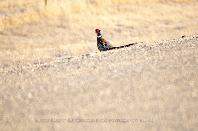
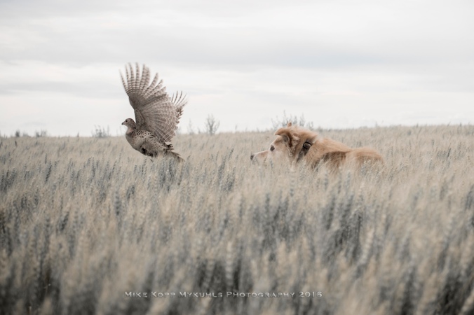
Pheasants are more easily spotted if you’re in central or southwestern North Dakota. They like the cover provided by wetland grasses, tall pastures and stubble fields. Often they’re along the side of the road and can get up just as you pass by, which can mean a broken grill.geese-pheasant-doesnt-fit-in-sig-smallIf you have a dog with you,  he can help you see them because they’ll huddle down in the tall grass until the last moment.bird-gets-up-2-sig-desat
Hungry hawks will be lingering on perches such as fence posts, telephone poles and trees. Click here to get the ND Game and Fish guide to identifying ND Hawks.

hawk-sig-small

A group of blackbirds is most correctly called either a cloud, a cluster, murmeration or a merle of blackbirds.  blackbirds-cu-vigDid you know a similar group of larger birds, such as crows is called “a murder?”

blackbird-flock-in-tree-top-sig-small

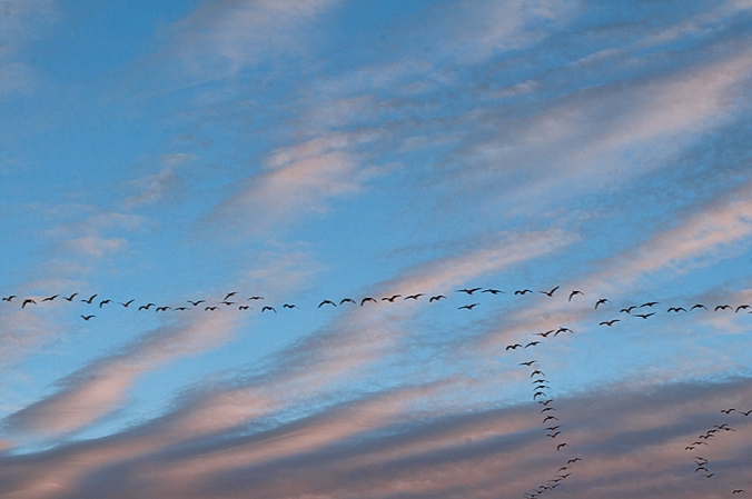
Central North Dakota, through the prairie pothole region east of the Missouri River, is under the Central or Midway flyway where waterfowl migrate across the region. That’s why through much of October, depending on weather, Great Canadian Geese are in fields and waterholes.   A stroll along an unused road with my dog kicks up geese from their hiding places.

two-geese-take-off-from-gunnar-sig-small

As long as you’re in the wetlands region of North America, stick around until about 6:00 p.m. — sunset.  The hour before, the golden hour with long shadows and a golden filter on the sun is great photo time.  Immediately after sunset, sunsets in the sky are repeated in waterholes where geese and ducks are floating.

sunset-on-waterhole-with-ducks-sig-small

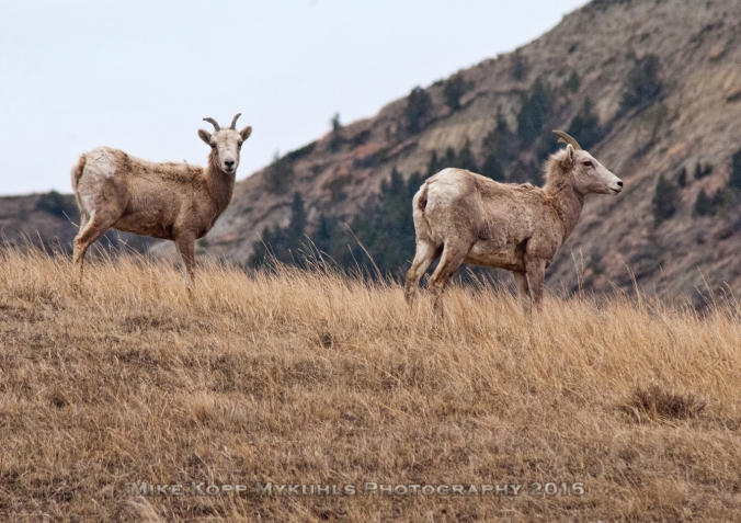
Finally, the most rewarding and hardest to spot wildlife is south of Watford City along the Little Missouri River. Big Horn Sheep populate the area.  I’ve never worked too hard at trying to spot them, which may be why I’ve only seen them once or twice.  If you’re careful not to spook them, they’ll pose for you.

two-big-horn-sheep-on-a-hill-nearby-sig-small

Other rare-to-spot animals in the state that run free are moose and mountain lions.  Moose sometimes wander in to towns or farmsteads.  Have you seen one in town?  Or mountain lions — have you spotted one?  What is the predominant wildlife you spot in the fall where you live?

Five tips to get your best photos from the North Dakota Badlands.

Your camera -- never leave home without it. It's easier than you may think to get your stellar images of the North Dakota Badlandds

Your camera — never leave home without it. It’s easier than you may think to get your stellar images of the North Dakota Badlands

Want pretty pictures of the Badlands? Go buy a post card.

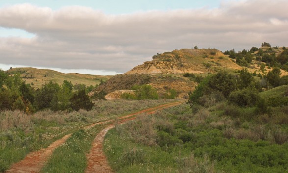
Want to capture your own one-of-a-kind keepsake memory of the Badlands?  Go get it. It’s easier than you think – if you are willing to slow down, get out of your car and look for it.

Just about suppertime, from any high point, venus' belt makes a good backdrop for your landscape photo.

Just about suppertime, from any high point, venus’ belt makes a good backdrop for your landscape photo.

There are thousands of square miles of unsullied beauty in the Badlands of North Dakota. In those endless horizons are millions of your own scenes to capture, frame and display back home.  Here’s how in five easy tips: Timing, Temperament, Tools, Tenacity, and Technique.

Timing – it’s all about light.  North Dakota is blessed with clean clear air.  Smog?  Nope.  Hazy humidity? Gone.   You’ve got unfettered access to the sun, almost.  You’re still 95,000,000 miles from it, but that’s close enough to get the shots you will want to display.

Avoid mid-day when the sun is high and bright. As you know, the Badlands are endless contours of bluffs, buttes, slopes, hills, canyons and valleys.  It takes shadows to show them and those shadows are strongest early in the morning or late in the day.

Contrasts and contours are hidden most of the day. Once the sun begins to lower the shadows present a great view of the bluffs and buttes.

Contrasts and contours are hidden most of the day. Once the sun begins to lower the shadows present a great view of the bluffs and buttes.

Shooting at the ends of the day means you also get the advantage of the Golden Hour when the solar Rapunzel lets down her golden locks and the landscape takes on a golden or yellow cast.   Generally, that’s the first hour and the last hour of daylight. Depending on where you are in the Badlands, you could be out at sunrise which is about 5:45 a.m. in June, or out at sunset which is about 9:45 p.m.

And if you like to take sunset photos – turn around.  Put your back to the sun and shoot Venus’ Belt as it appears in the east at sunset.

Tip: Late-day landscapes are better than noon-day landscapes

Temperament – take it easy, but keep moving.  If you want to jump out of your car, run to the edge of an overlook and shoot the scene, you are better off performing that activity at a gas station where you can run in and buy a postcard.    Sadly that’s what many people do, drive through one of the Theodore Roosevelt National Parks, pull over to the side of the road, snap a shot and head home.

Park your car, (you don’t want it to roll away down a bluff or butte) and walk.  If you’re stopped at a ridge or hilltop, you’ll have a relatively easy time finding a vantage point.  If you are down below, be prepared to hike. You don’t have to hike to the tallest point, but the higher up you go, the more you will see.  The trails that have been cut in the parks, or the Maah Daah Hey trail make it easy to walk to the top.  You can make your own trail as long as you are on public land.  Make a zig-zag “Z” pattern of switchbacks up the hill, stopping at each point on the repeated “Z” pattern.  It’s encouraging to see how far you’ve climbed and at each point, you get a new view.

Tip: Don’t get in a hurry. 

Don't get in a hurry. Take time to look -- and feel. You'll feel the shot more than you see the shot.

Don’t get in a hurry. Take time to look — and feel. You’ll feel the shot more than you see the shot.

Absorb – that’s the key activity. Absorb and feel what you see.  It takes a quiet and still temperament to absorb what you are about to see.  It’s in that moment of absorption that you can see the details, the shading, the colors the contrasts that will give you the image you want to capture.

Tools – we’re not talking camera gear here.  An expensive camera doesn’t take any better photos than an expensive computer writes a better document.  The tools we’re talking about here are an accurate weather report and a good map. If you have a GPS system on your phone, that can be handy, but a paper map is preferred. All of western North Dakota is covered by the US Forest Service maps.  The maps are matchless for showing you what you need to know:

  • Public groomed trails such as the Maah Daah Hey or other marked trails.
  • Gravel roads and two-track trails to show you where to get off the highways.
  • Points of Interest – historical, geographical and topographical.
  • Topography – the closer the lines, the more steep the terrain.
  • Water – most of which is not drinkable.

The U.S. Forest Service Maps are updated regularly. You can get the latest map from the visitor centers at the Theodore Roosevelt Parks, or at the US Forest Service Office in Bismarck, Watford City or Dickinson.  They cost about $13. They’re worth it!

The U.S. Forest Service map costs about $13 and is the most valuable tool (other than your camera) that you can take.

The U.S. Forest Service map costs about $13 and is the most valuable tool (other than your camera) that you can buy.

A GPS on your phone will give you the precise location at any moment. With that information, you can coordinate on the Forest Service map to see not only where you are, but where you are going.

A critical element is a weather forecast.  North Dakota’s weather is notorious for frequent and sudden changes.  It lies in the middle of the continent and several different weather systems from different direction influence conditions. So, one thing you can do is monitor trends before you set out on your photo safari.  About three to five days before your photo safari, look up the weather forecast for where you expect to go.

Forecasts are updated several times a day, so check twice a day, such as 7 a.m. and 9 p.m. every day.  Notice the changes or trends in the anticipated temperatures, rain chances or cloud cover.  That practice will give you more of a motion picture sense of what to expect.  Checking just once as you head out the door will give you only a snapshot of what to expect.  It’s better to see the weather pattern than the weather snapshot.

Beyond those specific tools, good shoes and proper clothing will allow you to not only get to the place where you can get a good shot, but will also provide you the comfort you need to be patient.   Warm enough when temps are cool, protective enough when mosquitoes are out.  Discomfort will prompt you to hurry your exploration for a shot, so get comfortable.

Tip: Prepare yourself with comfort and knowledge.

Tenacity – don’t stop, don’t give up.  The shot you’re looking for is over the next hill. Drive, walk or ride over the next hill and you’ll see something new.  If it’s not as spectacular as that scene two hills back, turn around and go back.  Or shoot as you go, it keeps getting better and when you get home you can decide which one is the best shot – but keep moving.

From time to time,  turn around.  It’s easy to get so focused on what is in front of you, that you may miss the beauty behind you. So, from time to time, turn around to see the scene you just came through.

Remember that point about absorbing the scene, the moment?  One of the greatest mindsets you can embrace to get the stellar shot you seek is to keep yourself prodded with this question: “What if?”  “What if I climbed that butte, what would I see?”  “What if I followed this deer trail, where would it lead?”

I wonder where that goes...is where great visual discoveries begin.

I wonder where that goes…is where great visual discoveries begin.

Parallel to that question is this postulate: “I wonder where that goes.” As you see a road heading over the hill don’t be afraid to check it out—with caution.

Take a short hike, or if you’re still driving and haven’t got out of your vehicle yet, take that two-track trail, but remember: it’s  good to be in a reliable vehicle. There are no corner service stations out here.  You need something to get over ruts and ridges and up and down the hills.

The point is this.  Just because where you are standing at the moment doesn’t yield the shot you are looking for, don’t give up.  Investigate the next curve, the next hill, the next trail.  Be tenacious in your search for the shot you want.

Tip: Be curious.

Technique – do what you do best. 

What is it in the scene that you want to shoot?  Is it the buffalo on the trail, the Little Missouri River down below, the abandoned jalopy?  Decide what is it in the scene that caught your eye, and crop out anything else that is distracting. Avoid visual distractions, zoom in on the subject.

Not all the intriguing shots are found on the trail. The next farm, the next small town may have a great shot. Zero in on what catches your eye, remove the background distractions.

Not all the intriguing shots are found on the trail. The next farm, the next small town may have a great shot. Zero in on what catches your eye, remove the background distractions.

It shouldn’t take a viewer of your photo more than an instant to determine what the photo is about.

Once you know what your photo is about, and are cropping out the distractions by zooming in on the subject, align the photo but don’t put it smack dab in the center of the photo. If you are shooting a landscape photo, don’t put the horizon right across the middle of the image.  In fact,  some time when you are out and about anywhere outside, notice how much of your view is sky.  It’s often the majority if your view, it’s one way you can capture what you see — include the sky.

On the vertical line of a tic-tac-toe board, the prairie dog!

On the vertical line of a tic-tac-toe board, the prairie dog!


Whether it’s landscape you’re shooting, or anything else that catches your eye in the Badlands, remember the rule of thirds, and place your subject at or near one of the crosshairs of a tic-tac-toe board.  Even if it’s a close-up of an image like the face of a horse, put the eyes on the third.

Tip: Don’t abandoned basic photo techniques


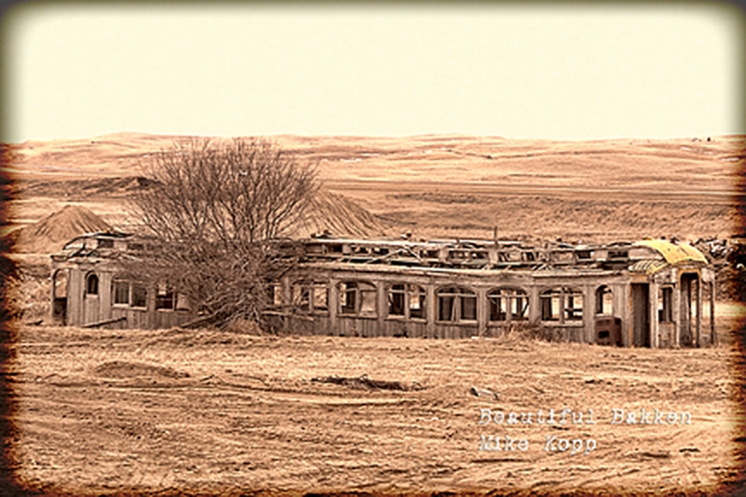
The abandoned rail car in this shot is on the lower horizontal line of a tic-tac-toe board. (rule of thirds.)

The abandoned rail car in this shot is on the lower horizontal line of a tic-tac-toe board. The horizon is on the top horizontal line.  (rule of thirds.)

Like we said at the start of this article, the best times of the day to shoot the Badlands of Western North Dakota do not include mid-day.  At all times, when shooting outside, adjust the sun in relation to your subject. The sun should be at your shoulder.  Don’t shoot in to it, nor have it directly behind you.  If you put it at your shoulder, you’ll get the contrast you need to show texture and variety in your subject.

In all cases, the best advice is to borrow from Nike’s saying, “just do it, just shoot it.”

Tip: Just shoot it.

There’s more to capturing the image than merely taking the photo. The bragging rights come from the adventure you took to get that shot.  It bears repeating to your friends and family repeating the details of the work it took to get you to where you found that stellar shot. There are millions of vantage points in the North Dakota Badlands, got get on one and get your shot.


North Dakota is made for bicycles in the spring

An old Burlington-Northern rail bed opens up in the spring for a ride

An old Burlington-Northern rail bed opens up in the spring for a ride

Spring in North Dakota opens new horizons: the next landmark, the next vantage point, the next hill (everywhere except the Red River Valley). An advantage to being a sparsely-settled state is the open roads for bicycling.

Bicycles freely cross the DeMers bridge at Grand Forks.

Bicycles freely cross the DeMers bridge at Grand Forks.

In the eastern part of the state, with the flat-as-glass terrain, bicyclists cruise along and over the Red River on gentle paved paths.

Communities such as Grand Forks, Mayville and Fargo offer well-used paved recreation trails.

On the western end is the grueling challenge of the Maah Daah Hey trail. It’s more than 130 miles long through the Badlands and Grasslands of North Dakota.  Every year, mountain bikers attempt the Maah Daah Hey 100 — and last year, the winning time for the 100 mile ride was just under 10 hours.

Near the Ice Caves along the Maah Daah Hey trail, two bicyclists navigate the easy part of the ride, through the grass before hitting the trail

Near the Ice Caves along the Maah Daah Hey trail, two bicyclists navigate the easy part of the ride, through the grass before hitting the trail

A few places are easy challenges, but the greatest share of the Maah Daah Hey trail is a world-class mountain bike route. It is a tougher pedal than I’ll ever do.  For those families who want to enjoy the scenic Badlands, they can take an easy ride through Medora and the recreation trail, or can venture on to other nearby easy routes.

In the middle of the state, here in the Missouri Slope region, open gravel roads allow a mix of level and sloped rides.

Late in the day,  a power plant on the horizon burns coal to make electricity to power homes in Midwest states.

Late in the day, a power plant on the horizon burns coal to make electricity to power homes in Midwest states.

Take northern Burleigh County, for example.

On the nights I ride the gravel roads, I find an evening pedal out to the hills gives a chance for a good strong exercise in not only physical, but a visual exercise. On high-traffic evenings, I may see as many as three vehicles sharing the gravel roads in one or two hours.  Most evenings, there are none.couple walk their dogs at bottom of hill

Sometimes a farm family may stroll the gravel roads with their dogs.

A farm couple walk the gravel road with their dogs.

A farm couple walk the gravel road with their dogs.


Farm kids put their ATVs to work riding around the country.

Farm kids put their ATVs to work riding around the country.

Other times, kids will use the family’s ATV to spread dust.  Most of the time, it’s just the lone bicyclist (me) out to capture evening atmosphere.


Overhead, geese follow the Central Flyway across the North American Continent.  They’re always talking to themselves so you will hear the flocks before you see them.  Some evenings there will be as many as four or five large flocks with hundreds of geese talking among themselves and heading north.

Canadian geese head north following the Missouri River.

Canadian geese head north following the Missouri River.

As long as I’m out in the country in the evening, I try to time my rides to capture sunset. The golden hour and the long contrasting shadow give much greater evidence to the uneven terrain when shadows roll over the hills and valleys. golden hour hill top with bicycle The environment picks up that warm golden glow. Across the river the sun drops behind Oliver and Mercer Counties.

The sun sets behind a tree row on a late afternoon North Dakota spring day

The sun sets behind a tree row on a late afternoon North Dakota spring day

An endless variety of weather conditions create an infinite variety of sunsets – the reward of an evening pedal on the back roads of North Dakota.OIL_2809

That’s my recommendation. Where do you recommend bicycling in your country?

Follow me on Facebook:

https://www.facebook.com/MykuhlsPhotography.MikeKopp?ref=hl

He is not here

You know it had to be one of the worst mornings ever, that first Easter morning. Not only were Mary and the disciples mourning the death of Someone whom they loved, they were afraid. So they were hiding from the Romans, fearing they would be next.

A dark place

They were grieving. They were afraid.  They felt abandoned.  They felt hopeless.  Grief. Loss. Fear. Sadness. Sorrow. Confusion. Abandonment.

Mary got up to leave. She must leave. She had something to do. It was a dark place Mary went, the cemetery where they left the lifeless body of  Jesus.

Imagine the long, tearful walk she walked alone.  Tears. Could there be so many tears?  She had never cried like this.  She had never gone through this.  No one had ever gone through this. She must have been frightened.  She must have been sad.

She must also have been in love.  She loved Jesus so much she left the safety of the others hidden in that grief-filled room.  She went alone.  No one else had the love or the guts to do what she had to do, visit that borrowed tomb.

I cannot imagine her confusion when she arrived and she met what she thought was a gardener.  Her frame of reference, her point of view were shaped by the horrible hours she had just experienced.  The betrayal, the arrest, the trial, the torture, the spikes, the blood, the darkness, the earthquake, the torn temple veil — all shaped her mind and left her little prepared for the next event that topped anything she had experienced in the last three days.

A light shines in a dark place

She looked for a dead man and thought she found a gardener.

“Please Sir, what have you done with the body?”

The body?  A dead lifeless form that had held the Man whom she loved?

“Mary, it is I.”

He’s alive! He is risen!

Where there was darkness, now there was light!

Can there be, has there ever been such a shocking turnaround?  Not merely from darkness to light, but rather from death to life?

Light was shining in the darkness of that morning, but also in the dark gloom of her thoughts, her mind and her heart.

He is alive!

You know the story. She ran back to tell others.  John — the disciple who writes more of love in his Gospel than the other three, the one who wrote those famous words, “For God so loved the world, He gave…”  loving John ran to the tomb.  From fear and grief now to unbelievable excitement.  John ran.  Peter ran.

Peter outran John.  He was first.  He stooped down, and there were the grave clothes, neatly folded. (Isn’t that just like Jesus to leave things better than he found them?) Angels met Peter and the disciples.

He is not here. He is risen!  It is Easter this morning as I write this. I look up. I look past the cross. I look past the darkness.

He is not here. He is risen

He is risen!

Footnote:  And so, here in little Wilton, I don’t have to look far to see the story.  All within sight of my home (if it weren’t for the trees) are these pictorial reminders that Jesus is a Risen Savior.

oOctober 18 My most popular image of Mandan

Mandan as seen from Bismarck at sunset

There. That’s better.  The week’s dreary, grey, lifeless sunsets were disappointing this week, but on this night, the clouds and the sun worked together to give a good backdrop to the landscape.

I was on the hilltop overlooking I-94 to shoot traffic and the bridge for one of my contracts, but the imagery of the cityscape took precedence.  I was surprised how the camera picked up the blue of the galvanized chain link fence.  The Interstate is blue, the bridge, and support structures are blue. They add a chill to the contrast of the warm sunset.  The river provides a good dividing line with its soft peach tones.

If you look closely to the north (right) you can make out the lights just starting to glow at North Dakota’s only oil refinery.

All in all, a good moment to capture forever.

Have you noticed how colors change, such as the galvanized fence, when the sun is filtered through the cloudsd?

October 10 Wilton’s pond at sunset

Sunset at Wilton Centennial Park

This is one of my favorite images in my year-long project of shooting North Dakota every day of 2010.  Some days my photos are so amateurish and bad that I don’t post them.

But on this day, just a short walk from my home I saw what might work for a good image. Of course it’s the Golden Hour, and it shows.  The color is radiant in the trees and along the horizon.

Most unusual (and if you’re from North Dakota, you know what I mean) there is no wind.  The reflective glass of the Wilton Centennial Park pond is perfect to bounce back the trees and light around it.

I could easily vote for this as my favorite photo of the year in North Dakota 365.  What do you think?

August 24


Harvesting wheat and wind


Okay, one more. I’ve caught combine action for a few days now, but couldn’t pass up this one.  I was driving east out of Wilton when I spotted this combine working next to the wind farm. The juxtaposition of the combine and the wind turbine tell a big part of North Dakota’s story, harvesting wheat and wind for people across the Midwest, even the world.

Again, as you may notice, it’s the Golden Hour of sunset and the skies and air have that reddish glow that I’ve mentioned the last couple of days.

I think this image would make a good postcard, or a good image to represent North Dakota.