Here’s how to enjoy Lake Sakakawea for free at McKenzie County

This North Dakota county gives you nearly unlimited access to outdoor recreation — free!

Sunset over Lake Sakakawea at McKenzie County.

You don’t need a boat to enjoy Lake Sakakawea.  The magnificent lake is 180 miles long with 1,530 miles of PUBLIC shoreline.

Plenty of opportunities to wade in the water to cool off on a hot day hike.

As we found out, that means you can explore, hike, bike for days on end.  Find a bay or inlet and you can camp next to the water, or if it’s a hot day, dive in and cool off. It’s what we did, and here’s all you need to know to enjoy the Lake.

Hiking the shoreline north of Charlson along Lake Sakakawea


First, a little background:

The Army Corps of Engineers created and maintains the lake; it owns the immediate shoreline. It says the lake covers 382,000 surface acres making it the largest manmade lake in North America where the entire shoreline is open to the public. It is world-famous for its recreation, walleye fishing and its paddlefish snagging.

History

Without a ferry system, McKenzie County farmers struggled to get grain to a nearby rail line across the Missouri River.

Lake Sakakawea was formed in the 1950’s by damming the Missouri River. Even before it was a lake, the River was a transportation barrier. The river challenged McKenzie County farmers to get their crops to market, going north across the river to Williston.

Ferries such as those at the ghost town Banks on the Tobacco Garden Creek helped farmers move their grain.  Eventually, a bridge across the river at Williston helped ease transportation.

After WWII, the Army Corps of Engineers built a series of dams on the Missouri River, each one backing up on to historic tribal land and Indian Reservations. In 1956, the Garrison Dam swallowed up the largest amount of historic land in the new dam system.

Garrison Dam created Lake Sakakawea and flooded hundreds of thousands of farmland, and homes. Courtesy of State Historical Society of North Dakota (B8081).

The lake became a recreation attraction. It flooded some 150,000 acres, three towns, and several villages. It divided the Fort Berthold Indian Reservation so that two districts are south of the lake and three are north of the lake.  Lake crossings are about 70-miles apart at the dam itself or at the Mountrail County/McKenzie County crossing, Four Bears Bridge.

Some of the towns and villages flooded by the creation of Lake Sakakawea.


What to do

If life before the dam intrigues you. The Three Affiliated Tribes Museum on the eastern edge of McKenzie County has a full display of pre-lake years.   It’s that large A-Frame building inside a wrought-iron fence north of the Casino.  We discovered you will need to check ahead to see if it is open.  You can call 701-627-4477.  Generally, it is said to be open from 10:00 a.m. to 4:00 p.m.  That’s not always the case, though.  The last two times we attempted to visit were during those hours, but it was closed.

Admission isn’t free but close.  The last time we were there it was $3.00.

If you are successful, head to the second floor. That’s where we found the most interesting displays.  It’s an eye-opener to learn the history of the Mandan, Hidatsa and Arikara nation.  It will shape your views on the region.

If you are in to land-based activities, you’ve got hundreds of miles of opportunity.  Many locations are easily accessed by following two-track trails or no-maintenance roads.  The public access shoreline provides landlubbers the opportunity to hike and explore, swim, camp, view waterfowl and other birds. We like to drive north from Highway 23 on what is designated to be Highway 1806.  It’s a good idea to be in a pickup truck, or a high-clearance vehicle to access the lake. Turn off 1806 to the north and explore the two-track trails.  We’ve done it several times, but only when it’s dry enough that we won’t get stuck.  The dog gets excited about this time because we slow down to about 5 mph and weave our way through the hills and valleys to the shoreline.

In the winter, when the lake’s many bays and inlets freeze over, cross-country skiing is possible.  Snowmobilers often ride the ice and snow.

Pontoon and fishing boats are the most popular boats on the water. Up until about 1970, hydroplane boats raced on the lake, but floating trees and other debris made it too dangerous.

On the water, pleasure boats are commonly seen with passengers enjoying the vast expanse of water. In addition to swimming, water skiing, jet skiing, and scuba diving are just some of the favorite activities.

Fishermen travel from across the world to catch walleye, northern pike, and salmon. The waters also yield a good harvest of smallmouth bass, catfish, yellow perch, and trout.

For a few days in the spring, on the upper reaches of the lake, paddlefish snagging attracts thousands of people to the upper reaches of the lake on the northern edge of McKenzie County. The prehistoric fish lay on the bottom of the river where anglers snag them and harvest their eggs as caviar.

Click: The Williston Herald has a great story about paddlefish snagging.

 How to get there:

East of Watford City on Hwy 23, you access Lake Sakakawea at Four Bears. The mile-long Four Bears Bridge spans the Missouri River and Lake Sakakawea

Drive north or east of Watford City in McKenzie County. State Highway 1806 north or State Highway 23 east will take you to the shores of Lake Sakakawea.

If you use Google Maps, you’ll get something like this (the complete round trip with an extension to Four Bears is almost 3 hours.  But if you are just going to one spot, the drive is less than one hour):

Easy access from Watford City to Lake Sakakawea.

Our Recommendation

We were not boating when we explored the region.  We went northeast of Watford City and then north past the ghost town of Charlson.  We always take with us a U.S. Forest Service Map ($13) to see all the back roads and trails that got us down to the lake for a good day of hiking, sightseeing, and swimming.  Another useful tool is Google Earth that gives you a precise location and a view of what’s ahead on the trail.

Imagine the steep valley that drops down below this tributary to Lake Sakakawea. You can hike along the top, or take a canoe to explore the shoreline.

If you own a kayak or canoe, just about any road that goes up to the lake from McKenzie County will give you access. Again, a U.S. Forest Service Map is most helpful to find those access roads.

We have accessed the waterscape on canoe.  This summer we’ll do it with a kayak.  It allowed us to get up in to some of the tributaries.  Exploring the upper reaches scratches the curiosity itch.

A canoe or other smaller fishing boats gets up in to some of the tributaries of Lake Sakakawea so you can explore hidden riches.


If you want to get out on the water for little money (not free)– consider renting a canoe or kayak.  You can follow the shoreline, investigate bays and inlets, and get a sense of what it must have been like for the Thomas Jefferson’s Corps of Discovery.


Admittedly, it’s hard to find a canoe or kayak to rent.  Are there any in Williston or Minot? I don’t know any rentals. Do you?

East of Williston in Williams County (directly across the lake from Tobacco Gardens in McKenzie County)  is Lund’s Landing. You can rent a kayak or canoe there for the day.

http://www.lundslanding.com/fishingboatrentals.htm

People who drive up from Bismarck have a couple of places where they can pick up a canoe or kayak in Mandan. They have multi-day rates so you can rent one day and return the next.

http://0317f38.netsolhost.com/rentals.html

http://www.paddleonnd.com/rentals.html#kayak

If you have a boat, here are a couple of good points to consider: the first access point is the Four Bears Peninsula, on the far eastern edge of McKenzie County, is a popular access to the water. A boat ramp, bait shop and large parking area will let you get out on the water. It will introduce you to Native American history of the region. Go in August to take in the Little Shell Powwow.  The peninsula extends south of the Four Bears Casino where people camp, fish and picnic.

Others recommend

(The goal this summer is to check out this highly recommended McKenzie County location.)

The second access point is Tobacco Garden Creek Bay — 2 miles east of Watford City on ND Highway 23, then 25 miles north and east on ND Highway 1806. The resort is open year round and is pet-friendly. A full-service restaurant serving: Breakfast, Lunch, and Dinner – with Prime rib every Saturday Night.  A convenience store providing Groceries, camping supplies, off sale beer, bait and tackle shop, gas on the water, and everything in between.  There are over 100 camp sites, two log cabins, family picnic shelters, two playgrounds, wireless Internet and hiking on the Birnt Hills Trail – a certified Lewis and Clark site.

We’re always looking for other free or low-cost opportunities to explore Lake Sakakawea.  What do you recommend?

Here’s another free spot in McKenzie County to explore

Subscribe to this blog to get more ideas to explore in this great state of North Dakota

To get a free 22 page travelogue to plan your trip in McKenzie County, just type in the word “McKenzie” in the subject field and send.


Iconic architecture for you to tour in McKenzie County — FREE!

Bridging cultures, counties and communities – the Four Bears Bridge

Each arched span directs the weight of the bridge in to the piers

Each arched span directs the weight of the bridge into the piers

This mile-long bridge is the latest effort to overcome the continental division of the Missouri River. The Missouri River has been a transportation corridor and a barrier since before Thomas Jefferson.  That’s why he commissioned the Corps of Discovery to learn more about the river.

History

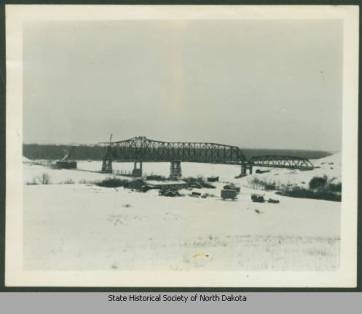
From the North Dakota State Historical Society, the first Four Bears Bridge built near the now flooded town of Elbowoods.

From the North Dakota State Historical Society, the first Four Bears Bridge built near the now-flooded town of Elbowoods.

From the U.S. Geological Survey

1940 Four Bears Bridge at Elbowoods, 13 years before the Army Corps of Engineers flooded the valley and moved the bridge. (From the U.S. Geological Survey)

Until about 1925 there was no way to cross the river in this part of the United States.

America had fought a World War and had become a powerhouse in world politics, but travelers still couldn’t cross the Missouri River, except by unreliable and unsafe ferries.

A national lobbying effort prompted Washington to pay for a bridge across the Missouri River on Highway 8 south of Stanley in Mountrail County and north of Halliday in Dunn County.

In 1950, after the Second World War, the Army Corps of Engineers built a series of dams on the Missouri including one in Garrison, North Dakota. The water would have covered the original Four Bears Bridge on old Highway 8.

So, the government paid to have the original bridge dismantled and moved about 70 miles upstream.

Dismatntled at it's first site, the Four Bears Bridge was rebuilt at McKenzie County to reach the opposite side of Lake Sakakawea and Mountrail County.

Dismantled at its first site, the Four Bears Bridge was rebuilt at McKenzie County to reach the opposite side of Lake Sakakawea and Mountrail County.

The bridge was built to 1925 standards – two eight foot driving lanes, no shoulders, no walkways. By modern standards, it was functionally obsolete.  It was too narrow and too low of clearance  Two large farm trucks could not meet on the bridge.

A construction barge under the old Four Bears Bridge while the new bridge was built.

Two construction barges under the old Four Bears Bridge move two precast concrete bridge segments in to place to be lifted and attached to the growing structure.

During four construction seasons, 2003-2007, a new $54 million dollar bridge was built using context sensitive design.  It has won several international design contests and been recognized as a model for designing a modern structure that seamlessly fits in to the cultural, natural, social and economic environment of the area.

The arches between piers mimic the hills along the river.

The arches between piers mimic the hills along the river.

The sweeping curves of the bridge are designed to visually replicate the curves of the nearby hills in the Badlands.


Our Recommendations

Tribal symbols on the bridge wall.

Tribal symbols on the bridge wall.

Walk the bridge to see the history in artwork of the Three Affiliated Tribes of the Fort Berthold Indian Reservation, the MHA Nation.  The stories of the Mandan, Hidatsa and Arikara nations are on storyboards on both ends of the bridge with tributes to their ancestors along the railing of the walkway. The pedestrian walkway includes medallions of the cultural history of the Three Affiliated Tribes and tributes to leaders, sacred animals, and historical events. The railing also includes silhouettes of sacred animals.

There are benches on which you can sit and absorb the sights and sounds. The concrete trail at the park will lead you down the riverbank to observation points below and alongside the bridge.  From here you can clearly see the medicine wheel on the opposite hillside. This ancient sacred place accurately points the four cardinal directions.

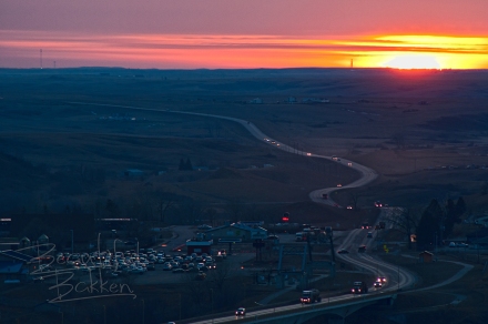
Looking over McKenzie County from Crow Flies High, on the east end of the bridge, it's apparent Highway 23 wanders and snakes across the hills toward the Four Bears Casino and Lodge

Looking over McKenzie County from Crow Flies High, on the east end of the bridge, it’s apparent Highway 23 wanders and snakes across the hills toward the Four  Bears Bridge.


On the east side of the bridge, the Mountrail County side, drive to the maintained historical site on the south side of the road above the medicine wheel. The point is called Crows High or Crow Flies High and includes storyboards of Native American history.  Over the edge of the parking area to the north, straight down is what remains of the flooded town of Sanish.  When the lake level is low, many of the foundations are visible.

Click here to read how the new bridge was built

Click here to read John Weeks excellent description of the bridge and the parks

How to get therearrows-from-wc-to-four-bears-bridge

 From Watford City drive east on Highway 23 about 40 miles to the far eastern border of McKenzie County.  There can be a fair amount of truck traffic on the road, but don’t get in a hurry.  Many passing lanes are built into the route between Watford City and New Town.

The Four Bears Bridge is one of McKenzie County’s 5 affordable (low cost or free) landmarks visitors and travelers tour year-round. For a free 20-page ebook on all five of the McKenzie County landmarks, enter the word “McKenzie” in the subject line of this email form.

If you want regular tips on quality opportunities in Western North Dakota, be sure to subscribe to this blog.


Enjoy the cold that keeps out riff raff — healthy people do

It’s not easy keeping up your spirits when winter and polar vortexes catapult the thermometer in to a region well below zero.  What do you do to keep out the invading winter blues?  Some people fall prey to the knighthood of long dark nights when the kingdom of cold invades.

It is possible not to fall to the avenging onslaught of relentless waves of killer cold fronts, but you have to work at it. You have to look for it.  You have to venture out to see the beauty of the season.  That may mean adjusting your schedule a bit. The Golden Hour is mid-afternoon, that last hour when the landscape turns gold.  On a holiday, such as New Years Day, the first sunset of the year is mid-afternoon, about 4:30.  That is when I forced myself to break free from the clutches of the cold to get out with my camera to capture the day.

The first sunset of 2014

The first sunset of 2014

One of the things I’ve come to discover about North Dakotans is they accept the things they cannot change and change the things they can.  So, when record-breaking cold weather sets in, they know they can do nothing about the weather, but they can do something about their own comfort or their own activity.  Of course it’s easier to do nothing and fall prey to the demons of darkness.  Taking a step to fight back is what many healthy people of the cold north such as North Dakotans do every winter.

965859_719882948021983_1441034643_oskis point to the clearing other side of woods wtrmrk     Some will go cross-country skiing.  Cross Ranch, a quiet state park where groomed cross-country ski trails weave through a cottonwood forest that stood here when Lewis and Clark tugged their boats up the Missouri River.

For some of us, it means layering up.  I’ve spent the coldest days of the winter working in my anti-starvation work. Outside.  Attempting to stay warm while keeping the bills paid.I wear as many as 7 layers of clothing when I know I’ll be working outside. I caught this image of myself in the mirror of the tractor I was driving.

The John Deere way to view the winter.

The John Deere way to view the winter.

  • Short underwear
  • Long underwear
  • Jeans
  • sleeveless T-shirt
  • Long Sleeve T-shirt
  • Flannel shirt
  • Bib overalls
  • Hooded sweatshirt
  • Coveralls
  • Parka and
  • Hoodie face and neck protection

Camera and me in tractor cab

Not everyone has to work outside. And not everyone can resign themselves to the fact there are some things (like cold weather) that you just can’t do much about.  Sure, North Dakotans could sit at home and complain, and wait for spring, or they could get out and do something about it.  The North Dakotans I know choose to enjoy it.  For some, that means racing up a hill in to town.02-24-10 snowmobiles

Or for some who know they can’t change the weather, but they can change their activities, it means diving in to those winter hobbies.  I’m fortunate to have a wood shop where I teach myself how to build wood frames for my prints.

open door to wood burning stove logs inside

Wood burning stove keeps things warm and friendly on a cold winter night.

wood and the table saw  The wood stove sits quiet, unused and neglected much of the year.  However, this time of the year, it’s actually a rewarding way to get out of the cold.  I love burning wood to stay warm.

It’s all about attitude, isn’t it.  I think that’s one of the healthiest things about North Dakotans.  They work at keeping up their spirits when the cold keeps out the riff raff.  What’s a good way to enjoy winter and beat the winter blues?

Free! An amazing history tour #3 is memorable!

Badlands mary 11 sgntre

Labor Day weekend is a great weekend to get away from your neighborhood without spending a lot of money.

Ready for some freedom? This is the weekend! It’s a 3-day weekend for you to rest from your labors, and here are opportunities for you to get out and get away!

Free –  The added bonus for the weekend is for families who’ve spent a ton on school supplies.  It’s free educational support for geography, geology, history, math, engineering, physics and geometry.

Fairview Bridge late summer horz long shot sig

Fairview Lift Bridge is so impressive that by the time you get across the bridge and through the tunnel, you will say “Wow” at least once.

1 Fairview Lift Bridge and Tunnel

While the day is cool and everyone has enough energy for the walk you will want to take, head out on Highway 200 west of Watford City to the state line at Cartwright and Fairview.

Cartwright well bb

Main Street Cartwright offers clean, cool well water for thirsty people — and their horses.

Once you get to Cartwright, stop on main street for a memorable cool drink of water, from the town pump that’s been there since the last century.  You can’t miss it, but you better because those are pretty strong guard rails around it.  It sits right in the middle of what would be “Main Street.”

Gunnar explores the bridge sigAs soon as you cross the Highway 200 bridge turn south in to the Sundheim public park on the west bank of the Yellowstone. Drive up the ramp to the parking area and take a hike.  It’s safe, secure, handicap accessible and above all, you don’t have to worry about meeting a train like travelers worried about 30 years ago. Both the bridge and tunnel are closed to all traffic except pedestrians.
 

There was almost no steamboat traffic on the Yellowstone when the bridge was built, but it was still considered a navigable waterway. So, the U.S. Government required one span over the channel to be lifted for steamboats.  The machinery was installed to raise the 1.14 million pound lift section of the bridge.

DSC_9511

Overhead, the 300-ton counterweight still sits ready to be used.

It operated only once, as a test, and was never used for commercial river traffic.

When it was built, with the required, but unnecessary lift section, there was not enough money to also build a highway bridge, so this bridge was modified to include vehicles as well as trains by adding planks across the bridge. Traffic was controlled by a watchman who make sure there were no trains coming when a car or truck wanted to cross.  The bridge owner, Great Northern Railroad charged a toll.  Late in the 30’s the North Dakota Highway Commission took over the bridge and the toll was dropped.

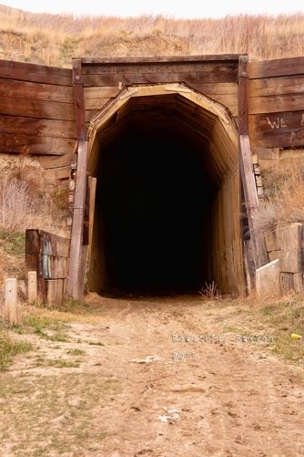
While you’re at the Fairview Lift Bridge go ahead and walk on in to the Cartwright Tunnel. It’s bout 1500 feet long with a slight bend in the middle so that you cannot see one end from the other.

It’s a wooden-planked tunnel large enough for trains to pass through, and most importantly, it was built by hand.  Sure, they used dynamite to blast the rock, and horse-drawn carts to carry out the rubble, but the labor was provided by local farmers and ranchers who needed a job in 1913.

Cartwright Tunnel

Built by hand, trains passed trough this tunnel until about 1986.


During the years of shared use with cars, trains took the tunnel while cars drove overhead and down to the bridge.


historic lift bridge and tunnel. Bill Shemmory Collection

State Historical Society of North Dakota,  William E. (Bill) Shemorry Collection                  (1-44-12-29)

There are no lights in the tunnel, so be prepared for dark. Most cell phones have a flashlight feature to use. Or take that one from your glove compartment.  You do carry a flashlight, don’t you?

Tunnel without flashlights sgntre

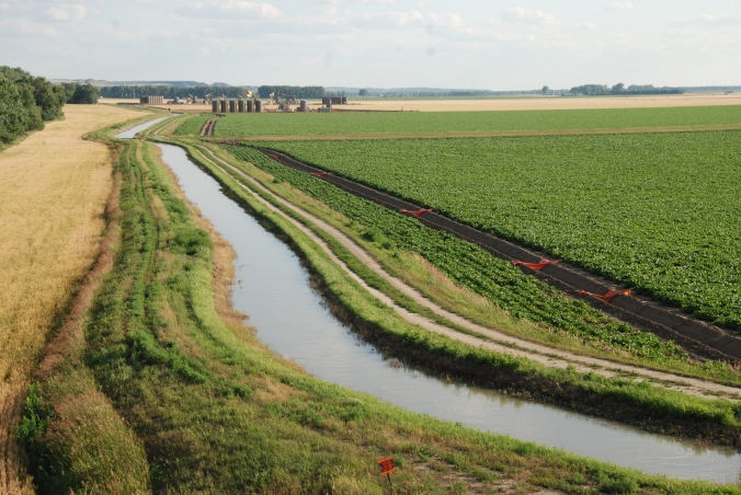
Your next stop is just 20 minutes down the road and is another free educational moment – agriculture.  As you travel along the Yellowstone River, you’ll see irrigation farming that uses more than one techniques such as traditional overhead irrigation sprayers, or ditches and tubes.

DSC_9477


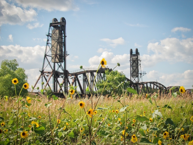
1 (alternate B) if you want to expand your lift bridge experience,  head north up highway 58 and then highway 147 to the twin of the Fairview Lift Bridge to the Snowden Bridge in Montana. It’s about 20 minutes up the road, and is still in use.  It too once carried automobile traffic until the mid-1980s.

Snowden Bridge with Flowers in tight slight vignette edit 3-1


In addition to, or instead of the Snowden Bridge, stay on highway 58 and head to Missouri-Yellowstone Confluence Interpretive Center and the Fort Buford historic site. You can picnic here, if you skipped Sundheim Park.

2. Missouri-Yellowstone Confluence Center 13958191_1733049450290235_6939199483645982407_o 

When you stand here, you stand in a place of significance that goes way back before the wild west of cowboys, even back before there was a United States of America.
Your educational opportunities here include geography and history as you trace the flow of the water from south and west to this location.  The museum also includes the rich history of trappers and traders who passed through here in the late 1700’s and early 1800’s as well as the Corps of Discovery’s mission through here.The Confluence Center has a gift shop and a museum.13923703_1733049440290236_8796213656820432287_o

Take a moment to check out the large images of the Fairview and Snowden bridges, bison  from the region, views of the Badlands, and of Fort Union Trading Post, all from the Beautiful Bakken Collection of Mary Tastad’s photos and mine.

Mary walks pathWalk the 6-block long blacktop trail from the Confluence center down toward historic Fort Buford where an actual cemetery withDSC_0409 less-than-actual headstones inform you about how tough it was living here 150 years ago.

DSC_0373
Fort Buford had a military mission, but it is probably best remembered as the place where the famous Sioux leader, Sitting Bull, surrendered in 1881. When the fort was first under construction, the first or second day, Sitting Bull attacked the Fort, killing one soldier.  Not one to give up easily Sitting Bull and his warriors kept up their attacks on soldiers and wood cutters who were passing through the region.  Civilians, soldiers and Sioux warriors were killed.

You can walk past the Fort Buford site for free. To go inside, you’ll have to pay a $5.00 fee for adults, less for children.DSC_0431

3. Fort Union Trading Post

Fort Union wheat field vig sig

Finally, plan your day trip to end at the Fort Union Trading Post. It about 10 minutes away. An interesting factoid is that to get in to the Trading Post, you actually drive in to Montana for a few feet on Highway 1804, then back in to North Dakota.

Entering ND bb

Plan to arrive bout 5:30, but make sure you stay until just before sundown, about 8:00. (Sundown is about 8:45).  That’s the last Bell Tour.  This is the pinnacle of your day’s free educational events.  This Labor Day weekend, is also the Living History Weekend where you’ll see how things were done 150 years ago, including a shooting demonstration. Costumed re-enactors will help you visualized how life was lived before statehood.

Buckskinners at Fort Union bb

Labor Day weekend is “Living History” weekend at the Fort Union Trading Post.


The Fort Union Trading Post was not a military or government institution. It was a privately owned facility to provide a shipping point of furs and pelts out of the region to points east, including Europe. As many as 200 people were employed here.  As a business enterprise, it is estimated that each year, more than $100,000 worth of business was done here. (Imagine how much money that would be in 2016 terms!)

The buffalo hides, beaver pelts and other furs were carried over long distances to reach the Trading Post.  In what are now the states of Wyoming, Montana South Dakota nad North Dakota, trappers and traders would rendezvous back here to make their exchanges.   In exchange trappers and traders could get necessities such as rifles, cookware, coffee and food stuffs.  At least five indigenous tribes (Assiniboine, Crow, Cree, Ojibway, Blackfoot, Hidatsa, Mandan) traded buffalo robes and other furs for trade goods such as beads, guns, blankets, knives, cookware, and cloth, including the Assiniboine who are said to have requested the American Fur Company establish this “shopping center.”  The Assiniboine tribe also protected the Trading Post from less friendly tribes.


The folks at the Fort Union Trading Post shared this about the Last Bell Tour:

During the tour, participants will discover why the summer of 1832 defined Fort Union’s future importance in the western fur trade. They’ll hear from the first artist to visit Fort Union, find out what industrial advancements revolutionized how Fort Union was re-supplied, and observe the effect a new trade partner, one formerly loyal to the British Hudson’s Bay Company, had on the peaceful coexistence between Fort Union’s traders and its visiting tribes.

The family-oriented tours will begin in the parking lot closest to the fort. Departing at 15-minute intervals, each guided tour will include 20–25 people who will be lead through a series of five inter-related scenes portraying events from the summer of 1832. Refreshments for participants will be available at the registration table in the parking lot. During the tours, the only illumination will be provided by candlelight, lanterns, and lit fireplaces.

Click here to learn more about visiting the Fort Union Trading Post

At the end of the day, you are just 30 minutes from fine eating at Sidney, Montana or Williston, North Dakota.  We’ll tell you more about fine dining, family dining and night life in those two communities another time.

Until then, enjoy your free educational tour of Western North Dakota.

Fort Union unites time, traders, trappers and tribal merchants

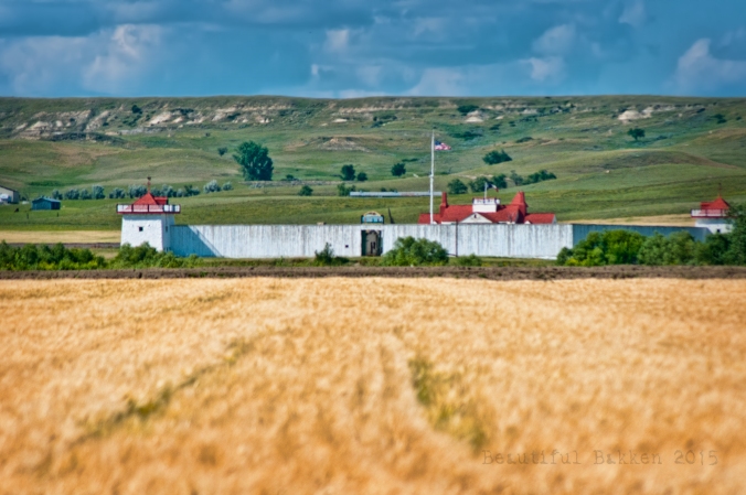
Fort Union, from across the Missouri River just yards from the ND/MT state line

Fort Union, from across the Missouri River just yards from the ND/MT state line

A cool wet September morning…and a traveling pair head for the trading post.  Word had reached them in their homes near Bismarck and Fargo that this was the weekend of a good gathering at the Fort Union Trading Post. For nearly 40 years, this fur trading post on the upper Missouri provided peaceful trade between traveling frontiersmen, trappers, traders and Native American merchants. Assiniboine, Crow, Blackfeet, Ojibwa, Mandan, Hidatsa, Arikara and Sioux merchants all traded at the post.  From the days of Lewis and Clark until the Civil War, this was a cultural and economic nerve center in the middle of the North American Continent.

Earlier in the season, the couple had spied the trading post from across the Missouri River.  The water was up; the distance was great, so they didn’t try to ford the river or cross at another point.  Instead they vowed to return when they were within range.  That day was the first Saturday in September.

The couple navigated the 25 miles of back roads and watched for signs of the trading post.  “Turn north and follow the river,” she counseled him as she consulted a series of maps. He directed the surefooted horsepower in the direction she indicated.  Bluffs and buttes around, they found the trading post and crossed over the state line in to Montana to enter the compound from the west just feet in to Montana, heading east back in to North Dakota.

The southwest basion was designed for defense. George Catlin used it as a studio in 1832

The southwest bastion was designed for defense. George Catlin used it as a studio in 1832

They crossed the low-lying spaces below the trading post.  There, down below the trading post their time was one hour off.  The low-lying area is in mountain time zone. It changed as they walked the rise up in to the  structure where they entered central time zone. The tall tower and wind vane they had spotted from across the river was now above them as they entered in through the garrisoned walls.  At the entrance a couple discussed their evening plans for socializing, food and sleep at the trading post.

At the main gate and entrance of the trading post

At the main gate and entrance of the trading post

Across the entrance, a young woman navigated her way across the muddy grounds. Frog-drowning rain the night before had left a lake in the compound and more rain was expected.

A boardwalk keeps visitors out of the mud from last night's rain

A boardwalk keeps visitors out of the mud from last night’s rain

At the moment, water slowly seeped in to the ground, leaving behind soft mud bridge by planks.

Different cultures, different ages and different families converge on the trading post

Different cultures, different ages and different families converge on the trading post

Despite the mud and rain, families moved about the post freely, playing and enjoying the social event. fort union boy


As much as the trading post is about commerce and products, it’s also about families and social gatherings.

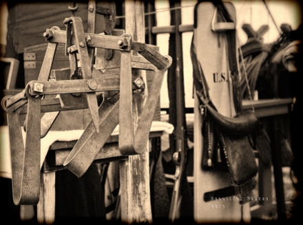
Hardware is made, then traded and sold in booths and tents along the permiter of the Fort Union Trading Post

Hardware is made, then traded and sold in booths and tents along the perimeter of the Fort Union Trading Post

Since the days of John Jacob Astor and the American Fur Company, this has been the largest trade, shopping and supply post in the western frontier U.S.  Positioned up-stream from the joining point or confluence of the Yellowstone and Missouri Rivers, the trading post merges several cultures in to one moment on the northern plains.fort union two young mothers and daughter

Nearby, buckskinners took shelter in the warmth of the trade house at the entrance of post.

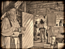
Inside the west Indian Trade House, a fire keeps visitors warm and dry.

Inside the west Indian Trade House, a fire keeps visitors warm and dry.

Here is where ledgers, inventories and business records are kept.  It’s also the room where important meetings with visiting tribal merchants could strike a deal. A fire crackled in its work to ward off the damp chill of the day.  “We meet here as often as we can,” the older trader told a visitor while he nursed his precious hot coffee.  “We’re happy to have visitors like you.  We like to swap stories and share our adventures.”


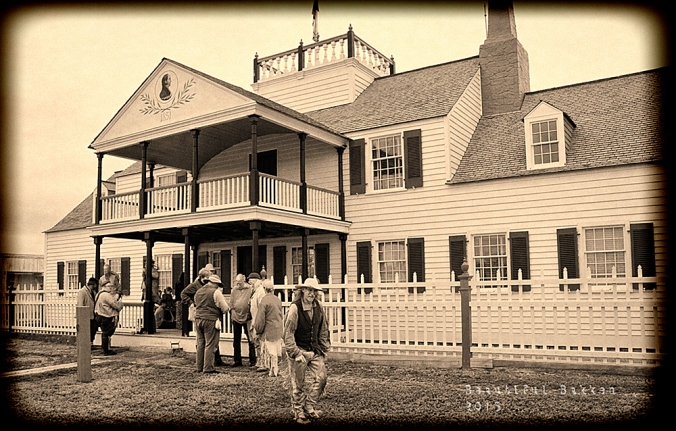
fort union buckskinner sepia vig sigThe old-timer’s words were demonstrated;  a gathering and multiple conversations were housed on the front porch of the Bourgeois House.Fort Union two buckskinners 2 sepia vig sig

This is where the field agent lived in 1851 after a smaller building was enlarged in to this two-story house with a porch.

Fort Union Bourgeois House 2 story sepia vig sig

Just outside the palisades, young marksmen prepared his muzzleloader.

Preparing the flint

Preparing the flint

Fort Union ramrod muzzle loader sepia vig sigHis target, down by the river, was out of sight at the moment.  By the time he got his shot ready, the target would be visible again.  His efforts attracted the attention of friends and strange visitors.  After a couple of misfires, his shot echoed across the valley.
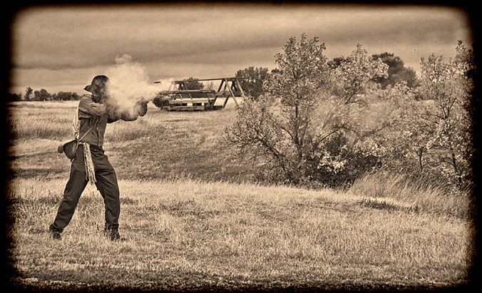
Fort Union Muzzleloader shoots

Fort Union mothers and daughters watachA few spectators watched as the shooter demonstrated his skills.  Some, chose to stay inside, including a small gathering of men who sat and swapped stories.

The trading post provided a chance to not only swap goods and stories, but to kick back and relax.

Fort Union Three buckskinners sepia vig sig The visitors who had come so far to visit the Fort Union Trading Post were warmly received and learned much from this annual gathering. Fort Union Lief and another sepia vig sig The visit extended until nearly sunset when the gathering broke up and headed to their lodging for the evening, some outside the post, and some farther down the river in more civilized settlements. There, they spread the word of the days’ events on Facebook and in the Beautiful Bakken photo gallery.Ft Union Front Porch gathering sepia vig sig


North Dakota is made for bicycles in the spring

An old Burlington-Northern rail bed opens up in the spring for a ride

An old Burlington-Northern rail bed opens up in the spring for a ride

Spring in North Dakota opens new horizons: the next landmark, the next vantage point, the next hill (everywhere except the Red River Valley). An advantage to being a sparsely-settled state is the open roads for bicycling.

Bicycles freely cross the DeMers bridge at Grand Forks.

Bicycles freely cross the DeMers bridge at Grand Forks.

In the eastern part of the state, with the flat-as-glass terrain, bicyclists cruise along and over the Red River on gentle paved paths.

Communities such as Grand Forks, Mayville and Fargo offer well-used paved recreation trails.

On the western end is the grueling challenge of the Maah Daah Hey trail. It’s more than 130 miles long through the Badlands and Grasslands of North Dakota.  Every year, mountain bikers attempt the Maah Daah Hey 100 — and last year, the winning time for the 100 mile ride was just under 10 hours.

Near the Ice Caves along the Maah Daah Hey trail, two bicyclists navigate the easy part of the ride, through the grass before hitting the trail

Near the Ice Caves along the Maah Daah Hey trail, two bicyclists navigate the easy part of the ride, through the grass before hitting the trail

A few places are easy challenges, but the greatest share of the Maah Daah Hey trail is a world-class mountain bike route. It is a tougher pedal than I’ll ever do.  For those families who want to enjoy the scenic Badlands, they can take an easy ride through Medora and the recreation trail, or can venture on to other nearby easy routes.

In the middle of the state, here in the Missouri Slope region, open gravel roads allow a mix of level and sloped rides.

Late in the day,  a power plant on the horizon burns coal to make electricity to power homes in Midwest states.

Late in the day, a power plant on the horizon burns coal to make electricity to power homes in Midwest states.

Take northern Burleigh County, for example.

On the nights I ride the gravel roads, I find an evening pedal out to the hills gives a chance for a good strong exercise in not only physical, but a visual exercise. On high-traffic evenings, I may see as many as three vehicles sharing the gravel roads in one or two hours.  Most evenings, there are none.couple walk their dogs at bottom of hill

Sometimes a farm family may stroll the gravel roads with their dogs.

A farm couple walk the gravel road with their dogs.

A farm couple walk the gravel road with their dogs.


Farm kids put their ATVs to work riding around the country.

Farm kids put their ATVs to work riding around the country.

Other times, kids will use the family’s ATV to spread dust.  Most of the time, it’s just the lone bicyclist (me) out to capture evening atmosphere.


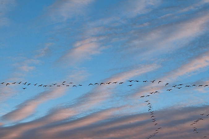
Overhead, geese follow the Central Flyway across the North American Continent.  They’re always talking to themselves so you will hear the flocks before you see them.  Some evenings there will be as many as four or five large flocks with hundreds of geese talking among themselves and heading north.

Canadian geese head north following the Missouri River.

Canadian geese head north following the Missouri River.

As long as I’m out in the country in the evening, I try to time my rides to capture sunset. The golden hour and the long contrasting shadow give much greater evidence to the uneven terrain when shadows roll over the hills and valleys. golden hour hill top with bicycle The environment picks up that warm golden glow. Across the river the sun drops behind Oliver and Mercer Counties.

The sun sets behind a tree row on a late afternoon North Dakota spring day

The sun sets behind a tree row on a late afternoon North Dakota spring day

An endless variety of weather conditions create an infinite variety of sunsets – the reward of an evening pedal on the back roads of North Dakota.OIL_2809

That’s my recommendation. Where do you recommend bicycling in your country?

Follow me on Facebook:

https://www.facebook.com/MykuhlsPhotography.MikeKopp?ref=hl

Beauty is where you find it — if you’re looking for it.

An abandoned truck from decades ago in the Badlands.

An abandoned truck from decades ago in the Badlands.

Have you ever noticed that negative critical people find negative things to criticize? Conversely, a person who goes looking for good, for beauty will find it – often in the same area where black-hearted people see decay and destruction.

That’s the case here in the Badlands, the Bakken Shale Play region of North America. People who do not live here are sending film crews, photographers and others here to document the destruction of the Badlands caused by the oil boom. With a predetermined point of view, a prejudice, they look for and find what is in their heart.  People with a good heart see good, see beauty.  What is in the heart of the Bakken haters?

magpie creek

One of the many oxbow bends in the Magpie Creek that feeds in to the Little Missouri River

I see the same beauty out here that I’ve always seen in my 33 years of exploring and hiking the North Dakota Badlands and Grasslands.  It’s one of the most popular galleries on my website www.mykuhls.com

Little Mo ice jam

Ice goes out on the Little Missouri River as it winds through the Badlands toward the Missouri River and Lake Sakakawea.

On this day, March 11 I drove one of my favorite roads for only about 10 miles. The Long X road extends from south of Watford City to north of Killdeer, about 30 miles of gravel – much of it “unimproved” gravel.   The ice was going out and rain was moving north of the region.  Sure signs of the exciting time called “spring.”

A month later, I found the other end of the road near Killdeer.  The road follows the Little Missouri River that flows through the epicenter of the Bakken Oil Play where there are literally thousands of oil wells extracting oil to build up America’s energy independence.   It’s even more spring-like and even more exciting.  It is beautiful, open country.

Destruction? Pollution? Damage? I don’t see it. Do you?

Muddy water from snow melt up in the hills finds its way to the Little Missouri River

North of Killdeer, muddy water from snow melt up in the hills finds its way to the Little Missouri River

You can see more of not only mine, but my hiking partner’s views at www.mykuhls.com

Ride for St. Judes at Ft Lincoln

Custer's home hosts riders again -- a reminder of 1875.

Custer’s home hosts riders again — a reminder of 1875.

Shades of history were repeated for children at St. Jude’s hospital.  A century ago, riders here were in a protective mode. This time, they’re in a supportive role.

Riders organize before the start of the trail ride fund raiser

Riders organize before the start of the trail ride fund-raiser

It was more than 130 years ago when blue-coated riders rode the hills along the west side of the Missouri River at Fort Abraham Lincoln.  Soldiers were posted there to protect railroad workers building the Northern Pacific Railroad, but their mission changed in the ill-begotten battle at Little Big Horn.

This summer, nearly 100 riders covered the hills above the Missouri at Fort Abraham Lincoln State Park to raise thousands of dollars for St. Jude’s Children’s Hospital.  It was one of the best shoots I’ve ever been on. All the photos are here http://www.mykuhlsphotography.co/Events/St-Jude-Trail-Ride

Riders at the block houses

Riders at the block houses

I got a copy of the map where they’d ride and I intercepted them at various points such as at the blockhouses on a hill overlooking the valley.

A gorgeous day for weather, not too hot, not at all chilly, a good day for soaking up sun and riding without stressing the horses.

Past the blockhouses, the ride went past the original cemetery at the fort — an eerie reminder of life a century ago when people were considered “old” at 45.

Riding past the Ft. Lincoln cemetery

Riding past the Ft. Lincoln cemetery

Riders on hill

Riders in a line come up the hill

The ride started in the valley and went up the hill across the prairie and through the trees.  It was an easy pace — thankfully so that I could catch them at various points.

A family-centered kind of ride where children were more than welcomed — they were encouraged to get on board the powerful horses who gently submitted to the young hands.

Boy gets up Little girl rider

Then, it went back down to the river, and along the trees, out of the sun and in to the cooling shade.

Riding through the trees

Riding through the trees

Once back at the start, later that afternoon, a pot luck feed gave riders a feast that matched the greatness of the ride they just completed.  Grilled burgers, hot dogs and all the other kind of summer picnic food we love.

Good food, good chow line

Good food, good chow line

In the end, the ride raised several thousand dollars for St. Jude’s Children’s Hospital — one of several rides in the nation to support the hospital.  Plans are already underway for next year’s ride.  Until then, here is where this year’s photographs are stored http://www.mykuhlsphotography.co/Events/St-Jude-Trail-Ride

Where does the trail take you in 2013

The trail toward the Missouri River.

The trail toward the Missouri River.

Where does the trail in to 2013 take you this year?

I’m sure it’s too early to tell..unless you’re an anal retentive planner. Who knows what the year will throw at you.

For me, I hope to remain as physically active as I was on this, the first day of 2013.  Ahh…it’s been a long long time since I was at my best physical shape, and today shows that clearly.  But hopefully today was a good sign.  It meant heading out of town, away from the videos and photos to edit, away from the papers to write. Away from the frames to make and the photos to mat.

The road west of Wilton leads straight to the river.  This region of the state is called The Missouri Slope region and you can see why…the soft rolling hills slope down to the river.

Once to the bottom, cross over to the west side and there’s the best cross country skiing in the region.

trail along river wtrmrk

Along the Missouri River

So, there’s my first hint at where I want the trail to take me — away from the daily grind.  First a drive toward the Missouri River, then to the river itself.  This is as close to where Lewis and Clark and the Corps of Discovery traveled the winter of 1803 — 210 years ago.  It’s the Missouri River along the Lewis and Clark trail, south of Washburn at Cross Ranch State Park.

But wait!  There’s more!

skis point to clearing horz wtrmrk

Skis to the trees

It’s not just a pretty place, it’s a place to get physical.  So, I did, on cross country skis.  It just seems to me that as long as we’re gonna have winter — and we can’t do anything about that — we might as well use it.  A bright day, light winds from the south, and fresh snow.

Mike stops on curve

The trail starts

Years ago, I skied these trails regularly, but in recent years, there’s not been enough snow.

The trail starts through the trees and a short distance from the start, a person can choose to take a long, long, LONG route south, or curve back to the north. That’s me.  Ready to take the curve back north.

So, along the river I skied for about 45 minutes.  My daughter would roll her

away from camera along river bank wtrmrk

along the trail

eyes. When she and I used to do this every week, we’d be gone for a few hours.

*pant*

*pant*

*pant*

Maybe next time.  But certainly not today.  Dang I’m outta shape.

So, the trail in to 2013, hopefully will take me back to better physical conditioning and I won’t take the turn back to the north, but will ski along the trail south of Cross Ranch.

Are you up to join me some afternoon?

.

October 21 Images larger than life

Clark, Sheheke, Lewis

Here we are again, a seasonal visit to the larger-than-life images of three people who shaped the United States like no one else has done.William Clark, hired by Captain Lewis visit with Mandan Chief Sheheke.  The three represent the lost art of cultural curiosity and cultural acceptance.  Clark and Lewis stayed months with the Mandans at a campsite just under the hill from these statues.  They learned from the Mandans, and thanks to the hospitality (which still marks the Mandans today) they were able to live through the winter and carry on their expedition.

Chief Sheheke, curious about white man’s life went back to Washington DC to meet President Jefferson and to learn of this culture he did not know existed until he met the Corps of Discovery.  Sadly, it was not a good move for the Chief. When he returned to his people he was not well-received, nor were his stories of white man’s civilization readily believed nor accepted.  He lost status, leadership and eventually his life.

These statues stand at the Lewis and Clark Interpretive Center at Washburn, just above the Missouri river. See that tree in the background, it’s literally on the crest of the hill overlooking the Missouri River below.

Most travelers through North Dakota stick to the Interstate, or don’t even bother to head west to see North Dakota outside of the Red River Valley, and so they do themselves a disservice by not exposing themselves to the beauty that Lewis and Clark encountered,  a region fairly unsullied by modern life, a region where the actual trees the Corps of Discovery walked through are still standing, living and growing.  The Interpretive Center is a hidden jewel in America.

Have you been up the Missouri River to the near-wilderness areas of North Dakota? Have you been to the Interpretive Center or nearby Fort Mandan?