Here’s how to enjoy Lake Sakakawea for free at McKenzie County

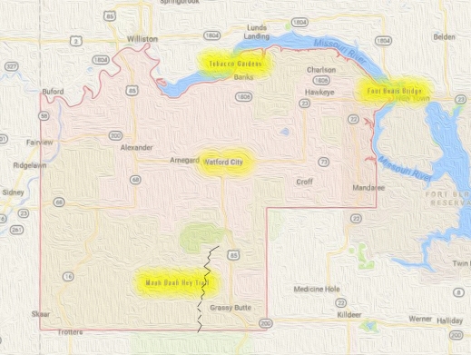
This North Dakota county gives you nearly unlimited access to outdoor recreation — free!

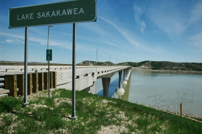
Sunset over Lake Sakakawea at McKenzie County.

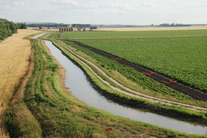
You don’t need a boat to enjoy Lake Sakakawea.  The magnificent lake is 180 miles long with 1,530 miles of PUBLIC shoreline.

Plenty of opportunities to wade in the water to cool off on a hot day hike.

As we found out, that means you can explore, hike, bike for days on end.  Find a bay or inlet and you can camp next to the water, or if it’s a hot day, dive in and cool off. It’s what we did, and here’s all you need to know to enjoy the Lake.

Hiking the shoreline north of Charlson along Lake Sakakawea


First, a little background:

The Army Corps of Engineers created and maintains the lake; it owns the immediate shoreline. It says the lake covers 382,000 surface acres making it the largest manmade lake in North America where the entire shoreline is open to the public. It is world-famous for its recreation, walleye fishing and its paddlefish snagging.

History

Without a ferry system, McKenzie County farmers struggled to get grain to a nearby rail line across the Missouri River.

Lake Sakakawea was formed in the 1950’s by damming the Missouri River. Even before it was a lake, the River was a transportation barrier. The river challenged McKenzie County farmers to get their crops to market, going north across the river to Williston.

Ferries such as those at the ghost town Banks on the Tobacco Garden Creek helped farmers move their grain.  Eventually, a bridge across the river at Williston helped ease transportation.

After WWII, the Army Corps of Engineers built a series of dams on the Missouri River, each one backing up on to historic tribal land and Indian Reservations. In 1956, the Garrison Dam swallowed up the largest amount of historic land in the new dam system.

Garrison Dam created Lake Sakakawea and flooded hundreds of thousands of farmland, and homes. Courtesy of State Historical Society of North Dakota (B8081).

The lake became a recreation attraction. It flooded some 150,000 acres, three towns, and several villages. It divided the Fort Berthold Indian Reservation so that two districts are south of the lake and three are north of the lake.  Lake crossings are about 70-miles apart at the dam itself or at the Mountrail County/McKenzie County crossing, Four Bears Bridge.

Some of the towns and villages flooded by the creation of Lake Sakakawea.


What to do

If life before the dam intrigues you. The Three Affiliated Tribes Museum on the eastern edge of McKenzie County has a full display of pre-lake years.   It’s that large A-Frame building inside a wrought-iron fence north of the Casino.  We discovered you will need to check ahead to see if it is open.  You can call 701-627-4477.  Generally, it is said to be open from 10:00 a.m. to 4:00 p.m.  That’s not always the case, though.  The last two times we attempted to visit were during those hours, but it was closed.

Admission isn’t free but close.  The last time we were there it was $3.00.

If you are successful, head to the second floor. That’s where we found the most interesting displays.  It’s an eye-opener to learn the history of the Mandan, Hidatsa and Arikara nation.  It will shape your views on the region.

If you are in to land-based activities, you’ve got hundreds of miles of opportunity.  Many locations are easily accessed by following two-track trails or no-maintenance roads.  The public access shoreline provides landlubbers the opportunity to hike and explore, swim, camp, view waterfowl and other birds. We like to drive north from Highway 23 on what is designated to be Highway 1806.  It’s a good idea to be in a pickup truck, or a high-clearance vehicle to access the lake. Turn off 1806 to the north and explore the two-track trails.  We’ve done it several times, but only when it’s dry enough that we won’t get stuck.  The dog gets excited about this time because we slow down to about 5 mph and weave our way through the hills and valleys to the shoreline.

In the winter, when the lake’s many bays and inlets freeze over, cross-country skiing is possible.  Snowmobilers often ride the ice and snow.

Pontoon and fishing boats are the most popular boats on the water. Up until about 1970, hydroplane boats raced on the lake, but floating trees and other debris made it too dangerous.

On the water, pleasure boats are commonly seen with passengers enjoying the vast expanse of water. In addition to swimming, water skiing, jet skiing, and scuba diving are just some of the favorite activities.

Fishermen travel from across the world to catch walleye, northern pike, and salmon. The waters also yield a good harvest of smallmouth bass, catfish, yellow perch, and trout.

For a few days in the spring, on the upper reaches of the lake, paddlefish snagging attracts thousands of people to the upper reaches of the lake on the northern edge of McKenzie County. The prehistoric fish lay on the bottom of the river where anglers snag them and harvest their eggs as caviar.

Click: The Williston Herald has a great story about paddlefish snagging.

 How to get there:

East of Watford City on Hwy 23, you access Lake Sakakawea at Four Bears. The mile-long Four Bears Bridge spans the Missouri River and Lake Sakakawea

Drive north or east of Watford City in McKenzie County. State Highway 1806 north or State Highway 23 east will take you to the shores of Lake Sakakawea.

If you use Google Maps, you’ll get something like this (the complete round trip with an extension to Four Bears is almost 3 hours.  But if you are just going to one spot, the drive is less than one hour):

Easy access from Watford City to Lake Sakakawea.

Our Recommendation

We were not boating when we explored the region.  We went northeast of Watford City and then north past the ghost town of Charlson.  We always take with us a U.S. Forest Service Map ($13) to see all the back roads and trails that got us down to the lake for a good day of hiking, sightseeing, and swimming.  Another useful tool is Google Earth that gives you a precise location and a view of what’s ahead on the trail.

Imagine the steep valley that drops down below this tributary to Lake Sakakawea. You can hike along the top, or take a canoe to explore the shoreline.

If you own a kayak or canoe, just about any road that goes up to the lake from McKenzie County will give you access. Again, a U.S. Forest Service Map is most helpful to find those access roads.

We have accessed the waterscape on canoe.  This summer we’ll do it with a kayak.  It allowed us to get up in to some of the tributaries.  Exploring the upper reaches scratches the curiosity itch.

A canoe or other smaller fishing boats gets up in to some of the tributaries of Lake Sakakawea so you can explore hidden riches.


If you want to get out on the water for little money (not free)– consider renting a canoe or kayak.  You can follow the shoreline, investigate bays and inlets, and get a sense of what it must have been like for the Thomas Jefferson’s Corps of Discovery.


Admittedly, it’s hard to find a canoe or kayak to rent.  Are there any in Williston or Minot? I don’t know any rentals. Do you?

East of Williston in Williams County (directly across the lake from Tobacco Gardens in McKenzie County)  is Lund’s Landing. You can rent a kayak or canoe there for the day.

http://www.lundslanding.com/fishingboatrentals.htm

People who drive up from Bismarck have a couple of places where they can pick up a canoe or kayak in Mandan. They have multi-day rates so you can rent one day and return the next.

http://0317f38.netsolhost.com/rentals.html

http://www.paddleonnd.com/rentals.html#kayak

If you have a boat, here are a couple of good points to consider: the first access point is the Four Bears Peninsula, on the far eastern edge of McKenzie County, is a popular access to the water. A boat ramp, bait shop and large parking area will let you get out on the water. It will introduce you to Native American history of the region. Go in August to take in the Little Shell Powwow.  The peninsula extends south of the Four Bears Casino where people camp, fish and picnic.

Others recommend

(The goal this summer is to check out this highly recommended McKenzie County location.)

The second access point is Tobacco Garden Creek Bay — 2 miles east of Watford City on ND Highway 23, then 25 miles north and east on ND Highway 1806. The resort is open year round and is pet-friendly. A full-service restaurant serving: Breakfast, Lunch, and Dinner – with Prime rib every Saturday Night.  A convenience store providing Groceries, camping supplies, off sale beer, bait and tackle shop, gas on the water, and everything in between.  There are over 100 camp sites, two log cabins, family picnic shelters, two playgrounds, wireless Internet and hiking on the Birnt Hills Trail – a certified Lewis and Clark site.

We’re always looking for other free or low-cost opportunities to explore Lake Sakakawea.  What do you recommend?

Here’s another free spot in McKenzie County to explore

Subscribe to this blog to get more ideas to explore in this great state of North Dakota

To get a free 22 page travelogue to plan your trip in McKenzie County, just type in the word “McKenzie” in the subject field and send.


5 amazing free or low cost world class points in McKenzie County

The county is larger than Washington DC, Rhode Island and Delaware. When settlers moved to the area, McKenzie County was known as an island and called the Island Empire. You cannot get to it without crossing water.stylized-map-of-mckenzie-county-map

The Missouri River, Yellowstone River and Little Missouri River set the boundaries of the county. They also contribute to the world-class recognition of McKenzie County.he largest county in the state, McKenzie County has always been fascinating, going back to the Dakota Territory days.

I was first intrigued by the county thanks to the historic McKenzie County Grazing Association, a rancher group intent on maintaining the industry and the environment that supports ranching. From there, my interest and my involvement in the county’s heritage grew.

There are five world-class points in the county:

  1. Four Bears Bridge
  2. Lake Sakakawea
  3. Theodore Roosevelt National Park
  4. Maah Daah Hey trail
  5. Rough Rider Event Center

Sure, you can take a day trip to buzz through all six locations, but why would you? We put this together so you can take advantage of vacation days, weekends or holidays through the year to explore the adventures, get insight and history of America. It’s  yours to enjoy.  Each site is free or very low cost.

Four Bears Bridge

The mile-long Four Bears Bridge spans the Missouri River and Lake Sakakawea

The mile-long Four Bears Bridge spans the Missouri River and Lake Sakakawea

This mile-long bridge is the latest effort to overcome the continental division of the Missouri River. During four construction seasons, 2003-2007, a new $55 million dollar bridge was built using context sensitive design.  It won several international design contests and is recognized as a model for designing a modern structure that seamlessly fits in the cultural, natural, social and economic environment of the area.

Each sweeping arch is designed to transfer the load in to the piers and the rock bed 90 feet below the water. The chopped off cones at the base of the piers are designed to stand up to ice floes coming downstream.

Each arched span directs the weight of the bridge in to the piers

Each arched span directs the weight of the bridge in to the piers

Walk the bridge to see artwork detailing the history of the Three Affiliated Tribes of the Fort Berthold Indian Reservation, the MHA Nation.  The stories of the Mandan, Hidatsa and Arikara nations are on storyboards on both ends of the bridge.

Here’s what you can do here next to an internationally recognized engineering feat (and it’s free!):

  • Walk across,
  • Walk under
  • Follow the recreation trail,
  • Learn history
  • Have a picnic.

Lake Sakakawea

Lake Sakakawea is 180 miles long, providing public shoreline access from which sunrises and sunsets can be viewed.

Lake Sakakawea is 180 miles long, providing public shoreline access from which sunrises and sunsets can be viewed.

Damming the Missouri River at Garrison with Garrison Dam, created a magnificent 180-mile long lake with 1,530 miles of PUBLIC shoreline.  The Army Corps of Engineers says the lake covers 382,000 surface acres making it the largest manmade lake in North America where the entire shoreline is open to the public.

Pontoons, and other boats take full access of the 300,000 acre lake.

Pontoons and other boats take full access of the 300,000-acre lake.

It is world famous for its recreation, walleye fishing and its paddlefish snagging.

Here’s what you can do here next to this world-famous lake:

  • Hike the shoreline
  • Watch sunset/sunrise
  • Visit the parks
  • Learn history
  • Have a picnic
  • Fish
  • Boat (fishing, sail, jet ski)
  • Scuba Dive
  • Camp
  • Swim

Theodore Roosevelt National Park

Bison roam freely at the Theodore Roosevelt National Park. They are not domesticated, so give them plenty of space.

Bison roam freely at the Theodore Roosevelt National Park. They are not domesticated, so give them plenty of space.

Undersold and over delivering as a National Park, the North Unit of the Theodore Roosevelt National Park (TNRP) is on the south edge of McKenzie County.  It is a rugged wilderness with a variety of trails through the park to suit all types of hikers.  The roadway through the park takes visitors to the Riverbend Overlook cabin above the Little Missouri River.  Along the drive, it’s likely you will see a collection of bison or other species such as mule deer.

When Theodore Roosevelt came to Dakota Territory to hunt bison in 1885, he was a skinny, young, spectacled dude from New York. He could not have imagined how his adventure in this remote and unfamiliar place would forever alter the course of the nation. The rugged landscape and strenuous life that TR experienced here would help shape a conservation policy that we still benefit from today.

–National Park System publication on the TRNP

On the Achenbach Trail, the views of the Little Missouri River Valley are outstanding.

On the Achenbach Trail, the views of the Little Missouri River Valley are outstanding.

It would seem a great number of visitors view the park through their windshield. They’re missing out. There are several trails in the park to accommodate all levels of fitness. One of the most challenging is the Achenbach Trail. It is 18 miles long and you can extend it into a two-day hike. (Anyone intending to camp in the backcountry must obtain a free backcountry permit prior to their trip. Permits are issued at the South Unit and North Unit visitor centers.)

Here’s what you can do here next to this National Park:

  • Hike
  • Picnic
  • Photograph
  • scout wildlife
  • access the river
  • research, browse books
  • drive

Maah Daah Hey trail (Otherwise knowns as the “lasting a long time” trail)

The world-class 125-mile long Maah Daah Hey trail attracts riders from all over the United States and many European nations.

The world-class 125-mile long Maah Daah Hey trail attracts riders from all over the United States and many European nations.

Imagine a 125-mile trek through Badlands wilderness on a mountain bike, horse or on foot. Mule and whitetail deer, antelope, wild turkeys, beaver, prairie dogs, and coyotes are often sighted, while an occasional golden eagle, red-tail hawk, or prairie falcon may be spotted soaring above. Bighorn sheep and elk have been reintroduced into the area and can be spotted by keen observers.

On rare occasions, you can catch a glimpse of the Big Horn sheep.

On rare occasions, you can catch a glimpse of the Big Horn sheep.

Wildflowers such as this crocus adorn the trail.

Wildflowers such as this crocus adorn the trail.

The single-track mountain bike trail has attracted world riders to visit with their $4,000 bikes. You can rent mountain bikes on the south end of the Maah Daah Hey trail at Medora.

The dream was to connect the two units of the Theodore Roosevelt National Park. The actual planning and building took about 14 years. It’s a difficult trail to maintain through the erosive and wild Badlands. In recent years, your tax dollars have not been spent to keep it up. Locals including the Save the Maah Daah Hey trail group sculpt and mow the trail. The group hosts the annual Maah Daah Hey 100 mountain bike ride: 100-miles in one day. The winning time is just minutes under 10 hours.

There is no time of year that is a bad time to strike out on the trail. Of course, North Dakota’s legendary afternoon and evening thunderstorms can make the trail very challenging even for the most experienced adventurer.  dead-tree-in-the-brush-color-sig

Don’t be scared off by the massive challenge the Maah Daah Hey can present.  There are plenty of short-access hikes, here’s where you can get on the trail to get in to the Badlands:

  • CCC Campground
  • Summit Campground
  • Bennet Creek
  • Beicegel Creek
  • Highway 50 West of Grassy Butte

Rough Rider Event Center

img_3287Imagine a $100-million indoor swimming pool with a few extra features.  That’s a silly way to describe the Rough Rider Event Center.  It is an auditorium, arena, gymnasium, and indoor water park, swimming pool, walking track, two ice hockey rinks, convention center, coffee shop and restaurant. Concerts, conventions, hockey and basketball tournaments draw thousands of people to the Rough Rider Event Center.

Architect’s specs:

  • 22,000-square-foot multi-use field house
  • Three basketball courts
  • Removable artificial turf
  • 1,000-seat hockey arena
  • Separate practice hockey rink
  • 3,000-seat arena for sporting events and concerts
  • Eight executive suites
  • 12,000-square-foot gymnastics club
  • 10,000 square feet of convention space
  • Continuous elevated running track.

img_3279

Watford City visitors can use the facility for a surprisingly low fee. For $7.00 visitors can enjoy daily use of any open activities, including swimming.

Just because these are the six world-class sites in McKenzie does not mean there are no more incredible places such as the Long X Museum and Visitor Center, art galleries and coffee houses in Watford City,  Fairview Lift Bridge, the Cartwright Tunnel,  Grassy Butte and its post office, the Frontier Village, the museum at Alexander.

There’s a lot more to these five world-class sites. Type the word McKenzie in the subject line of the contact form to know:
  • more about each one
  • how to get to each one
  • recommendations activities at each site
  • the history of each site
It’s free!
We’ll send you a 20-page travelogue for free just because we think McKenzie County is worth bragging about and you will too.  So, have a good time.
 
Oh, and click to subscribe to this blog to learn more of events, locations, activities each week. Pictures, information, and helps each week are posted here.  


Enjoy the cold that keeps out riff raff — healthy people do

It’s not easy keeping up your spirits when winter and polar vortexes catapult the thermometer in to a region well below zero.  What do you do to keep out the invading winter blues?  Some people fall prey to the knighthood of long dark nights when the kingdom of cold invades.

It is possible not to fall to the avenging onslaught of relentless waves of killer cold fronts, but you have to work at it. You have to look for it.  You have to venture out to see the beauty of the season.  That may mean adjusting your schedule a bit. The Golden Hour is mid-afternoon, that last hour when the landscape turns gold.  On a holiday, such as New Years Day, the first sunset of the year is mid-afternoon, about 4:30.  That is when I forced myself to break free from the clutches of the cold to get out with my camera to capture the day.

The first sunset of 2014

The first sunset of 2014

One of the things I’ve come to discover about North Dakotans is they accept the things they cannot change and change the things they can.  So, when record-breaking cold weather sets in, they know they can do nothing about the weather, but they can do something about their own comfort or their own activity.  Of course it’s easier to do nothing and fall prey to the demons of darkness.  Taking a step to fight back is what many healthy people of the cold north such as North Dakotans do every winter.

965859_719882948021983_1441034643_oskis point to the clearing other side of woods wtrmrk     Some will go cross-country skiing.  Cross Ranch, a quiet state park where groomed cross-country ski trails weave through a cottonwood forest that stood here when Lewis and Clark tugged their boats up the Missouri River.

For some of us, it means layering up.  I’ve spent the coldest days of the winter working in my anti-starvation work. Outside.  Attempting to stay warm while keeping the bills paid.I wear as many as 7 layers of clothing when I know I’ll be working outside. I caught this image of myself in the mirror of the tractor I was driving.

The John Deere way to view the winter.

The John Deere way to view the winter.

  • Short underwear
  • Long underwear
  • Jeans
  • sleeveless T-shirt
  • Long Sleeve T-shirt
  • Flannel shirt
  • Bib overalls
  • Hooded sweatshirt
  • Coveralls
  • Parka and
  • Hoodie face and neck protection

Camera and me in tractor cab

Not everyone has to work outside. And not everyone can resign themselves to the fact there are some things (like cold weather) that you just can’t do much about.  Sure, North Dakotans could sit at home and complain, and wait for spring, or they could get out and do something about it.  The North Dakotans I know choose to enjoy it.  For some, that means racing up a hill in to town.02-24-10 snowmobiles

Or for some who know they can’t change the weather, but they can change their activities, it means diving in to those winter hobbies.  I’m fortunate to have a wood shop where I teach myself how to build wood frames for my prints.

open door to wood burning stove logs inside

Wood burning stove keeps things warm and friendly on a cold winter night.

wood and the table saw  The wood stove sits quiet, unused and neglected much of the year.  However, this time of the year, it’s actually a rewarding way to get out of the cold.  I love burning wood to stay warm.

It’s all about attitude, isn’t it.  I think that’s one of the healthiest things about North Dakotans.  They work at keeping up their spirits when the cold keeps out the riff raff.  What’s a good way to enjoy winter and beat the winter blues?

Free! An amazing history tour #3 is memorable!

Badlands mary 11 sgntre

Labor Day weekend is a great weekend to get away from your neighborhood without spending a lot of money.

Ready for some freedom? This is the weekend! It’s a 3-day weekend for you to rest from your labors, and here are opportunities for you to get out and get away!

Free –  The added bonus for the weekend is for families who’ve spent a ton on school supplies.  It’s free educational support for geography, geology, history, math, engineering, physics and geometry.

Fairview Bridge late summer horz long shot sig

Fairview Lift Bridge is so impressive that by the time you get across the bridge and through the tunnel, you will say “Wow” at least once.

1 Fairview Lift Bridge and Tunnel

While the day is cool and everyone has enough energy for the walk you will want to take, head out on Highway 200 west of Watford City to the state line at Cartwright and Fairview.

Cartwright well bb

Main Street Cartwright offers clean, cool well water for thirsty people — and their horses.

Once you get to Cartwright, stop on main street for a memorable cool drink of water, from the town pump that’s been there since the last century.  You can’t miss it, but you better because those are pretty strong guard rails around it.  It sits right in the middle of what would be “Main Street.”

Gunnar explores the bridge sig
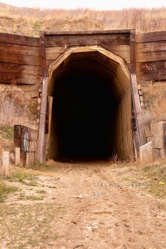
As soon as you cross the Highway 200 bridge turn south in to the Sundheim public park on the west bank of the Yellowstone. Drive up the ramp to the parking area and take a hike.  It’s safe, secure, handicap accessible and above all, you don’t have to worry about meeting a train like travelers worried about 30 years ago. Both the bridge and tunnel are closed to all traffic except pedestrians.


There was almost no steamboat traffic on the Yellowstone when the bridge was built, but it was still considered a navigable waterway. So, the U.S. Government required one span over the channel to be lifted for steamboats.  The machinery was installed to raise the 1.14 million pound lift section of the bridge.

DSC_9511

Overhead, the 300-ton counterweight still sits ready to be used.

It operated only once, as a test, and was never used for commercial river traffic.

When it was built, with the required, but unnecessary lift section, there was not enough money to also build a highway bridge, so this bridge was modified to include vehicles as well as trains by adding planks across the bridge. Traffic was controlled by a watchman who make sure there were no trains coming when a car or truck wanted to cross.  The bridge owner, Great Northern Railroad charged a toll.  Late in the 30’s the North Dakota Highway Commission took over the bridge and the toll was dropped.

While you’re at the Fairview Lift Bridge go ahead and walk on in to the Cartwright Tunnel. It’s bout 1500 feet long with a slight bend in the middle so that you cannot see one end from the other.

It’s a wooden-planked tunnel large enough for trains to pass through, and most importantly, it was built by hand.  Sure, they used dynamite to blast the rock, and horse-drawn carts to carry out the rubble, but the labor was provided by local farmers and ranchers who needed a job in 1913.

Cartwright Tunnel

Built by hand, trains passed trough this tunnel until about 1986.


During the years of shared use with cars, trains took the tunnel while cars drove overhead and down to the bridge.


historic lift bridge and tunnel. Bill Shemmory Collection

State Historical Society of North Dakota,  William E. (Bill) Shemorry Collection                  (1-44-12-29)

There are no lights in the tunnel, so be prepared for dark. Most cell phones have a flashlight feature to use. Or take that one from your glove compartment.  You do carry a flashlight, don’t you?

Tunnel without flashlights sgntre

Your next stop is just 20 minutes down the road and is another free educational moment – agriculture.  As you travel along the Yellowstone River, you’ll see irrigation farming that uses more than one techniques such as traditional overhead irrigation sprayers, or ditches and tubes.

DSC_9477


1 (alternate B) if you want to expand your lift bridge experience,  head north up highway 58 and then highway 147 to the twin of the Fairview Lift Bridge to the Snowden Bridge in Montana. It’s about 20 minutes up the road, and is still in use.  It too once carried automobile traffic until the mid-1980s.

Snowden Bridge with Flowers in tight slight vignette edit 3-1


In addition to, or instead of the Snowden Bridge, stay on highway 58 and head to Missouri-Yellowstone Confluence Interpretive Center and the Fort Buford historic site. You can picnic here, if you skipped Sundheim Park.

2. Missouri-Yellowstone Confluence Center 13958191_1733049450290235_6939199483645982407_o 

When you stand here, you stand in a place of significance that goes way back before the wild west of cowboys, even back before there was a United States of America.
Your educational opportunities here include geography and history as you trace the flow of the water from south and west to this location.  The museum also includes the rich history of trappers and traders who passed through here in the late 1700’s and early 1800’s as well as the Corps of Discovery’s mission through here.The Confluence Center has a gift shop and a museum.13923703_1733049440290236_8796213656820432287_o

Take a moment to check out the large images of the Fairview and Snowden bridges, bison  from the region, views of the Badlands, and of Fort Union Trading Post, all from the Beautiful Bakken Collection of Mary Tastad’s photos and mine.

Mary walks path
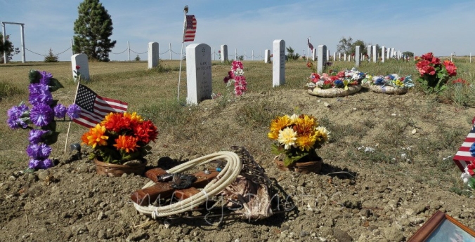
Walk the 6-block long blacktop trail from the Confluence center down toward historic Fort Buford where an actual cemetery withDSC_0409 less-than-actual headstones inform you about how tough it was living here 150 years ago.

DSC_0373
Fort Buford had a military mission, but it is probably best remembered as the place where the famous Sioux leader, Sitting Bull, surrendered in 1881. When the fort was first under construction, the first or second day, Sitting Bull attacked the Fort, killing one soldier.  Not one to give up easily Sitting Bull and his warriors kept up their attacks on soldiers and wood cutters who were passing through the region.  Civilians, soldiers and Sioux warriors were killed.

You can walk past the Fort Buford site for free. To go inside, you’ll have to pay a $5.00 fee for adults, less for children.DSC_0431

3. Fort Union Trading Post

Fort Union wheat field vig sig

Finally, plan your day trip to end at the Fort Union Trading Post. It about 10 minutes away. An interesting factoid is that to get in to the Trading Post, you actually drive in to Montana for a few feet on Highway 1804, then back in to North Dakota.

Entering ND bb

Plan to arrive bout 5:30, but make sure you stay until just before sundown, about 8:00. (Sundown is about 8:45).  That’s the last Bell Tour.  This is the pinnacle of your day’s free educational events.  This Labor Day weekend, is also the Living History Weekend where you’ll see how things were done 150 years ago, including a shooting demonstration. Costumed re-enactors will help you visualized how life was lived before statehood.

Buckskinners at Fort Union bb

Labor Day weekend is “Living History” weekend at the Fort Union Trading Post.


The Fort Union Trading Post was not a military or government institution. It was a privately owned facility to provide a shipping point of furs and pelts out of the region to points east, including Europe. As many as 200 people were employed here.  As a business enterprise, it is estimated that each year, more than $100,000 worth of business was done here. (Imagine how much money that would be in 2016 terms!)

The buffalo hides, beaver pelts and other furs were carried over long distances to reach the Trading Post.  In what are now the states of Wyoming, Montana South Dakota nad North Dakota, trappers and traders would rendezvous back here to make their exchanges.   In exchange trappers and traders could get necessities such as rifles, cookware, coffee and food stuffs.  At least five indigenous tribes (Assiniboine, Crow, Cree, Ojibway, Blackfoot, Hidatsa, Mandan) traded buffalo robes and other furs for trade goods such as beads, guns, blankets, knives, cookware, and cloth, including the Assiniboine who are said to have requested the American Fur Company establish this “shopping center.”  The Assiniboine tribe also protected the Trading Post from less friendly tribes.


The folks at the Fort Union Trading Post shared this about the Last Bell Tour:

During the tour, participants will discover why the summer of 1832 defined Fort Union’s future importance in the western fur trade. They’ll hear from the first artist to visit Fort Union, find out what industrial advancements revolutionized how Fort Union was re-supplied, and observe the effect a new trade partner, one formerly loyal to the British Hudson’s Bay Company, had on the peaceful coexistence between Fort Union’s traders and its visiting tribes.

The family-oriented tours will begin in the parking lot closest to the fort. Departing at 15-minute intervals, each guided tour will include 20–25 people who will be lead through a series of five inter-related scenes portraying events from the summer of 1832. Refreshments for participants will be available at the registration table in the parking lot. During the tours, the only illumination will be provided by candlelight, lanterns, and lit fireplaces.

Click here to learn more about visiting the Fort Union Trading Post

At the end of the day, you are just 30 minutes from fine eating at Sidney, Montana or Williston, North Dakota.  We’ll tell you more about fine dining, family dining and night life in those two communities another time.

Until then, enjoy your free educational tour of Western North Dakota.

An amazing find — a little known Indian Scout Cemetery honors fallen U.S. Soldiers

Indian Scout Post #1 on the Fort Berthold Indian Reservation between White Shield and Parshall is a nearly forgotten veteran cemetery. The Old Scout Society has kept alive the memory of the tribal members who served in the U.S. Army since the time of General Custer. (photo courtesy of Mary Tastad of Mary's Photos)

Indian Scout Post #1 on the Fort Berthold Indian Reservation between White Shield and Parshall is a nearly forgotten veteran cemetery. The Old Scout Society has kept alive the memory of the tribal members who served in the U.S. Army since the time of General Custer. (photo courtesy of Mary Tastad of Mary’s Photos)

There’s no other place on earth like this place.  There is only one Old Scouts Society and this is the graveyard where the Society honors their war dead.  Here lay members of the Three Affiliated Tribes, the Mandan, Hidatsa and Arikara who served in the U.S. military.

Relatives leave memorials at the site of their ancestors who served in the U.S. Military.

Relatives leave memorials at the site of their ancestors who served in the U.S. Military.

The tradition of scouts from the Mandan, Hidatsa and Arikara goes back nearly 200 years.  Today, the Society is a group of relatives of those historic soldiers.  They honor the U.S. Army veterans of the Indian Wars and other tribal members who served in all branches after the Indian Wars.old scouts_0005

old scouts_0009


old scouts_0002Go back to the first Hidatsa scout, Sakakawea (Hidatsa pronunciation suh-CAG-a-wee-uh).  She and her husband Charbonneau helped the Corps of Discovery find its way west and back again.sagawea-picture-1

Later when the U.S. Army occupied this region to protect the railroad expansion to the west coast, Army commanders relied on scouts from these tribes to provide intelligence about the tribe’s hostile opponents, the warriors of the Sioux Nation. The Mandan, Hidatsa and Arikara scouts carried dispatches, found food and water, tracked game and served as interpreters.

Several unrelated events converged to create the birth of the long-standing tradition of tribal members joining the U.S. military.  In 1873, Colonel George Armstrong Custer and the Seventh Cavalry were stationed at Fort Lincoln, south of Mandan, North Dakota.  The Seventh Cavalry was to protect the Northern Pacific Railroad Survey crews who had been attacked by hostile Sioux.

A rebuilt blockhouse above Fort Lincoln marks the uppermost reach of the Fort where General Custer and his scouts once lived.

A rebuilt blockhouse above Fort Lincoln marks the uppermost reach of the Fort where General Custer and his scouts once lived.

Before Custer, hostile Sioux were at war with neighboring tribes, including the Mandan, Hidatsa and Arikara who had withstood the Sioux attacks, at first.  Then, small pox wiped out nearly all the three tribes so they banded together to defend themselves against the Sioux.  Forming a confederacy between the three tribes, was insufficient, they were not strong enough to battle the Sioux, so they aligned themselves with the new and stronger opposition to the Sioux – the Blue Coats or the Seventh Cavalry – the enemy of my enemy is my friend.

At first, the Arikara or Ree were the principal tribe to supply scouts for Custer.  From 1872 until the late 1800’s Arikara scouts were the backbone of the Army’s scouts.

A few soldiers are buried at Fort Abraham Lincoln south of Mandan including some of Custer's scouts from the Hidatsa and Arikara tribes

A few soldiers are buried at Fort Abraham Lincoln south of Mandan including some of Custer’s scouts from the Hidatsa and Arikara tribes

One of the earliest scouts was Red Bear who later was joined by his younger brother Boy Chief.  He was one of the first scouts to die in a skirmish with the Sioux while stationed at Fort Lincoln along the Missouri River south of present day Mandan.

Bobtailed Bull, one of Custer's favorite scouts in the Indian Wars against the Sioux is second from the left.

Bobtailed Bull, one of Custer’s favorite scouts in the Indian Wars against the Sioux is second from the left.

Boy Chief tells the story of his enlistment like this: “Bobtail Bull brought me to Fort Abraham Lincoln in 1872.  Bobtail Bull took me to headquarters to ‘touch the pen’ to my enlistment papers.  I thought the medical examination would throw me out, as I was very young.  But I passed.  In another building, an officer gave me a gun, clothing and two gray blankets.”

Bobtail Bull was one of the first Indian scouts to be promoted and receive a commission under Lt. Col Custer who often bragged of this Arikara scout when in Washington.  Custer said of Sergeant Bobtail Bull that he was a man of good heart and good character.  He promised that if anything happened to Bobtail Bull and his fellow scouts that “their reward will not be forgotten by the government.”

It is said that a good scout who was promoted as Bobtailed Bull was promoted, could earn more than the $13/month paid most soldiers and in some cases earned as much as $50/month

Sgt. Bobtail Bull was one of the first under Custer to fall at Little Big Horn. That was despite the fact that Custer would not use his scouts as a fighting force except for skirmishes. Bobtail Bull, however, boasted of his experience in fighting the Sioux and stood ready for whatever battle commands Custer ordered.

Custer used the scouts to find the enemy, report their movement and act as couriers.  On the day of the Battle of Little Big Horn, Custer ordered Bobtail Bull and other scouts to “take the horses away from the Sioux camp. Take away as many horses as possible.”  Custer knew that a warrior on foot was no match for a soldier on horse.

Bobtail Bull's grave site is at Little Big Horn, one of the few Hidatsa Scouts in a marked grave off the Fort Berthold Indian Reservation.

Bobtail Bull’s grave site is at Little Big Horn, one of the few Hidatsa Scouts in a marked grave off the Fort Berthold Indian Reservation.

Bobtail Bull got separated from the rest of the troops. Sioux warriors grouped behind him, separating him from help and from escape.  A dense swarm of Sioux rode against him and he attempted to fall back. He was left as a solitary horseman, surrounded by circling warriors.  He was shot off his horse and so became one of the first to fall at the Battle of Little Big Horn.

Like Bobtail Bull, Red Bear, Boy Chief and others the scouts who served in the U.S. Army from 1866 to 1914 at most western forts, these scouts served with fidelity, placing their unique skills at the disposal of the frontier army.  To the shame of the U.S. Government, many of these brave soldiers were harshly treated after they served the U.S. Army.  For some, prison, poor health, disabilities or even death was the future they faced after serving the United States.  Many have been completely forgotten.

(A contemporary of Custer who worked with tribal members of the Mandan, Hidatsa and Arikara left an influence on the people who remains today.  To learn of Harold Case’ missionary work see this link: http://wp.me/pOdPo-HP )

In 1979 the Old Scouts Society of White Shield was established. The group cares for and maintains Post #1 Cemetery at White Shield where several of the scouts of the Seventh Cavalry are buried alongside veterans of WWI, WWII, Korea and Vietnam.old scouts_0003

In 1983, the Fort McKeen Detachment, Old Scouts Society was officially formed. Organizers included the grandsons of Bears Belly who was one of the original scouts who served under Custer at Fort Lincoln.

The Fort McKeen Detachment of the Old Scouts Society is dedicated to correcting misconceptions about the scouts who served in the U.S. Army.  Members educate the public about the military scouts and work to keep alive the stories of how the historic scouts influenced American and North Dakota history.  They work to preserve and honor the gravesites of the scouts buried at Fort Abraham Lincoln south of Mandan.  They also help maintain the Old Scouts Cemetery west of Garrison, North Dakota on Highway 1804.

The Indian Scout Cemetery, also known as the Old Scouts Cemetery is near White Shield, North Dakota. On New Years Eve, 2014, it stood quietly against the setting sun.

The Indian Scout Cemetery, also known as the Old Scouts Cemetery is near White Shield, North Dakota. On New Years Eve, 2014, it stood quietly against the setting sun.

As often as possible, I go past the cemetery, usually on motorcycle. I stop to tend to fallen flags and other markers left to honor this group of war dead who contributed much but received so little recognition for their sacrifice.  old scouts_0001
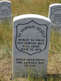
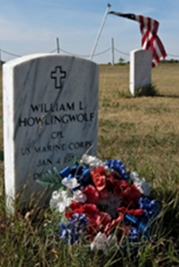
Have you taken the scenic drive past Garrison, up to Parshall on 1804?  Did you see the Old Scouts Cemetery?

(This article is excerpted from a script I wrote for a documentary on the Old Scouts Society — yet unproduced. It is the product of months of research at the Fort Berthold Library, the Three Affiliated Tribes Museum and the North Dakota State Historical Society. For more information see http://www.mhanation.com/main2/history.html)

Follow tales of Western North Dakota at https://www.facebook.com/beautifulbakken.

Tweet me at https://twitter.com/ryderwriter

A Sunday stroll up Chimney Butte

It doesn't look like a chimney, but that's what it is called, "Chimney Butte."

It doesn’t look like a chimney, but that’s what it is called: “Chimney Butte.”

It’s been called “Chimney Butte” for more than 200 years, but I’m not sure why; it doesn’t look like a smokestack.  Lewis and Clark used it as one of their markers when they trekked the Missouri River a few miles north.  You can find it between Mandaree and Keane between Highways 22 and 23 in McKenzie County.

The McKenzie County road past Chimney Butte is well-maintained and an easy drive.

The McKenzie County road past Chimney Butte is well-maintained and an easy drive.

It was our target for the Sunday hike because for one reason, it’s public-access land.  We didn’t have much time because the sunshine we’d enjoyed all day disappeared; rain clouds moved in at the same time we parked along the road on the south side of the butte — a well-maintained road.

We’ve been adding to our Beautiful Bakken Facebook page and thought this Sunday photo hike would help add to the collection of images displaying the beauty of the Badlands, the Bakken oil field.


Here’s the address –https://www.facebook.com/beautifulbakken

and our gallery of Beautiful Bakken photos on our website at this address —

http://www.mykuhls.com/Beautiful-Bakken/

Rain approaching from the southwest gave us a sense of urgency.

Rain approaching from the southwest gave us a sense of urgency.

We packed only our cameras and something to drink, then crossed the prairie and up the slope toward the base of the rocks. There, we stopped long enough to survey the incoming rain behind us to the south.

Chimney butte wildflowers
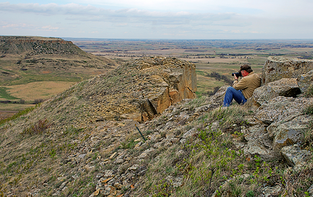
Our mission was to photograph a seasonal transition,  capturing the change from early spring’s dormant brown to the more lively green.  A few hints of spring met us along the slope such as the wildflowers sprouting ahead of the green grass.

Once at the base of the rocks, we followed the grass line around to the opposite side where we could more easily follow a switchback to the top.

At our destination, the top, we could survey the entire region of the heart of the Bakken Oil Field, eastern McKenzie County and western Mountrail County.  To the east Chimney Butte’s partner, Table Butte invited us to hike and climb to the top, but we declined. It’s private property and we thought we’d first get the rancher’s permission to climb Table Butte.

Table Butte looks more like a table than Chimney Butte looks like a chimney.

Table Butte to the east looks more like a table than Chimney Butte looks like a chimney.

While at the top, we could see where we’d started and there, a mile or so away, was whatMike shoots from Chimney Butte copy Chimney butte mare and coltlooked like dogs running across the region.  I used my telephoto (as low-power as it is) to try to get a better glimpse. It wasn’t dogs, it was a pair of colts.  I zoomed in on one when it ran back to its mother at water’s edge.

After resting a bit, we hiked back down the easy side.  It would have been faster to go down the rock side, but that would mean a jump of 70 or 80 feet.

At the bottom, we hiked back across the grassland base.  Over the hill, a different sign of spring watched us — a mare and her colt. This was not the same ones we had watched when we were up on top.white mare black colt appear over the hill

white mare black colt walk by in the trees sig
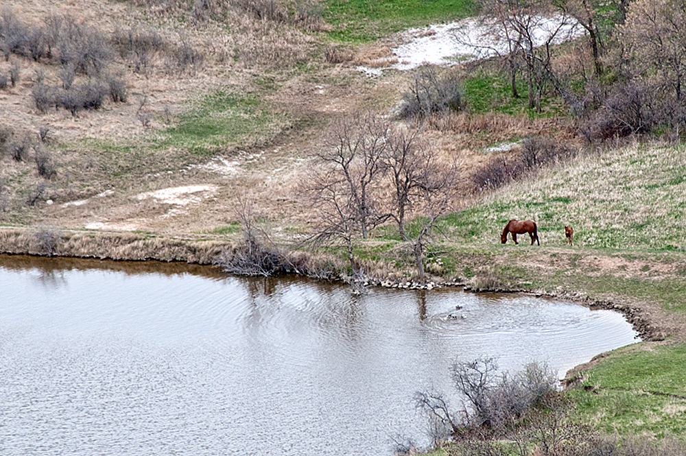
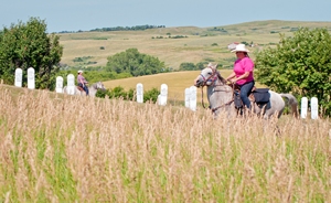
We stopped to see if the white mare and black cold would get closer. We were between them and the water — their apparent goal.  Mom chimney butte white mare black coltprotected her babe, so they skirted around us. We stopped, watched and photographed their patient easy stroll past us.   They disappeared over the hill.


Oh, and those first two colts we spotted?  They had moved on, but not far. We looked around for them, but they were safely out of sight. We got back in to our pickup and drove around Chimney Butte to the east side.  There they were! The mares and their colts didn’t mind us driving by. We stopped long enough to grab a shot or two of spring’s new life.two colts and a mare on a hillside

two colts


two mares two coltsWe’d met our goal. We’d captured signs of spring in the beautiful Bakken region of North Dakota where nature underground is yielding a harvest of plenty and where nature above the ground displays the beauty we’ve come to see.

https://www.facebook.com/beautifulbakken

http://www.mykuhls.com/Beautiful-Bakken/

Where does the trail take you in 2013

The trail toward the Missouri River.

The trail toward the Missouri River.

Where does the trail in to 2013 take you this year?

I’m sure it’s too early to tell..unless you’re an anal retentive planner. Who knows what the year will throw at you.

For me, I hope to remain as physically active as I was on this, the first day of 2013.  Ahh…it’s been a long long time since I was at my best physical shape, and today shows that clearly.  But hopefully today was a good sign.  It meant heading out of town, away from the videos and photos to edit, away from the papers to write. Away from the frames to make and the photos to mat.

The road west of Wilton leads straight to the river.  This region of the state is called The Missouri Slope region and you can see why…the soft rolling hills slope down to the river.

Once to the bottom, cross over to the west side and there’s the best cross country skiing in the region.

trail along river wtrmrk

Along the Missouri River

So, there’s my first hint at where I want the trail to take me — away from the daily grind.  First a drive toward the Missouri River, then to the river itself.  This is as close to where Lewis and Clark and the Corps of Discovery traveled the winter of 1803 — 210 years ago.  It’s the Missouri River along the Lewis and Clark trail, south of Washburn at Cross Ranch State Park.

But wait!  There’s more!

skis point to clearing horz wtrmrk

Skis to the trees

It’s not just a pretty place, it’s a place to get physical.  So, I did, on cross country skis.  It just seems to me that as long as we’re gonna have winter — and we can’t do anything about that — we might as well use it.  A bright day, light winds from the south, and fresh snow.

Mike stops on curve

The trail starts

Years ago, I skied these trails regularly, but in recent years, there’s not been enough snow.

The trail starts through the trees and a short distance from the start, a person can choose to take a long, long, LONG route south, or curve back to the north. That’s me.  Ready to take the curve back north.

So, along the river I skied for about 45 minutes.  My daughter would roll her

away from camera along river bank wtrmrk

along the trail

eyes. When she and I used to do this every week, we’d be gone for a few hours.

*pant*

*pant*

*pant*

Maybe next time.  But certainly not today.  Dang I’m outta shape.

So, the trail in to 2013, hopefully will take me back to better physical conditioning and I won’t take the turn back to the north, but will ski along the trail south of Cross Ranch.

Are you up to join me some afternoon?

.

October 21 Images larger than life

Clark, Sheheke, Lewis

Here we are again, a seasonal visit to the larger-than-life images of three people who shaped the United States like no one else has done.William Clark, hired by Captain Lewis visit with Mandan Chief Sheheke.  The three represent the lost art of cultural curiosity and cultural acceptance.  Clark and Lewis stayed months with the Mandans at a campsite just under the hill from these statues.  They learned from the Mandans, and thanks to the hospitality (which still marks the Mandans today) they were able to live through the winter and carry on their expedition.

Chief Sheheke, curious about white man’s life went back to Washington DC to meet President Jefferson and to learn of this culture he did not know existed until he met the Corps of Discovery.  Sadly, it was not a good move for the Chief. When he returned to his people he was not well-received, nor were his stories of white man’s civilization readily believed nor accepted.  He lost status, leadership and eventually his life.

These statues stand at the Lewis and Clark Interpretive Center at Washburn, just above the Missouri river. See that tree in the background, it’s literally on the crest of the hill overlooking the Missouri River below.

Most travelers through North Dakota stick to the Interstate, or don’t even bother to head west to see North Dakota outside of the Red River Valley, and so they do themselves a disservice by not exposing themselves to the beauty that Lewis and Clark encountered,  a region fairly unsullied by modern life, a region where the actual trees the Corps of Discovery walked through are still standing, living and growing.  The Interpretive Center is a hidden jewel in America.

Have you been up the Missouri River to the near-wilderness areas of North Dakota? Have you been to the Interpretive Center or nearby Fort Mandan?

June 26

Fort Clark walking trail

Sunset at the historic Fort Clark site near Washburn can give only a hint of what it must have looked like 200 years ago when Lewis and Clark passed through this region and where the Mandan Indians called home.

Today, it’s an historic site with reportedly great archeological importance.   Nearby wind turbines in Oliver County overlook the site. Many earth lodge foundations are visible on the walking trail, all marked with story boards to help tell visitors the history of this notch in the Missouri River breaks.

This site goes back to 1822 when members of the Mandan Indian Tribe built earth lodges to create a village overlooking the Missouri River. A few years later, the American Fur Company made contact with the people of the village.  Later, painter/illustrator/historian Karl Bodmer and George Catlin visited the village.  Teh fur trading fort was named for William Clark who with Meriwether Lewis traveled through the area about 25 years earlier.

The village was wiped out when a steamboat with passengers and goods infected with small pox passed the disease on to the villagers.

June 14

Sun sets behind Oliver County Buttes

I have a hard time, if downright impossible time imagining what Lewis and Clark wrote about these hills covered with buffalo.  When the Corps of Expedition reached this site on the Missouri River, about 15 miles south of Fort Mandan, it was coming on to winter.  The Corps stayed with the Mandan and Hidatsa  that winter and later Fort Mandan was built.  Here, however is where they wrote about vast herds of buffalo covering the landscape.

Today, its ranch country.  Mostly cattle over there on the buttes in Oliver County and some wheat along the bottom ground.  The entire Missouri River valley once looked much like this until the U.S. Government decided to use Indian Reservation land as catch basins for flood control down stream.  Land like this was taken when Lakes Oahe and Sakakawea were flooded behind the dams the government built.

On this particular day or evening, I was headed south to Bismarck along River Road. I could see the sun shifting the colors of the landscape in to a more rosy tint.  I found a place where I could pull over, then hiked a bit to get to the high point along the river where the buttes would visually “support” the sun.  I haven’t found the trick yet to shooting straight in to the sun and at the same time getting the landscape to be visible.  The sun will overpower the aperture and exposure of the camera and everything else will be a black silhouette, but this time, I think I got pretty close to getting the scene as it was.

Have you a spot near you where I can practice my sunset shots?