You can see why this is a popular easy rugged trip: Theodore Roosevelt National Park

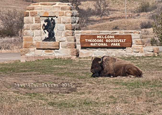
A bison sleeps at the entrance of the North Unit of the Theodore Roosevelt National Park.

I love taking visitors, even young children to the North Unit of the Theodore Roosevelt National Park (TRNP). It’s on the very south edge of McKenzie County, and is one of those features that makes McKenzie County a world class destination.  In classic North Dakota style, the TRNP under promises and over delivers.  You’ll be amazed when you put on your hiking shoes and explore the park.

It’s a rugged wilderness with a variety of trails through the park to suit all types of hikers. That’s why, when we visit the park, we don’t stay in the car, we get out of the car and in to nature.  When my three kids were in their energetic elementary and preschool days, they could be loose, free and safe to run, explore and challenge one another.

Sure, some people just drive through the park, a 14-mile Scenic Drive that leads from the entrance station to Oxbow Overlook, with turnouts and interpretive signs along the way. Drive-by tourists look for bison, park at the top loop and the lookout post, then drive away.

You can see the Little Missouri River from the far end of the park, near the Overlook Shelter

The park is there for you to experience, not merely view. So, along the 14-mile drive, you will pass a number of hiking trails. Some are self-guiding nature trails that have interpretive brochures to help you learn more about the park.

The Caprock Coulee nature trail is an easy jaunt with good photo opportunities. It does not have the rugged climbs and overlooks that the Achenbach trail has.


History

The idea for a park was evolutionary.  It started to be just an idea for a memorial to President Theodore Roosevelt in about 1919 shortly after he died.  Eventually, in addition to a connection with a president, the land was recognized for its diverse cultural and natural resources. On November 10, 1978, the area was given national park status when President Carter signed the bill that changed the memorial park to Theodore Roosevelt National Park.


Here’s the history of the park

When Theodore Roosevelt came to Dakota Territory to hunt bison in 1885, he was a skinny, young, spectacled dude from New York. He could not have imagined how his adventure in this remote and unfamiliar place would forever alter the course of the nation. The rugged landscape and strenuous life that TR experienced here would help shape a conservation policy that we still benefit from today.  –from the the National Park System publication about TRNP

Our recommendation

The North Unit is eons younger than it’s twin in the southern part of the state, the South Unit near Medora. The North Unit is more rugged and challenging. It also has less tourist traffic since it is more remote than the South Unit. The South Unit is on Interstate 94 and easily attracts people to pull off the Interstate.

Our personal favorite is to hike all or part of the Achenbach Trial. It is 18 miles long and you can extend it in to a two-day hike. If you intend to camp in the backcountry must obtain a free backcountry permit prior to their trip. Permits are issued at the South Unit and North Unit visitor centers. The full trail provides steep climbs and descents and two river crossings await you on a trail that leads deep into the heart of the Theodore Roosevelt Wilderness. 

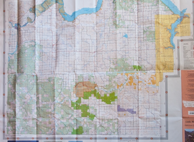
It’s tough to do in one day, so we recommend just taking the west end of the trail down the hill from the Oxbow overlook.  The map will shows where to get on and off. 

Family Tip

If you have children, try the Caprock Coulee or Cannonball Concretions for a couple hours.  If you keep it short, you won’t get as worn out, and the kids will look forward to returning.

See what we saw

Last fall, we hiked the west portion of the Achenbach. We parked our Jeep near the bottom of the hill, and hiked up over a ridge to the south to intersect with the trail. Once on the trail, we headed westerly.  It’s an upward grade, but we were fresh, so it was an easy hike up. 

We’d stop every so often to look over the hills, or look back to see how far we’d come. 

At one of the highest points on the Achenbach Trail, near the west terminus, a look back at where the trail started.

It doesn’t seem like much until you look back to see where you started.  There are attractive/amazing/impressive spots along the trail where we got and exercise climbing over, around or through rock formations.

The Oxbow Overlook is one of the most photographed buildings in the state.

How to get there

The North Unit is a 50-mile drive north from Interstate 94.  Or a 15 mile drive south of Watford City in McKenzie County.  It’s a good highway in to the park from either direction.  The highway in the park is well-maintained.  Motorcyclists often make it a day ride to and through the park.

The 14-mile loop in the park attracts motorcyclists and others who ride through the canyon floor up to the overlook at the end. The highway is below some of the higher points on the trail.

Stop in the visitor center when you pay the entrance fee to get maps. There are three easy trails, each shorter than one mile and can be hiked in less than a half hour.

 It’s right on Highway 85, a modern two-lane highway 50 miles north from Belfield and Interstate 94.  Or you can come down from the north, about 14 miles south of Watford City on Highway 85.

Can you recommend a hike in the North Unit?

What to read more?  Here’s a link to read more about the Achenbach Trail  

Here’s the link to get the Park Hiking Guide

Subscribe to get more vacation and exploration ideas from Western North Dakota.

Enter the word “McKenzie” in the subject line to get a free 22-page eGuide to places to go in McKenzie County.


5 amazing free or low cost world class points in McKenzie County

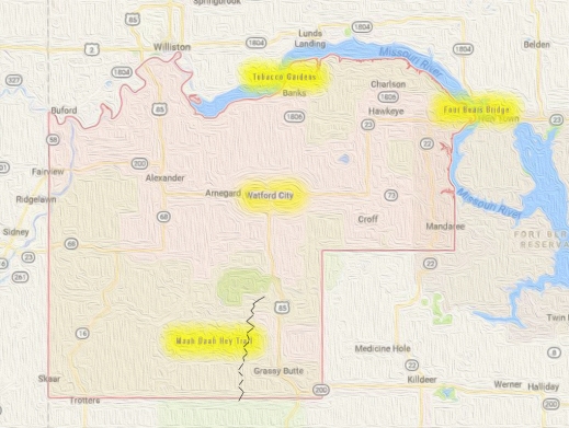
The county is larger than Washington DC, Rhode Island and Delaware. When settlers moved to the area, McKenzie County was known as an island and called the Island Empire. You cannot get to it without crossing water.stylized-map-of-mckenzie-county-map

The Missouri River, Yellowstone River and Little Missouri River set the boundaries of the county. They also contribute to the world-class recognition of McKenzie County.he largest county in the state, McKenzie County has always been fascinating, going back to the Dakota Territory days.

I was first intrigued by the county thanks to the historic McKenzie County Grazing Association, a rancher group intent on maintaining the industry and the environment that supports ranching. From there, my interest and my involvement in the county’s heritage grew.

There are five world-class points in the county:

  1. Four Bears Bridge
  2. Lake Sakakawea
  3. Theodore Roosevelt National Park
  4. Maah Daah Hey trail
  5. Rough Rider Event Center

Sure, you can take a day trip to buzz through all six locations, but why would you? We put this together so you can take advantage of vacation days, weekends or holidays through the year to explore the adventures, get insight and history of America. It’s  yours to enjoy.  Each site is free or very low cost.

Four Bears Bridge

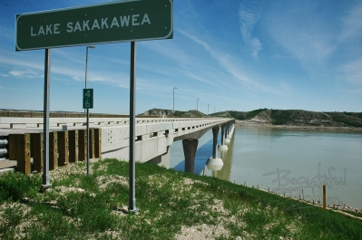
The mile-long Four Bears Bridge spans the Missouri River and Lake Sakakawea

The mile-long Four Bears Bridge spans the Missouri River and Lake Sakakawea

This mile-long bridge is the latest effort to overcome the continental division of the Missouri River. During four construction seasons, 2003-2007, a new $55 million dollar bridge was built using context sensitive design.  It won several international design contests and is recognized as a model for designing a modern structure that seamlessly fits in the cultural, natural, social and economic environment of the area.

Each sweeping arch is designed to transfer the load in to the piers and the rock bed 90 feet below the water. The chopped off cones at the base of the piers are designed to stand up to ice floes coming downstream.

Each arched span directs the weight of the bridge in to the piers

Each arched span directs the weight of the bridge in to the piers

Walk the bridge to see artwork detailing the history of the Three Affiliated Tribes of the Fort Berthold Indian Reservation, the MHA Nation.  The stories of the Mandan, Hidatsa and Arikara nations are on storyboards on both ends of the bridge.

Here’s what you can do here next to an internationally recognized engineering feat (and it’s free!):

  • Walk across,
  • Walk under
  • Follow the recreation trail,
  • Learn history
  • Have a picnic.

Lake Sakakawea

Lake Sakakawea is 180 miles long, providing public shoreline access from which sunrises and sunsets can be viewed.

Lake Sakakawea is 180 miles long, providing public shoreline access from which sunrises and sunsets can be viewed.

Damming the Missouri River at Garrison with Garrison Dam, created a magnificent 180-mile long lake with 1,530 miles of PUBLIC shoreline.  The Army Corps of Engineers says the lake covers 382,000 surface acres making it the largest manmade lake in North America where the entire shoreline is open to the public.

Pontoons, and other boats take full access of the 300,000 acre lake.

Pontoons and other boats take full access of the 300,000-acre lake.

It is world famous for its recreation, walleye fishing and its paddlefish snagging.

Here’s what you can do here next to this world-famous lake:

  • Hike the shoreline
  • Watch sunset/sunrise
  • Visit the parks
  • Learn history
  • Have a picnic
  • Fish
  • Boat (fishing, sail, jet ski)
  • Scuba Dive
  • Camp
  • Swim

Theodore Roosevelt National Park

Bison roam freely at the Theodore Roosevelt National Park. They are not domesticated, so give them plenty of space.

Bison roam freely at the Theodore Roosevelt National Park. They are not domesticated, so give them plenty of space.

Undersold and over delivering as a National Park, the North Unit of the Theodore Roosevelt National Park (TNRP) is on the south edge of McKenzie County.  It is a rugged wilderness with a variety of trails through the park to suit all types of hikers.  The roadway through the park takes visitors to the Riverbend Overlook cabin above the Little Missouri River.  Along the drive, it’s likely you will see a collection of bison or other species such as mule deer.

When Theodore Roosevelt came to Dakota Territory to hunt bison in 1885, he was a skinny, young, spectacled dude from New York. He could not have imagined how his adventure in this remote and unfamiliar place would forever alter the course of the nation. The rugged landscape and strenuous life that TR experienced here would help shape a conservation policy that we still benefit from today.

–National Park System publication on the TRNP

On the Achenbach Trail, the views of the Little Missouri River Valley are outstanding.

On the Achenbach Trail, the views of the Little Missouri River Valley are outstanding.

It would seem a great number of visitors view the park through their windshield. They’re missing out. There are several trails in the park to accommodate all levels of fitness. One of the most challenging is the Achenbach Trail. It is 18 miles long and you can extend it into a two-day hike. (Anyone intending to camp in the backcountry must obtain a free backcountry permit prior to their trip. Permits are issued at the South Unit and North Unit visitor centers.)

Here’s what you can do here next to this National Park:

  • Hike
  • Picnic
  • Photograph
  • scout wildlife
  • access the river
  • research, browse books
  • drive

Maah Daah Hey trail (Otherwise knowns as the “lasting a long time” trail)

The world-class 125-mile long Maah Daah Hey trail attracts riders from all over the United States and many European nations.

The world-class 125-mile long Maah Daah Hey trail attracts riders from all over the United States and many European nations.

Imagine a 125-mile trek through Badlands wilderness on a mountain bike, horse or on foot. Mule and whitetail deer, antelope, wild turkeys, beaver, prairie dogs, and coyotes are often sighted, while an occasional golden eagle, red-tail hawk, or prairie falcon may be spotted soaring above. Bighorn sheep and elk have been reintroduced into the area and can be spotted by keen observers.

On rare occasions, you can catch a glimpse of the Big Horn sheep.

On rare occasions, you can catch a glimpse of the Big Horn sheep.

Wildflowers such as this crocus adorn the trail.

Wildflowers such as this crocus adorn the trail.

The single-track mountain bike trail has attracted world riders to visit with their $4,000 bikes. You can rent mountain bikes on the south end of the Maah Daah Hey trail at Medora.

The dream was to connect the two units of the Theodore Roosevelt National Park. The actual planning and building took about 14 years. It’s a difficult trail to maintain through the erosive and wild Badlands. In recent years, your tax dollars have not been spent to keep it up. Locals including the Save the Maah Daah Hey trail group sculpt and mow the trail. The group hosts the annual Maah Daah Hey 100 mountain bike ride: 100-miles in one day. The winning time is just minutes under 10 hours.

There is no time of year that is a bad time to strike out on the trail. Of course, North Dakota’s legendary afternoon and evening thunderstorms can make the trail very challenging even for the most experienced adventurer.  dead-tree-in-the-brush-color-sig

Don’t be scared off by the massive challenge the Maah Daah Hey can present.  There are plenty of short-access hikes, here’s where you can get on the trail to get in to the Badlands:

  • CCC Campground
  • Summit Campground
  • Bennet Creek
  • Beicegel Creek
  • Highway 50 West of Grassy Butte

Rough Rider Event Center

img_3287Imagine a $100-million indoor swimming pool with a few extra features.  That’s a silly way to describe the Rough Rider Event Center.  It is an auditorium, arena, gymnasium, and indoor water park, swimming pool, walking track, two ice hockey rinks, convention center, coffee shop and restaurant. Concerts, conventions, hockey and basketball tournaments draw thousands of people to the Rough Rider Event Center.

Architect’s specs:

  • 22,000-square-foot multi-use field house
  • Three basketball courts
  • Removable artificial turf
  • 1,000-seat hockey arena
  • Separate practice hockey rink
  • 3,000-seat arena for sporting events and concerts
  • Eight executive suites
  • 12,000-square-foot gymnastics club
  • 10,000 square feet of convention space
  • Continuous elevated running track.

img_3279

Watford City visitors can use the facility for a surprisingly low fee. For $7.00 visitors can enjoy daily use of any open activities, including swimming.

Just because these are the six world-class sites in McKenzie does not mean there are no more incredible places such as the Long X Museum and Visitor Center, art galleries and coffee houses in Watford City,  Fairview Lift Bridge, the Cartwright Tunnel,  Grassy Butte and its post office, the Frontier Village, the museum at Alexander.

There’s a lot more to these five world-class sites. Type the word McKenzie in the subject line of the contact form to know:
  • more about each one
  • how to get to each one
  • recommendations activities at each site
  • the history of each site
It’s free!
We’ll send you a 20-page travelogue for free just because we think McKenzie County is worth bragging about and you will too.  So, have a good time.
 
Oh, and click to subscribe to this blog to learn more of events, locations, activities each week. Pictures, information, and helps each week are posted here.  


Three happy, hardy, healthy ways to get into the Badlands — The Poco Rio Frio race

Snow tires on a bicycle? You bet.  It’s a “fat bike.”

fat bike rider on the Maah Daah Hey trail

Riding a fat bike, a trail rider in orange heads out for a two to 5 mile loop on the Maah Daah Hey Trail

If you put snow tires on a specially built bicycle you’ve got the way to travel through the Badlands. Your tourism opportunities just took a turn for better health.  South of Watford City at the CCC Campground just off of Highway 85, you’ll find an easily accessed and groomed trail for hiking, xc skiing, snowshoeing or fatbike riding.

Not just the tires, but the entire frame, sprockets, gears and axles of a fat bike are set up to help riders through the snow.

Not just the tires, but the entire frame, sprockets, gears and axles of a fat bike are set up to help riders through the snow.

Explore. Exercise. Get away from the crowds – unless of course, it is the Poco Rio Frio race.  Then you have an additional benefit of getting with like-minded people. Outdoorsy, healthy, happy.

Riders, hikers, snowshoers and cross country skiers could take a break around a camp fire, get a bite to eat before their next loop on the trail

Riders, hikers, snowshoers and cross-country skiers could take a break around a campfire, get a bite to eat before their next loop on the trail.


“I think the best part is getting with other out here, friends to share this experience with, “said organizer Nick Ybarra.

Ybarra promoted the event across the region. One week before he’d organized a snowshoe trek on the same track.  It packed down the snow that otherwise would be as much a four feet deep.  The afternoon work by Ybarra, his family and friends turned the trails in to perfectly groomed trails for riders, showshoers and cross country skiers.

A cross country skier navigates the Long X trail on a two to five mile loop.

A cross country skier navigates the Long X trail on a two to five-mile loop.

Here’s the story on the fun day of snowshoe packing the trail

So, when riders hit the trail, it was packed and ready for their fat bikes.  Riders from as far as Fargo, Hazen and Bismarck racked up miles on two loops through the upper Badlands, one 2.5 miles, the other 4.5 miles.


A rider starts out on the packed and solid Maah Daah Hey loop that will bring him back around on the Long X trail in the Poco Rio Frio race.

Sean Hatten on one of his many laps to his first place, 54-mile victory!

Around and around the loops they went. The longest ride of the day was 54 miles! Both with their unique challenges such as the portion over the creek that empties in to the Little Missouri River. It’s frozen now, and in the morning, it was glare ice. After snow fell mid-day it became a smooth track easy glide for a short section to break up the heart-racing, deep breathing of the hills riders pedaled up and coasted down.

Riders looped around on the head of the Maah Daah Hey trail. Or they followed the Long X trail, or both.  The goal was to make as many laps as possible in the allotted time.

The Poco Rio Frio race included 19 fatbike riders, 42 snowshoers and two cross country skiers. After each round, they marked their mileage at the relief tent.

The Poco Rio Frio race included 19 fatbike riders, 42 snowshoers, and two cross country skiers. After each round, they marked their mileage at the relief tent.

Click here to see a gallery of photos from the Poco Rio Frio Maah Daah Hey fun day

More than 40 people on showshoes explored the loops in the Badlands in the Poco Rio Frio race.

More than 40 people on snowshoes explored the loops in the Badlands in the Poco Rio Frio race.

The miles added up…30, 40, 50 miles or more logged at the relief station at the head of the trail.  Here’s where riders laughed, ate and powered up for their next set of loops.

A rugged heating system welcomed riders who needed to rest before their next loops

A rugged heating system welcomed riders who needed to rest before their next loops

Collin Kemmesat is the General Manager of fat bike dealer Epic Sports in Bismarck, and he was as pumped as anyone about the Frio race.

His knowledge and experience could help with any mechanical issues, but mostly he was there to rack up fat bike miles.

Collin has a passion for bikes. “Fat biking has not peaked,” he said.  “It’s popular all year around.  Winter riding is best when there’s not a lot of snow. “This winter’s near-record snow depth has curtailed some of the fat bike riding. That’s why the packed trail for the race was a great opportunity.  Kemmesat said trails along Harmon Lake north of Bismarck, and other trails in the capital city are getting more interest.

For the Ybarra family, outdoor adventures involves every one, starting early in life.

For the Ybarra family, outdoor adventures involve everyone, starting early in life. Check out his website http://www.experienceland.org

Ybarra has taken on the care and use of the Maah Daah Hey trail, organizing a half-dozen mountain bike rides a year on the trail.  His goal is to bring back the popularity of the trail as it was 10 or 15 years ago. The 130-mile trail that loosely follows the Little Missouri River to southern North Dakota will become increasingly more well-known in 2017 as Ybarra and his happy bike trail friends put out the word.

Click here to read more about events and opportunities on the Maah Daah Hey

What can we do to help you get started riding or hiking the Maah Daah hey?  Name it in the comment section below.


Wanna ride a grasshopper?

Yes, you can saddle up on an enormous green thing.

You can feel very very small at the enchanting stops along a highway in Western North Dakota. Gargantuan sculptures give travelers and tourists a reason to pull off I-94 at Exit 72 and head south on a gentle rolling blacktop highway called the Enchanted Highway.geese-in-flight-sig-small

I have. More than once. Over several years.

For me, the first enticement came from that eye-catching structure on the north, Geese in Fight.

It’s considered Sculpture #1. Structurally as well artistically, artist Gary Greff’s design is impressive and deceptive.  It’s larger than you think, over 100 feet tall.  Geese that are 5 or 6 feet big pass in front of sun rays, hillsides and a great “eye.”

Like most people, I buzz by it more than I stop.  It’s a good place to stop on my way to or from Dickinson.  There’s a parking lot and room to get out and stretch your legs, so I do — sometimes when the dog is with me to let him get out of the pickup for a while. Or on a summer motorcycle cruise we’ll stop with fellow riders.

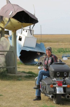
Sidehack Mary's rig is dwarfed by the giant sculpture

Sidehack Mary’s rig is dwarfed by the giant sculpture

tommn-blog-photo-of-the-deer

This is how most drivers cross North Dakota see deer, running across the highway, jumping the fence. TomMN’s blog includes this pic. You can see his blog at http://www.tommn.com/

And those grasshoppers…the scourge of the prairie.  Bikers from the old days will tell you how they rode across North Dakota in August and at the end of the day, their shins were bruised from the biggest devils…but they weren’t this big.

mike-mary-grasshoppers-2Still, the rascals look to me like they need a little wrangling and riding.  So, on occasion, that’s what I will do, just to keep them in line, you understand.  I don’t win any buckles or anything.  I make sure they don’t get away and I use my best bronco riding techniques to stay on.

They look fearsome, but a calm head and a steady hand is all it takes to bring one under control and ride it to the sunset.

Ride. Ride the tiger...er um, grasshopper

Ride. Ride the tiger…er um, grasshopper

Down the road a ways, things get a little fishy.  I couldn’t begin to design something so realistic, but I can sure admire it. I’d hate to be the fisherman in the boat above all these monsters, but he’s up there.  I’m glad it’s him and not me.enchanted-highway-fish

After you've slid out of the boat wreck watch out you'r not swallowed by a walleye -- bikers need not worry.

After you’ve slid out of the boat wreck watch out you’re not swallowed by a walleye — bikers need not worry.

mike-fish-enchanted-highway

zzdata-1161_640x480

Don’t stand under the back end…the “plop” may be more than you expect


The 32 mile stretch has a stop near the north end at the quaint, protected, sheltered little village of Gladstone, or you can keep going all the way to Regent, at the end of the line. It’s where Gary Greff makes his sculptures and is working on his next one, a knight in not-so-shiny armor.

The last time I visited the Enchanted Highway, fall of 2016, I got to the south end in time for one of North Dakota’s legendary sunsets.  In my mind, I removed the highways, the ranches, the signs of civilization and could imagine how rough it must have been to cross this region in a real stagecoach, not a plywood replica.  In fact, the Mandan to Deadwood stage did pass near here. What a ride!enchanted-highway-stagecoach-sunset-sig-small

At the end of my late-day drive down the highway, Teddy was there to welcome me, the moon at his hand, his gregarious outgoing nature larger-than-life.  And wouldn’t ya know it — as a president, you could say he was “transparent!”tr-on-enchanted-highway-with-moon-sig

The North Dakota Tourism Department does a great job of promoting this loop off of the beaten path. Read about the Enchanted Highway here .  Do you have photos of your enchanted visit?  I bet you have photos of Paul Bunyan, or New Salem Sue, or some other monster replica, right?


5 FREE things to do in North Dakota’s Badlands

Quick! Now that school is on break!

You’ve got a bit of time to gather the tribe of kids, family and friends to get out west and see a part of North Dakota that’s easily missed.  The best part is, the biggest cost will be your gasoline because there’s plenty to do in Western North Dakota that will build memories.  Here are five free things to finish out your summer memories.

#5 Fort Union Trading Post

Fort Union Trading post -- an authentic reproduction. Photo courtesy of Wikimedia Commons

Fort Union Trading post — an authentic reproduction. Photo courtesy of Wikimedia Commons

If you and your family like regional history or Lewis and Clark experiences, then head to the northwestern part of the state, and get right up to the Montana border.  About halfway between Sidney, Montana and Williston, North Dakota is the Fort Union Trading Post.  Late summer, it’s a fairly quiet place for you to explore.  In June the rendezvous brings the era  of the early 1800’s to life.  Decades before the Civil War, settlers, trappers, soldiers and tribes from the Northern Plains met here peacefully to trade goods.

This free stop on your late-summer tour of western North Dakota is best enjoyed by older children and adults. (But don’t worry, there are several other nearby sites such as Fort Buford and the Confluence Center that will keep the younger ones entertained. Or the best for all family members is nearby. It’s #1 in this list.)

Approaching from Sidney, take a gravel road north to the river to see how the trading post must have looked to trappers and tribes from across the river -- minus the wheat fields.

Approaching from Sidney, take a gravel road north to the river to see how the trading post must have looked to trappers and tribes from across the river — minus the wheat fields.

From inside the Fort, looking back to the other side of the river, in the trees where the shot above was taken.

From inside the Fort, looking back to the other side of the river, in the trees where the shot above was taken.

  To keep the youngest members of your group entertained, you probably won’t stay here long, but there are two more stops nearby.  Head around the bend to Fort Buford where you can camp (for a fee) or explore the Confluence Visitor Center and get three views of early Plains life.

#4 Wander Medora (but is this really free? Ice cream has a cost.)

It doesn’t cost anything to wander the streets of Medora.  There are several good places to eat.  If you’re an ice cream lover you’ll get surprisingly large servings.  Ice Cream at Medora is actually a summer goal for many families.  It’s easy to get to Medora, right off of I-94, about 25 miles from the Montana border.

If you and your family want to take advantage of the exercise opportunity, take your bicycles.  It’s free to pedal the streets and trails nearby. Many families do. There’s no cost to bicycle the town, take the East River Road south of town,  or take the recreation trail across the Little Missouri River to the west of Medora.

An option that is not free is to rent bicycles in town. Or bicycle in to the south unit of the Theodore Roosevelt National Park, you’ll have to pay the entrance fee.  Its entrance is on the edge of Medora.

A family takes advantage of the paved bicycle trails around Medora and out in the country.

A family takes advantage of the paved bicycle trails around Medora and out in the country.

Pay the entrance fee and take a bicycle ride in to the South Unit of the Theodore Roosevelt National Park. Take supplies, though. You will need to carry plenty of water.

Pay the entrance fee and take a bicycle ride in to the South Unit of the Theodore Roosevelt National Park. Take supplies, though. You will need to carry plenty of water.

North Dakota’s legendary Maah Daah Hey trail is a mountain biker’s dream. Families can get access to as much or as little of it as they want — free.  You don’t need a bicycle. Your feet go with you, right? Take them and use them.

Maps of the trail are available on-line, or buy the most comprehensive map from the U.S. Forst Service.

The U.S. Forest Service map costs about $13 and is the most valuable tool (other than your camera) that you can take.

The U.S. Forest Service map costs about $13 and is the most valuable tool (other than your camera) that you can take.

#3 Hike the Maah Daah Hey — head to the Ice Caves

Even short little hikes will keep the youngest in your family entertained if they know the destination is right down the path.  For a short hike with a rewarding destination, park at the Ice Caves Maah Daah Hey parking lot and take a half-mile hike to a cooling spot.   The Ice Caves is part of the Maah Daah Hey trail. It’s about 10 miles south of Grassy Butte on Highway 85 and then 10 miles west on a gravel road #713.  In the spring, snow run off melts in to the cave and freezes on the floor.  This time of year, there’s no ice, but it’s a great place to climb inside to cool off.

Inside the Ice Cave

Inside one of the Ice Caves

Hike around to the north of the Ice Caves to get a spectacular view of the North Dakota Badlands.

Hike around to the north of the Ice Caves to get a spectacular view of the North Dakota Badlands.  The caves are directly below where I’m sitting on the edge.

The Maah Daah Hey trail is marked with the turtle-branded sign posts, so it’s easy to follow the route.  Markers along the way give you information of different trails you can take

Hike the Maah Daah Hey to the Ice Caves. It's a short jaunt, less than a mile from the Ice Caves Parking lot. From the Magpie Campround it's about 3 miles, a full afternoon hike.

Hike the Maah Daah Hey to the Ice Caves. It’s a short jaunt, less than a mile from the Ice Caves Parking lot. From the Magpie Campround it’s about 3 miles, a full afternoon hike.

#2 North Dakota grasslands

A short hike in to the Long X Trail south of Watford City will open the valley to your family’s challenge. You can stay on the trail at the bottom of the valley, or pick a point and climb to the top.

Some of the best trails for a family are the Long X Trail south of Watford City on the southern edge of the Little Missouri River.  Near Grassy Butte are the Beicegel Trail and the Bennett Creek Trail.  Signs on Highway 85 direct you to both trails. They are easy trails, both give you a flat starting out point and provide hill-top challenges that reward you with a spectacular view.  Tall wooden markers along the trail are easy to follow.

The best views are from up on high.

The best views are from up on high.

Climbing seems is a favorite passion of children, so pick a high point that matches their skills.  Even the shortest of the tall bluffs and buttes gives kids a chance to build their muscles and their confidence.

A rest break is called for on the climb up a bluff off the trail.

A rest break is called for on the climb up a bluff off the trail.

Oliver, my grandson likes the challenge of a good climb

Oliver, my 6-year old grandson likes the challenge of a good climb

Click here to Read more about the Maah Daah Hey south of Medora

#1 Fairview Lift Bridge and the Cartwright Tunnel

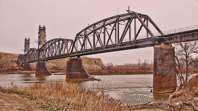
North Dakota's only lift bridge was retired from service before it ever lifted for a steamboat.

An autumn shot of North Dakota’s only lift bridge was retired from service before it ever lifted for a steamboat.

This free exploration will entertain the entire family.  It’s on highway 200 at the North Dakota-Montana state line.  To the west of the Fairview lift bridge, or on the right side of this above photo is the parking log and entrance to the fenced-off walkway across the bridge.

The safety fence gives families a safe place to walk the Fairview Lift Bridge. Children love the view from high above the water.

The safety fence gives families a safe place to walk the Fairview Lift Bridge. Children love the view from high above the water.

Once you start the walk across the bridge, you’ll get a great view of the well-maintained park below where you can enjoy a picnic in the shade of the trees.

Below the Fairview Lift Bridge is a park where you can fish.

Below the Fairview Lift Bridge is a park where you can fish.

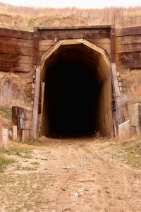
The final reward of the Fairview Lift Bridge is the Cartwright Tunnel.

Built by hand, trains passed trough this tunnel until about 1986.

Built by hand, trains passed trough this tunnel until about 1986.

Until the mid-1980’s trains passed through the tunnel across the bridge.  It’s a quarter-mile long pass through the hill and provides children with a memorable experience — but take a flashlight. It gets dark in there until you get close to the opposite end.

The Cartwright Tunnel has a slight bend in it. Flashlights illuminate the way.

The Cartwright Tunnel has a slight bend in it. Flashlights illuminate the way.

Exploring the tunnel thrills youngsters, but oldsters will be impressed with the knowledge the tunnel was built by hand by local ranchers and farmers using picks, shovels, ox or donkey carts.  It’s guaranteed that you will at some point utter one word: “wowl!”  It’s more impressive than you would think of a bridge and tunnel.

Click here to see the Facebook Page called “Beautiful Bakken” for more on the bridge and tunnel

The nearby Snowden Lift bridge is still in use. It’s downstream about 12 miles.  You can see more about it here.

Downstream (north) of the Fairview Lift Bridge is the Snowden Lift bridge. Though it no longer lifts, trains still cross the river on the Snowden bridge.

Downstream (north) of the Fairview Lift Bridge is the Snowden Lift bridge. Though it no longer lifts, trains still cross the river on the Snowden bridge.

Click here to see more about the Snowden Lift Bridge

Admittedly, these free family features are on the sparsely settled region of North Dakota. So, if you’re planning a visit, pack a picnic, or plan to stop in Sidney, Mt, Williston, ND, Medora, ND,  or Dickinson, ND for a bite to eat and a break from your day of discovery.  It’s all free, if you take a lunch, pack your bicycles if you want, and explore legendary North Dakota.

Ride for St. Judes at Ft Lincoln

Custer's home hosts riders again -- a reminder of 1875.

Custer’s home hosts riders again — a reminder of 1875.

Shades of history were repeated for children at St. Jude’s hospital.  A century ago, riders here were in a protective mode. This time, they’re in a supportive role.

Riders organize before the start of the trail ride fund raiser

Riders organize before the start of the trail ride fund-raiser

It was more than 130 years ago when blue-coated riders rode the hills along the west side of the Missouri River at Fort Abraham Lincoln.  Soldiers were posted there to protect railroad workers building the Northern Pacific Railroad, but their mission changed in the ill-begotten battle at Little Big Horn.

This summer, nearly 100 riders covered the hills above the Missouri at Fort Abraham Lincoln State Park to raise thousands of dollars for St. Jude’s Children’s Hospital.  It was one of the best shoots I’ve ever been on. All the photos are here http://www.mykuhlsphotography.co/Events/St-Jude-Trail-Ride

Riders at the block houses

Riders at the block houses

I got a copy of the map where they’d ride and I intercepted them at various points such as at the blockhouses on a hill overlooking the valley.

A gorgeous day for weather, not too hot, not at all chilly, a good day for soaking up sun and riding without stressing the horses.

Past the blockhouses, the ride went past the original cemetery at the fort — an eerie reminder of life a century ago when people were considered “old” at 45.

Riding past the Ft. Lincoln cemetery

Riding past the Ft. Lincoln cemetery

Riders on hill

Riders in a line come up the hill

The ride started in the valley and went up the hill across the prairie and through the trees.  It was an easy pace — thankfully so that I could catch them at various points.

A family-centered kind of ride where children were more than welcomed — they were encouraged to get on board the powerful horses who gently submitted to the young hands.

Boy gets up Little girl rider

Then, it went back down to the river, and along the trees, out of the sun and in to the cooling shade.

Riding through the trees

Riding through the trees

Once back at the start, later that afternoon, a pot luck feed gave riders a feast that matched the greatness of the ride they just completed.  Grilled burgers, hot dogs and all the other kind of summer picnic food we love.

Good food, good chow line

Good food, good chow line

In the end, the ride raised several thousand dollars for St. Jude’s Children’s Hospital — one of several rides in the nation to support the hospital.  Plans are already underway for next year’s ride.  Until then, here is where this year’s photographs are stored http://www.mykuhlsphotography.co/Events/St-Jude-Trail-Ride

September 4

Here is an example of a changed mind.

There was a time when I was strictly an industrial photographer and disdained the idea of shooting weddings.

I changed my mind.  Though the wedding shoot itself is a little more hectic and dramatic than shooting construction processes, the post production work, the final product is a touch of artistry that I never could touch by shooting only corporate photos.

This Labor Day weekend, I got to shoot Brandy and Jared’s wedding.  I’ve known them for a few years so I was personally invested in their wedding, the start of their marriage.  It was with warm emotions that I spent the extra effort to give them more than just a cd of photos, but also some special touches — free, as a wedding gift.

It opened my eyes to a new kind of photography that I was formerly unfamiliar with, and you know what, I like it.  At least with a fun couple like the Eckroths.  It’s what made special effects such as the jail shot even more fitting for them, and fun for me.

July 26

Small town suburbia

It could be a scene from any suburb in America.  Moms gathered in the semi-shade while the kids play in the nearby pool.  It’s not any suburb, it’s Wilton.  A small town of 800 people along Highway 83, north of Bismarck.  Life in small rural towns in the Northern Plains is pretty much like life anywhere in America — most of the time.  Winters are legendary. They are rugged, but summers are intense with long hours of daylight for neighbors to gather and do what Americans do in the summer, relax and rejuvenate.  Well, most North Dakotans do, anyway, the ones in town. Their rural cousins are too busy this time of year to spend much pool time, but life in even a small town like Wilton is good.

July 8

The street is his canvas

Spencer and his daughter

Thursdays in Downtown Bismarck is an eclectic mix of families and artistry.  Kids are encouraged to express their creativity whether it is with chalk on a normally busy street now closed, or with a hula hoop overhead, or with a band that is more often found in an adult-only venue.

Midnight Noise Orchestra

Urban harvest is a harvest of talent and expression.  Each Thursday in the summer,  vendors set up their booths of clothing and products that you will not find in the local Walmart or shopping mall.  A variety of food is available for lunch or later for supper.  Bands play to an appreciative crowd of youngsters, business people on break, shoppers and the band’s own faithful bunch of groupies.

It’s Bismarck’s attempt at offering a cultural mix that is normally reserved for larger cities or those cities further east in North Dakota such as Grand Forks and Fargo.  Bismarck’s hard-working homogenous German-Russian-Norwegian stock doesn’t have much time or interest in such summer time frivolity.  No, summer is for work in this part of the state.

Still, balance must be an essential part of a human’s health, as well as the health of a community’s humanity.  Work is good, but so is enjoying artistic expressions you might not otherwise see if it weren’t for the efforts of organizers such as those behind Urban harvest.

Urban Harvest

June 18

The family that dances together...

Can you imagine the hours of hand work that go in to these costumes.  The tiny beads that are threaded together to form a pattern, and then to outfit the whole family, including the growing children must take years of work. The families such as this one who make the powwow circuit invest a lot of themselves in their family tradition.

A friendship connects

The Twin Buttes Powwow is  a cultural, social and spiritual event, not one for amusement nor as a tourist attraction. It’s a generational event passed down from countless generations. Thanks to the federal government that took the land where the powwow once was held near the Missouri River, the powwow is now nestled in the buttes and bluffs next to Lake Sakakawea.   It’s not easy to find.  It’s not well advertised nor marked.  But the people who belong there find it year after year.  Though the federal government once cracked down on powwows and prevented them from their annual celebration, the tradition has survived.

I try to attend many of the annual powwows on the Fort Berthold Indian Reservation. There are at least five of them each year, but the Twin Buttes Powwow is my favorite.  It is as un-pretentious as you can get.  It’s authenticity is remarkable and humbling to a visitor like me. I can think of only one or two White European traditions that have carried on for so many generations: Passover, Chanukkah, Christmas, Easter remain but perhaps altered by commercial and societal influences.  Not so with this powwow.

I didn’t get to stay for more than a couple of hours this year, only long enough to greet a few friends, and to see the pageantry of the Grand Entry.  I was fortunate that the light was subdued and even so the photo-ops were even and colors equally visible, neither blown out nor hidden in shadows.

If you care to join me next year to sample a modern celebration of ancient history, let me know. Bring your camera. Let’s go!