You can see why this is a popular easy rugged trip: Theodore Roosevelt National Park

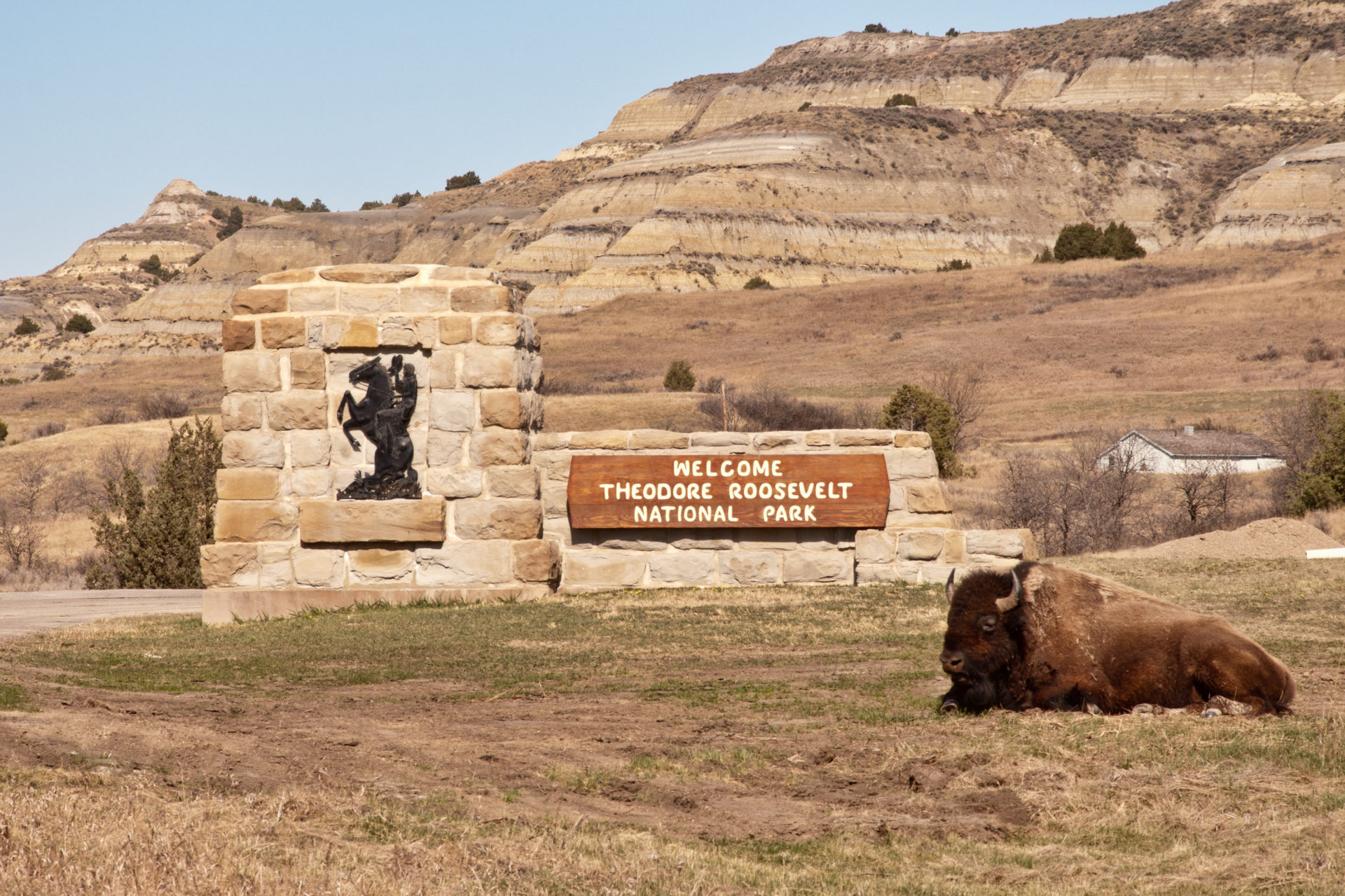
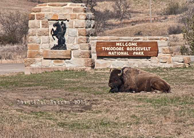
A bison sleeps at the entrance of the North Unit of the Theodore Roosevelt National Park.

I love taking visitors, even young children to the North Unit of the Theodore Roosevelt National Park (TRNP). It’s on the very south edge of McKenzie County, and is one of those features that makes McKenzie County a world class destination.  In classic North Dakota style, the TRNP under promises and over delivers.  You’ll be amazed when you put on your hiking shoes and explore the park.

It’s a rugged wilderness with a variety of trails through the park to suit all types of hikers. That’s why, when we visit the park, we don’t stay in the car, we get out of the car and in to nature.  When my three kids were in their energetic elementary and preschool days, they could be loose, free and safe to run, explore and challenge one another.

Sure, some people just drive through the park, a 14-mile Scenic Drive that leads from the entrance station to Oxbow Overlook, with turnouts and interpretive signs along the way. Drive-by tourists look for bison, park at the top loop and the lookout post, then drive away.

You can see the Little Missouri River from the far end of the park, near the Overlook Shelter

The park is there for you to experience, not merely view. So, along the 14-mile drive, you will pass a number of hiking trails. Some are self-guiding nature trails that have interpretive brochures to help you learn more about the park.

The Caprock Coulee nature trail is an easy jaunt with good photo opportunities. It does not have the rugged climbs and overlooks that the Achenbach trail has.


History

The idea for a park was evolutionary.  It started to be just an idea for a memorial to President Theodore Roosevelt in about 1919 shortly after he died.  Eventually, in addition to a connection with a president, the land was recognized for its diverse cultural and natural resources. On November 10, 1978, the area was given national park status when President Carter signed the bill that changed the memorial park to Theodore Roosevelt National Park.


Here’s the history of the park

When Theodore Roosevelt came to Dakota Territory to hunt bison in 1885, he was a skinny, young, spectacled dude from New York. He could not have imagined how his adventure in this remote and unfamiliar place would forever alter the course of the nation. The rugged landscape and strenuous life that TR experienced here would help shape a conservation policy that we still benefit from today.  –from the the National Park System publication about TRNP

Our recommendation

The North Unit is eons younger than it’s twin in the southern part of the state, the South Unit near Medora. The North Unit is more rugged and challenging. It also has less tourist traffic since it is more remote than the South Unit. The South Unit is on Interstate 94 and easily attracts people to pull off the Interstate.

Our personal favorite is to hike all or part of the Achenbach Trial. It is 18 miles long and you can extend it in to a two-day hike. If you intend to camp in the backcountry must obtain a free backcountry permit prior to their trip. Permits are issued at the South Unit and North Unit visitor centers. The full trail provides steep climbs and descents and two river crossings await you on a trail that leads deep into the heart of the Theodore Roosevelt Wilderness. 

It’s tough to do in one day, so we recommend just taking the west end of the trail down the hill from the Oxbow overlook.  The map will shows where to get on and off. 

Family Tip

If you have children, try the Caprock Coulee or Cannonball Concretions for a couple hours.  If you keep it short, you won’t get as worn out, and the kids will look forward to returning.

See what we saw

Last fall, we hiked the west portion of the Achenbach. We parked our Jeep near the bottom of the hill, and hiked up over a ridge to the south to intersect with the trail. Once on the trail, we headed westerly.  It’s an upward grade, but we were fresh, so it was an easy hike up. 

We’d stop every so often to look over the hills, or look back to see how far we’d come. 

At one of the highest points on the Achenbach Trail, near the west terminus, a look back at where the trail started.

It doesn’t seem like much until you look back to see where you started.  There are attractive/amazing/impressive spots along the trail where we got and exercise climbing over, around or through rock formations.

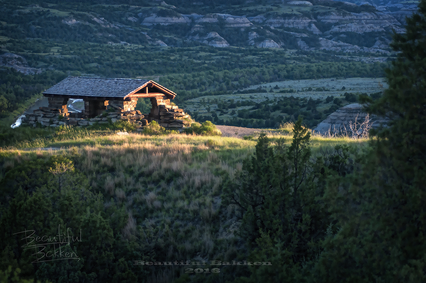
The Oxbow Overlook is one of the most photographed buildings in the state.

How to get there

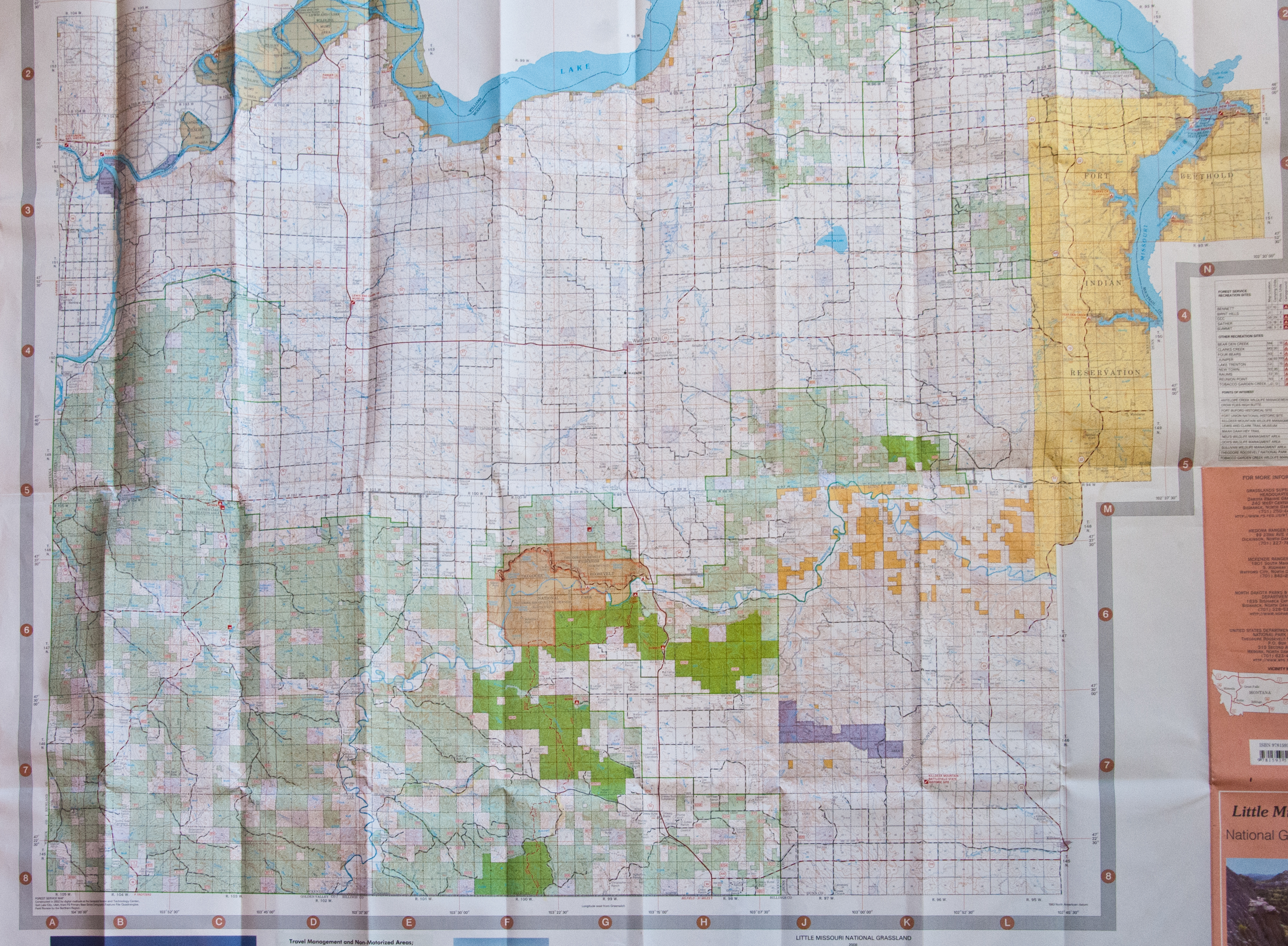
The North Unit is a 50-mile drive north from Interstate 94.  Or a 15 mile drive south of Watford City in McKenzie County.  It’s a good highway in to the park from either direction.  The highway in the park is well-maintained.  Motorcyclists often make it a day ride to and through the park.

The 14-mile loop in the park attracts motorcyclists and others who ride through the canyon floor up to the overlook at the end. The highway is below some of the higher points on the trail.

Stop in the visitor center when you pay the entrance fee to get maps. There are three easy trails, each shorter than one mile and can be hiked in less than a half hour.

 It’s right on Highway 85, a modern two-lane highway 50 miles north from Belfield and Interstate 94.  Or you can come down from the north, about 14 miles south of Watford City on Highway 85.

Can you recommend a hike in the North Unit?

What to read more?  Here’s a link to read more about the Achenbach Trail  

Here’s the link to get the Park Hiking Guide

Subscribe to get more vacation and exploration ideas from Western North Dakota.

Enter the word “McKenzie” in the subject line to get a free 22-page eGuide to places to go in McKenzie County.


Here’s how to enjoy Lake Sakakawea for free at McKenzie County

This North Dakota county gives you nearly unlimited access to outdoor recreation — free!

Sunset over Lake Sakakawea at McKenzie County.

You don’t need a boat to enjoy Lake Sakakawea.  The magnificent lake is 180 miles long with 1,530 miles of PUBLIC shoreline.

Plenty of opportunities to wade in the water to cool off on a hot day hike.

As we found out, that means you can explore, hike, bike for days on end.  Find a bay or inlet and you can camp next to the water, or if it’s a hot day, dive in and cool off. It’s what we did, and here’s all you need to know to enjoy the Lake.

Hiking the shoreline north of Charlson along Lake Sakakawea


First, a little background:

The Army Corps of Engineers created and maintains the lake; it owns the immediate shoreline. It says the lake covers 382,000 surface acres making it the largest manmade lake in North America where the entire shoreline is open to the public. It is world-famous for its recreation, walleye fishing and its paddlefish snagging.

History

Without a ferry system, McKenzie County farmers struggled to get grain to a nearby rail line across the Missouri River.

Lake Sakakawea was formed in the 1950’s by damming the Missouri River. Even before it was a lake, the River was a transportation barrier. The river challenged McKenzie County farmers to get their crops to market, going north across the river to Williston.

Ferries such as those at the ghost town Banks on the Tobacco Garden Creek helped farmers move their grain.  Eventually, a bridge across the river at Williston helped ease transportation.

After WWII, the Army Corps of Engineers built a series of dams on the Missouri River, each one backing up on to historic tribal land and Indian Reservations. In 1956, the Garrison Dam swallowed up the largest amount of historic land in the new dam system.

Garrison Dam created Lake Sakakawea and flooded hundreds of thousands of farmland, and homes. Courtesy of State Historical Society of North Dakota (B8081).

The lake became a recreation attraction. It flooded some 150,000 acres, three towns, and several villages. It divided the Fort Berthold Indian Reservation so that two districts are south of the lake and three are north of the lake.  Lake crossings are about 70-miles apart at the dam itself or at the Mountrail County/McKenzie County crossing, Four Bears Bridge.

Some of the towns and villages flooded by the creation of Lake Sakakawea.


What to do

If life before the dam intrigues you. The Three Affiliated Tribes Museum on the eastern edge of McKenzie County has a full display of pre-lake years.   It’s that large A-Frame building inside a wrought-iron fence north of the Casino.  We discovered you will need to check ahead to see if it is open.  You can call 701-627-4477.  Generally, it is said to be open from 10:00 a.m. to 4:00 p.m.  That’s not always the case, though.  The last two times we attempted to visit were during those hours, but it was closed.

Admission isn’t free but close.  The last time we were there it was $3.00.

If you are successful, head to the second floor. That’s where we found the most interesting displays.  It’s an eye-opener to learn the history of the Mandan, Hidatsa and Arikara nation.  It will shape your views on the region.

If you are in to land-based activities, you’ve got hundreds of miles of opportunity.  Many locations are easily accessed by following two-track trails or no-maintenance roads.  The public access shoreline provides landlubbers the opportunity to hike and explore, swim, camp, view waterfowl and other birds. We like to drive north from Highway 23 on what is designated to be Highway 1806.  It’s a good idea to be in a pickup truck, or a high-clearance vehicle to access the lake. Turn off 1806 to the north and explore the two-track trails.  We’ve done it several times, but only when it’s dry enough that we won’t get stuck.  The dog gets excited about this time because we slow down to about 5 mph and weave our way through the hills and valleys to the shoreline.

In the winter, when the lake’s many bays and inlets freeze over, cross-country skiing is possible.  Snowmobilers often ride the ice and snow.

Pontoon and fishing boats are the most popular boats on the water. Up until about 1970, hydroplane boats raced on the lake, but floating trees and other debris made it too dangerous.

On the water, pleasure boats are commonly seen with passengers enjoying the vast expanse of water. In addition to swimming, water skiing, jet skiing, and scuba diving are just some of the favorite activities.

Fishermen travel from across the world to catch walleye, northern pike, and salmon. The waters also yield a good harvest of smallmouth bass, catfish, yellow perch, and trout.

For a few days in the spring, on the upper reaches of the lake, paddlefish snagging attracts thousands of people to the upper reaches of the lake on the northern edge of McKenzie County. The prehistoric fish lay on the bottom of the river where anglers snag them and harvest their eggs as caviar.

Click: The Williston Herald has a great story about paddlefish snagging.

 How to get there:

East of Watford City on Hwy 23, you access Lake Sakakawea at Four Bears. The mile-long Four Bears Bridge spans the Missouri River and Lake Sakakawea

Drive north or east of Watford City in McKenzie County. State Highway 1806 north or State Highway 23 east will take you to the shores of Lake Sakakawea.

If you use Google Maps, you’ll get something like this (the complete round trip with an extension to Four Bears is almost 3 hours.  But if you are just going to one spot, the drive is less than one hour):

Easy access from Watford City to Lake Sakakawea.

Our Recommendation

We were not boating when we explored the region.  We went northeast of Watford City and then north past the ghost town of Charlson.  We always take with us a U.S. Forest Service Map ($13) to see all the back roads and trails that got us down to the lake for a good day of hiking, sightseeing, and swimming.  Another useful tool is Google Earth that gives you a precise location and a view of what’s ahead on the trail.

Imagine the steep valley that drops down below this tributary to Lake Sakakawea. You can hike along the top, or take a canoe to explore the shoreline.

If you own a kayak or canoe, just about any road that goes up to the lake from McKenzie County will give you access. Again, a U.S. Forest Service Map is most helpful to find those access roads.

We have accessed the waterscape on canoe.  This summer we’ll do it with a kayak.  It allowed us to get up in to some of the tributaries.  Exploring the upper reaches scratches the curiosity itch.

A canoe or other smaller fishing boats gets up in to some of the tributaries of Lake Sakakawea so you can explore hidden riches.


If you want to get out on the water for little money (not free)– consider renting a canoe or kayak.  You can follow the shoreline, investigate bays and inlets, and get a sense of what it must have been like for the Thomas Jefferson’s Corps of Discovery.


Admittedly, it’s hard to find a canoe or kayak to rent.  Are there any in Williston or Minot? I don’t know any rentals. Do you?

East of Williston in Williams County (directly across the lake from Tobacco Gardens in McKenzie County)  is Lund’s Landing. You can rent a kayak or canoe there for the day.

http://www.lundslanding.com/fishingboatrentals.htm

People who drive up from Bismarck have a couple of places where they can pick up a canoe or kayak in Mandan. They have multi-day rates so you can rent one day and return the next.

http://0317f38.netsolhost.com/rentals.html

http://www.paddleonnd.com/rentals.html#kayak

If you have a boat, here are a couple of good points to consider: the first access point is the Four Bears Peninsula, on the far eastern edge of McKenzie County, is a popular access to the water. A boat ramp, bait shop and large parking area will let you get out on the water. It will introduce you to Native American history of the region. Go in August to take in the Little Shell Powwow.  The peninsula extends south of the Four Bears Casino where people camp, fish and picnic.

Others recommend

(The goal this summer is to check out this highly recommended McKenzie County location.)

The second access point is Tobacco Garden Creek Bay — 2 miles east of Watford City on ND Highway 23, then 25 miles north and east on ND Highway 1806. The resort is open year round and is pet-friendly. A full-service restaurant serving: Breakfast, Lunch, and Dinner – with Prime rib every Saturday Night.  A convenience store providing Groceries, camping supplies, off sale beer, bait and tackle shop, gas on the water, and everything in between.  There are over 100 camp sites, two log cabins, family picnic shelters, two playgrounds, wireless Internet and hiking on the Birnt Hills Trail – a certified Lewis and Clark site.

We’re always looking for other free or low-cost opportunities to explore Lake Sakakawea.  What do you recommend?

Here’s another free spot in McKenzie County to explore

Subscribe to this blog to get more ideas to explore in this great state of North Dakota

To get a free 22 page travelogue to plan your trip in McKenzie County, just type in the word “McKenzie” in the subject field and send.


5 amazing free or low cost world class points in McKenzie County

The county is larger than Washington DC, Rhode Island and Delaware. When settlers moved to the area, McKenzie County was known as an island and called the Island Empire. You cannot get to it without crossing water.stylized-map-of-mckenzie-county-map

The Missouri River, Yellowstone River and Little Missouri River set the boundaries of the county. They also contribute to the world-class recognition of McKenzie County.he largest county in the state, McKenzie County has always been fascinating, going back to the Dakota Territory days.

I was first intrigued by the county thanks to the historic McKenzie County Grazing Association, a rancher group intent on maintaining the industry and the environment that supports ranching. From there, my interest and my involvement in the county’s heritage grew.

There are five world-class points in the county:

  1. Four Bears Bridge
  2. Lake Sakakawea
  3. Theodore Roosevelt National Park
  4. Maah Daah Hey trail
  5. Rough Rider Event Center

Sure, you can take a day trip to buzz through all six locations, but why would you? We put this together so you can take advantage of vacation days, weekends or holidays through the year to explore the adventures, get insight and history of America. It’s  yours to enjoy.  Each site is free or very low cost.

Four Bears Bridge

The mile-long Four Bears Bridge spans the Missouri River and Lake Sakakawea

The mile-long Four Bears Bridge spans the Missouri River and Lake Sakakawea

This mile-long bridge is the latest effort to overcome the continental division of the Missouri River. During four construction seasons, 2003-2007, a new $55 million dollar bridge was built using context sensitive design.  It won several international design contests and is recognized as a model for designing a modern structure that seamlessly fits in the cultural, natural, social and economic environment of the area.

Each sweeping arch is designed to transfer the load in to the piers and the rock bed 90 feet below the water. The chopped off cones at the base of the piers are designed to stand up to ice floes coming downstream.

Each arched span directs the weight of the bridge in to the piers

Each arched span directs the weight of the bridge in to the piers

Walk the bridge to see artwork detailing the history of the Three Affiliated Tribes of the Fort Berthold Indian Reservation, the MHA Nation.  The stories of the Mandan, Hidatsa and Arikara nations are on storyboards on both ends of the bridge.

Here’s what you can do here next to an internationally recognized engineering feat (and it’s free!):

  • Walk across,
  • Walk under
  • Follow the recreation trail,
  • Learn history
  • Have a picnic.

Lake Sakakawea

Lake Sakakawea is 180 miles long, providing public shoreline access from which sunrises and sunsets can be viewed.

Lake Sakakawea is 180 miles long, providing public shoreline access from which sunrises and sunsets can be viewed.

Damming the Missouri River at Garrison with Garrison Dam, created a magnificent 180-mile long lake with 1,530 miles of PUBLIC shoreline.  The Army Corps of Engineers says the lake covers 382,000 surface acres making it the largest manmade lake in North America where the entire shoreline is open to the public.

Pontoons, and other boats take full access of the 300,000 acre lake.

Pontoons and other boats take full access of the 300,000-acre lake.

It is world famous for its recreation, walleye fishing and its paddlefish snagging.

Here’s what you can do here next to this world-famous lake:

  • Hike the shoreline
  • Watch sunset/sunrise
  • Visit the parks
  • Learn history
  • Have a picnic
  • Fish
  • Boat (fishing, sail, jet ski)
  • Scuba Dive
  • Camp
  • Swim

Theodore Roosevelt National Park

Bison roam freely at the Theodore Roosevelt National Park. They are not domesticated, so give them plenty of space.

Bison roam freely at the Theodore Roosevelt National Park. They are not domesticated, so give them plenty of space.

Undersold and over delivering as a National Park, the North Unit of the Theodore Roosevelt National Park (TNRP) is on the south edge of McKenzie County.  It is a rugged wilderness with a variety of trails through the park to suit all types of hikers.  The roadway through the park takes visitors to the Riverbend Overlook cabin above the Little Missouri River.  Along the drive, it’s likely you will see a collection of bison or other species such as mule deer.

When Theodore Roosevelt came to Dakota Territory to hunt bison in 1885, he was a skinny, young, spectacled dude from New York. He could not have imagined how his adventure in this remote and unfamiliar place would forever alter the course of the nation. The rugged landscape and strenuous life that TR experienced here would help shape a conservation policy that we still benefit from today.

–National Park System publication on the TRNP

On the Achenbach Trail, the views of the Little Missouri River Valley are outstanding.

On the Achenbach Trail, the views of the Little Missouri River Valley are outstanding.

It would seem a great number of visitors view the park through their windshield. They’re missing out. There are several trails in the park to accommodate all levels of fitness. One of the most challenging is the Achenbach Trail. It is 18 miles long and you can extend it into a two-day hike. (Anyone intending to camp in the backcountry must obtain a free backcountry permit prior to their trip. Permits are issued at the South Unit and North Unit visitor centers.)

Here’s what you can do here next to this National Park:

  • Hike
  • Picnic
  • Photograph
  • scout wildlife
  • access the river
  • research, browse books
  • drive

Maah Daah Hey trail (Otherwise knowns as the “lasting a long time” trail)

The world-class 125-mile long Maah Daah Hey trail attracts riders from all over the United States and many European nations.

The world-class 125-mile long Maah Daah Hey trail attracts riders from all over the United States and many European nations.

Imagine a 125-mile trek through Badlands wilderness on a mountain bike, horse or on foot. Mule and whitetail deer, antelope, wild turkeys, beaver, prairie dogs, and coyotes are often sighted, while an occasional golden eagle, red-tail hawk, or prairie falcon may be spotted soaring above. Bighorn sheep and elk have been reintroduced into the area and can be spotted by keen observers.

On rare occasions, you can catch a glimpse of the Big Horn sheep.

On rare occasions, you can catch a glimpse of the Big Horn sheep.

Wildflowers such as this crocus adorn the trail.

Wildflowers such as this crocus adorn the trail.

The single-track mountain bike trail has attracted world riders to visit with their $4,000 bikes. You can rent mountain bikes on the south end of the Maah Daah Hey trail at Medora.

The dream was to connect the two units of the Theodore Roosevelt National Park. The actual planning and building took about 14 years. It’s a difficult trail to maintain through the erosive and wild Badlands. In recent years, your tax dollars have not been spent to keep it up. Locals including the Save the Maah Daah Hey trail group sculpt and mow the trail. The group hosts the annual Maah Daah Hey 100 mountain bike ride: 100-miles in one day. The winning time is just minutes under 10 hours.

There is no time of year that is a bad time to strike out on the trail. Of course, North Dakota’s legendary afternoon and evening thunderstorms can make the trail very challenging even for the most experienced adventurer.  dead-tree-in-the-brush-color-sig

Don’t be scared off by the massive challenge the Maah Daah Hey can present.  There are plenty of short-access hikes, here’s where you can get on the trail to get in to the Badlands:

  • CCC Campground
  • Summit Campground
  • Bennet Creek
  • Beicegel Creek
  • Highway 50 West of Grassy Butte

Rough Rider Event Center

img_3287Imagine a $100-million indoor swimming pool with a few extra features.  That’s a silly way to describe the Rough Rider Event Center.  It is an auditorium, arena, gymnasium, and indoor water park, swimming pool, walking track, two ice hockey rinks, convention center, coffee shop and restaurant. Concerts, conventions, hockey and basketball tournaments draw thousands of people to the Rough Rider Event Center.

Architect’s specs:

  • 22,000-square-foot multi-use field house
  • Three basketball courts
  • Removable artificial turf
  • 1,000-seat hockey arena
  • Separate practice hockey rink
  • 3,000-seat arena for sporting events and concerts
  • Eight executive suites
  • 12,000-square-foot gymnastics club
  • 10,000 square feet of convention space
  • Continuous elevated running track.

img_3279

Watford City visitors can use the facility for a surprisingly low fee. For $7.00 visitors can enjoy daily use of any open activities, including swimming.

Just because these are the six world-class sites in McKenzie does not mean there are no more incredible places such as the Long X Museum and Visitor Center, art galleries and coffee houses in Watford City,  Fairview Lift Bridge, the Cartwright Tunnel,  Grassy Butte and its post office, the Frontier Village, the museum at Alexander.

There’s a lot more to these five world-class sites. Type the word McKenzie in the subject line of the contact form to know:
  • more about each one
  • how to get to each one
  • recommendations activities at each site
  • the history of each site
It’s free!
We’ll send you a 20-page travelogue for free just because we think McKenzie County is worth bragging about and you will too.  So, have a good time.
 
Oh, and click to subscribe to this blog to learn more of events, locations, activities each week. Pictures, information, and helps each week are posted here.  


Do Sitting Bull’s horses live wild in the Badlands?

Sitting Bull’s sacred horse descendants – are they at the Theodore Roosevelt National Park?  There’s good reason to think so.
A pair of the wild horses in the South Unit of the Theodore Roosevelt National Park graze near by me

A pair of the wild horses in the South Unit of the Theodore Roosevelt National Park graze nearby me


How to meet the Park residents

This one kept getting closer and I kept getting more nervous, so I backed up the hill behind me to watch it wander down the trail

This one kept getting closer and I kept getting more nervous, so I backed up the hill behind me to watch it wander down the trail

Many/some/a few years back, I hiked the South Unit of the Theodore Roosevelt National Park two or three times a week. It was good healing at a time when I needed it.  Eventually, it led to close encounters with the residents of the Park: elk, bison and the wild horses.

Over the course of that year, I learned where to sit and how to remain patient enough to become part of the environment.  I’ve had a herd of elk run past me, about 10 to 12 feet away.  I’ve had bison graze their way up to near where I sat.

One of a herd of bison contined to graze toward me as I sat cautiously. He got about 8 feet from me until I chickened out.

One of a herd of bison continued to graze toward me as I sat cautiously. He got about 8 feet from me until I chickened out.

Sitting Bull’s spiritual horses

One of my favorite moments of quietness was with the wild horses of the South Unit.  I was not only alone but also lonely.  That may have been what they sensed as they grazed up to me.

medicine-hat-horse-sgntre-bb-sig-small

This one caught my eye and over time that afternoon, I got close enough to get startling photos of what I later learned was a sacred Medicine Hat horse. There is no single definition of what exactly marks a Medicine Hat horse, and I do not claim to provide the definitive answer.  I’ve read what I could find.

Equine enthusiasts and historians differ, but they seem to agree that a War Bonnet Horse or Medicine Hat horse has distinctive facial or head coloring, usually a “cap” or bonnet that is different from the face.  Others say that the sides of the horse’s face are opposite colors.  Others say that the eyes have to be “painted” or “circled.”  Still, others say at least one eye must be blue, a “heaven eye.”

The blue eye or heaven eye on one side, and brown on the other sets this medicine hat horse apart from the others.

The blue eye or heaven eye on one side, and brown on the other sets this medicine hat horse apart from the others.

The Debate over the horses

The wild horse herd in the South Unit of the TRNP has been the meeting place of years of emotional arguments. Many on one side of the argument say that the core of the herd has a historical lineage that goes through the Marquis D’More to Sitting Bull. I tend to agree with them.

A blue eye was considered a heaven eye. The other eye on this horse is brown.

A blue eye was considered a heaven eye. The other eye on this horse is brown.


Historical documents show that Sitting Bull’s ponies were taken from him and moved around the territory in a series of transactions, beginning with the taking or surrender of about 350 of his people’s horses at Fort Buford.

medicine-hat-blue-eyed-horse-sig-small

Some say that the black cap and ears make this a “war bonnet” paint horse and the blue eye gives it special spiritual significance as having a “heaven eye”

The National Park Service does not recognize the research or claims to the historicity of the horses at the South Unit of TRNP.

Tied to Sitting Bull

One of the most outspoken proponents of the idea the wild horses are from Sitting Bull is an authority on the Sioux Chief.  Historian and biographer Robert Utley is known as a top biographer of Sitting Bull and is the former chief historian for the park service. He said historic evidence amassed by Castle McLaughlin, a Harvard anthropologist hired years ago to study the horses at the park, is convincing.

Castle McLaughlin, at Harvard University’s Peabody Museum of Archeology and Ethnology, has linked some of the park’s horses as descendants of ponies surrendered by Sitting Bull and his supporters at Fort Buford in 1881.

Here is the transcript of an interview with McLaughlin

In 1993, the North Dakota Legislature designated the Nokota horse as the official state equine, declaring: “The Nokota breed may well be those distinct horses descended from Sioux Chief Sitting Bull’s war ponies.”

The issue will likely never be settled to everyone’s agreement.  That does not take away the romantic and inspiring impression created by the horses at the South Unit.  Most people will be content to spot the horses from the car as they drive through their park.

But if you want to get to know them, I recommend frequent visits to learn their favorite neighborhoods and spend time nearby. They are smart critters. They will know you are there. You will not sneak up on them. If you have the right spirit about you, they will know that about you, and so will you.

More Information

Here are links to learn more about the Nokota and Medicine Hat horses.

Want more stories like this? Be sure to subscribe!  Wait til you see what’s coming next week!

https://medium.com/@ryantbell/sitting-bulls-lost-horses-e2c9036d8284#.t623dy7iw

THE SPIRIT OR MEDICINE HORSE By Nanci Falley of Lockart, Texas[reproduced from Spring 2003 issue of Caution:Horses]
https://asci.uvm.edu/equine/law/articles/031_medicine.htm

Patrick Springer’s excellent overview of the history as of 2007 http://dev3.northlandoutdoors.com/event/article/id/182538/publisher_ID/1/


Three happy, hardy, healthy ways to get into the Badlands — The Poco Rio Frio race

Snow tires on a bicycle? You bet.  It’s a “fat bike.”

fat bike rider on the Maah Daah Hey trail

Riding a fat bike, a trail rider in orange heads out for a two to 5 mile loop on the Maah Daah Hey Trail

If you put snow tires on a specially built bicycle you’ve got the way to travel through the Badlands. Your tourism opportunities just took a turn for better health.  South of Watford City at the CCC Campground just off of Highway 85, you’ll find an easily accessed and groomed trail for hiking, xc skiing, snowshoeing or fatbike riding.

Not just the tires, but the entire frame, sprockets, gears and axles of a fat bike are set up to help riders through the snow.

Not just the tires, but the entire frame, sprockets, gears and axles of a fat bike are set up to help riders through the snow.

Explore. Exercise. Get away from the crowds – unless of course, it is the Poco Rio Frio race.  Then you have an additional benefit of getting with like-minded people. Outdoorsy, healthy, happy.

Riders, hikers, snowshoers and cross country skiers could take a break around a camp fire, get a bite to eat before their next loop on the trail

Riders, hikers, snowshoers and cross-country skiers could take a break around a campfire, get a bite to eat before their next loop on the trail.


“I think the best part is getting with other out here, friends to share this experience with, “said organizer Nick Ybarra.

Ybarra promoted the event across the region. One week before he’d organized a snowshoe trek on the same track.  It packed down the snow that otherwise would be as much a four feet deep.  The afternoon work by Ybarra, his family and friends turned the trails in to perfectly groomed trails for riders, showshoers and cross country skiers.

A cross country skier navigates the Long X trail on a two to five mile loop.

A cross country skier navigates the Long X trail on a two to five-mile loop.

Here’s the story on the fun day of snowshoe packing the trail

So, when riders hit the trail, it was packed and ready for their fat bikes.  Riders from as far as Fargo, Hazen and Bismarck racked up miles on two loops through the upper Badlands, one 2.5 miles, the other 4.5 miles.


A rider starts out on the packed and solid Maah Daah Hey loop that will bring him back around on the Long X trail in the Poco Rio Frio race.

Sean Hatten on one of his many laps to his first place, 54-mile victory!

Around and around the loops they went. The longest ride of the day was 54 miles! Both with their unique challenges such as the portion over the creek that empties in to the Little Missouri River. It’s frozen now, and in the morning, it was glare ice. After snow fell mid-day it became a smooth track easy glide for a short section to break up the heart-racing, deep breathing of the hills riders pedaled up and coasted down.

Riders looped around on the head of the Maah Daah Hey trail. Or they followed the Long X trail, or both.  The goal was to make as many laps as possible in the allotted time.

The Poco Rio Frio race included 19 fatbike riders, 42 snowshoers and two cross country skiers. After each round, they marked their mileage at the relief tent.

The Poco Rio Frio race included 19 fatbike riders, 42 snowshoers, and two cross country skiers. After each round, they marked their mileage at the relief tent.

Click here to see a gallery of photos from the Poco Rio Frio Maah Daah Hey fun day

More than 40 people on showshoes explored the loops in the Badlands in the Poco Rio Frio race.

More than 40 people on snowshoes explored the loops in the Badlands in the Poco Rio Frio race.

The miles added up…30, 40, 50 miles or more logged at the relief station at the head of the trail.  Here’s where riders laughed, ate and powered up for their next set of loops.

A rugged heating system welcomed riders who needed to rest before their next loops

A rugged heating system welcomed riders who needed to rest before their next loops

Collin Kemmesat is the General Manager of fat bike dealer Epic Sports in Bismarck, and he was as pumped as anyone about the Frio race.

His knowledge and experience could help with any mechanical issues, but mostly he was there to rack up fat bike miles.

Collin has a passion for bikes. “Fat biking has not peaked,” he said.  “It’s popular all year around.  Winter riding is best when there’s not a lot of snow. “This winter’s near-record snow depth has curtailed some of the fat bike riding. That’s why the packed trail for the race was a great opportunity.  Kemmesat said trails along Harmon Lake north of Bismarck, and other trails in the capital city are getting more interest.

For the Ybarra family, outdoor adventures involves every one, starting early in life.

For the Ybarra family, outdoor adventures involve everyone, starting early in life. Check out his website http://www.experienceland.org

Ybarra has taken on the care and use of the Maah Daah Hey trail, organizing a half-dozen mountain bike rides a year on the trail.  His goal is to bring back the popularity of the trail as it was 10 or 15 years ago. The 130-mile trail that loosely follows the Little Missouri River to southern North Dakota will become increasingly more well-known in 2017 as Ybarra and his happy bike trail friends put out the word.

Click here to read more about events and opportunities on the Maah Daah Hey

What can we do to help you get started riding or hiking the Maah Daah hey?  Name it in the comment section below.


Snowshoe the Maah Daah Hey


A metal post marks the end of the 130-mile Maah Daah Hey trail south of Watford City, along the Little Missouri River at the CCC Campground.

A metal post marks the end of the 130-mile Maah Daah Hey trail south of Watford City, along the Little Missouri River at the CCC Campground. http://www.mykuhls.com/Landscapes/Beautiful-Bakken/i-jthmcjM/A

Nick Ybarra loves the North Dakota Badlands, he invents ways to share it with others: snowshoeing, cross-country skiing, winter camping, and his favorite –fat bike racing. “I’m addicted to the (Maah Daah Hey) trail.  I’m on it at least once a week,” Ybarra said.p1090364little-girl-in-sled-pulled-behind-snowshoes-sig-small


On this day, he’s enjoying the trail with a dozen others on snowshoes – and two dogs without snowshoes.


Using the Maah Daah Hey trail on snowshoes is a family affair — even those who have yet to try it on their own are introduced to the adventure.

boy-dog-man-on-snow-shoes-above-little-mo-sig-small


First-time snowshoer, Heidi Carns dressed for the weather and donned the snowshoes with her husband Rick. In warmer weather, the pair rides the trail on bikes. She said, “The beauty is unreal. Everyone should enjoy the Badlands.”

Nick Ybarra leads the way for a group of Sunday Afternoon snowshoe hikers.

Nick Ybarra leads the way for a group of Sunday Afternoon snowshoe hikers.

Once the group started out, Ybarra led the way, setting the pace for the short 2-mile loop on the Long X and Maah Daah Hey trails.  For some on the hike, once around was not enough, and they repeated the loop a couple of times.nick-leads-group-sig-small

That’s good for Ybarra because the snowshoeing is packing the trail for the next week’s fat bike race.  The packed snow will give the fat bikes a good surface to race around the course as many times as they can in a day. It’s called the Poco Rio Frio.

Nick Ybarra is committed to utilizing the MDH 100, Maah Daah Hey trail. The summer's Maah Daah Hey 100 is the preeminent mountain bike race of the year.

Nick Ybarra is committed to utilizing the MDH 100, Maah Daah Hey trail. The summer’s Maah Daah Hey 100 is the preeminent mountain bike race of the year. Learn more here: http://www.experienceland.org/

As advertised, the POCO RÍO FRÍO… FREE, FREE, FREE-OH! Fatbike. Snowshoe. Ski. Sunrise to sunset. 8am – 6pm. Beautiful 3.5 mile groomed single track loop made up of the Maah Daah Hey Trail, Long X Trail & a “POCO RÍO FRÍO” or “COLD LITTLE RIVER.” Do as many laps as you care to. Winner gets bragging rights. BYOE. (Bring Your Own Everything). REQUIRED: everyone must have their own gear, food, drinks, and warmth… start your vehicle, build an igloo, bring an ice-fishing house, bring firewood…. whatever it takes to keep yourself warm & safe is 100% up to you. HQ will have free unlimited water & keep track of your laps.  Story to come next week.

Or if you’re like me…not p1090373
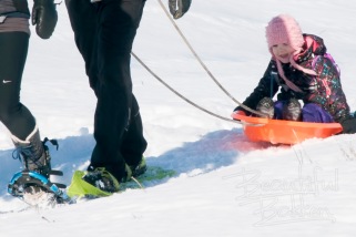
up to the challenge…it will be a good day for photos, or to just hike.  Anyone with good hiking boots who dresses warm can hike the region, you don’t need snowshoes.

Click here to see what hiking the region is like.

What would you need to try snowshoeing in the Badlands?  Want to rent snowshoes? You can.  I can steer you to the showshoe rental guy in Watford City.

See more in the Beautiful Bakken gallery. http://www.mykuhls.com/Landscapes/Beautiful-Bakken

Five reasons to use the Long X to break free of dreaded cabin fever

Explore the Badlands – hike, cross country ski or fat tire bike.

No, it’s not 75 degrees and sunny.

Yes, the air is fresh and the snow is deep, but that does not mean North Dakota tourism season over.   Here’s what we do.

We travel toward Watford City knowing we’d stop at the CCC Campground1.  That’s where adventurers see an unbelievably beautiful, pristine wilderness that few people ever see; and that’s the attraction right there, pristine wilderness that few people see.

There are several reasons The CCC Campground and the Long X trail are the best place to get a little winter outdoor time.

  1. It’s an easy travel distance and route
  2. It’s along the Little Missouri.
  3. The campground and parking area is well maintained.
  4. The trail is well-marked
  5. It’s an easy trail.
1. Easy travel distance.

Highway 85 from Belfield to Williston is a major federal highway, so we have good luck headed up that highway. Alternatively, we’ll head east across the state on Highway 200.

long x bridge spans the Little Missouri River

One of the few remaining through truss bridges in the state, The Long X Bridge marks the end of the Long X trail that begins in Texas. It spans the Little Missouri River which begins in Wyoming.

Up Highway 85, we always like to check out the historic Long X Bridge2 over the Little Missouri River. It’s south of Watford City, north of Grassy Butte.  The closer we get to the Long X bridge the more we perk up.  It’s an impressive landscape, colorful, striated, and beckoning.   That’s just a hint of what’s to come.

The entrance to the CCC Campground (CCC is Civilian Conservation Corps, a 100-year old government works program)  is at the very end of the bridge, just a few feet south.  We head west through a rancher’s rangeland pasture.  So, take it easy on those first couple of bends in the road. That’s where cattle are often milling about.

A herd of Charolais awaits drivers headed to the CCC campground and the Long X Trail. Just drive slowly through the herd an all will be well.

A herd of Charolais awaits drivers headed to the CCC campground and the Long X Trail. Just drive slowly through the herd and all will be well.

2. Along the Little Missouri River

At this section of the river through the Badlands, wildlife officials have stocked and increased the population of big horn sheep.  They’re not easy to see. The river you drive along started near Devils Tower in Wyoming. It snakes across Montana and North Dakota and empties in to the Missouri River about 65 miles east of the CCC Campground.

Mule deer are plentiful in the Little Missouri River valley.

Mule deer are plentiful in the Little Missouri River valley.

Most of the state's big horn sheep population thrives along the Long X Trail

Most of the state’s big horn sheep population thrives along the Long X Trail

The drive west is about a mile on a good gravel road, right along the Little Missouri River. At the Campground, we park on the west end at the literal start of the Maah Daah Hey trail and the Long X Trail.  On the south is the Little Missouri River. Beyond that, across the river is the north Theodore Roosevelt National Park.

The area is fairly undisturbed, since ranching blends in well with the environment.

That’s why it’s easy to see a sample of the wildest of North Dakota’s wildlife — deer and big horn sheep.

Winter-ready dogs love the chance to get out for some winter exercise

Winter-ready dogs love the chance to get out for some winter exercise

3. The area is well-maintained

There is plenty of room to park.  After we step out of the truck, we pull on our gloves and hoodies.  It’s cold at first, but once we get going, we warm up so that a lot of winter packing isn’t needed.  Here’s where people unload skis, bike or strap on their day pack.  Vehicles are safe, but we lock it anyway, and make sure we have the key secured in our inside coat pocket so we don’t lose it in the snow.

The parking lot and campground is well maintained for easy access.

The parking lot and campground is well maintained for easy access.

4. The trail is well-marked

If  you decide to hike this trail, you won’t get lost; just follow the tall posts with the angular cut top. Each post is marked with a turtle, the sign of the Maah Daah Hey3 trail. This portion is also the Long X trail, and the posts are marked with a Teddy Roosevelt brand.  At each post you can see the next post.

mary-hike-long-x-little-missouri-river-sunset

5. It’s an easy trail.

At first, the slopes rise gradually along the base of the hills.  People who hike or ski, can cut across valley floors between hills and ridges.  It cuts off quite a bit of distance on the trail since it switches back and forth to maintain a relatively easy grade for bikes. Hikers and skiers can cut straight across, at least until you come to a deep ravine.

The slope is easy to navigate even in the snow or on cross country skis.

The slope is easy to navigate even in the snow or on cross country skis.

_________________________________________________________________

Here’s the cautionary note:

Don’t go too far. It’s easy to start the jaunt feeling fresh and invigorated by the air, the scenery, the activity. So, it’s easy to think all that initial energy will last. For every step you take along the trail, you have to repeat that step going back.  Turn around or circle back early to save your energy for the return trip.  It’s easy to overextend yourself. ______________________________________________________________

We like these winter hikes because when we get done for the day we are exhilarated by the fresh air, the and exercise.  A hot meal at nearby Watford City is just 15 minutes away – and they know how to feed you there!


Oh yeah…the footnotes:

1In 1934, men from Civilian Conservation Corps companies 2771 and 2772 established camps adjacent to each other on the north bank of the Little Missouri River, not far from the old U.S. 85 bridge in the area that is now part of the North Unit of Theodore Roosevelt Park.  The CCC Campground at the head of the trail is a third campsite they built. There are other sites in the Badlands built by the CCC. Company 2771 moved out after a year, but 2772 remained here until the fall of 1939 when it transferred to a site in the South Unit, and that’s why it’s called the CCC Campground.

2The trail name, “Maah Daah Hey”, comes from the Mandan Indians. In the Mandan language, one word or phrase can describe a picture, feeling, or situation. In this case, the phrase means “an area that has been or will be around for a long time.” The trail uses a turtle as the trail marker. The turtle was honored because of its firm determination, steadfastness, patience, long life, and fortitude. Here’s where to find more about the CCC Campground and the trail head to the Long X Trail and the Maah Daah Hey trail.

Click here to read more about the new extension to the Maah Daah Hey

https://www.fs.usda.gov/recarea/dpg/recreation/recarea/?recid=79454&actid=29

The Long X Trail represents stereotypical historical, ranch life, that of driving large herds of cattle across the country from Texas to North Dakota. This achievement was first accomplished in 1884, when, under the leadership of A. N. Jeffries, the manager of the company, a daring band of Texan cowboys piloted a monster herd of cattle from the Rio Grande to the Little Missouri. The herd was guided by means of a compass, and reached North Dakota in September, having left Texas early in the spring. This process was repeated each year until 1897, and in this way the grazing lands of McKenzie county were replenished by new cattle

Click here to read more about the Long X Trail 

                   and here is more, too.

The tale of a doggone rescue

Ever get to a place that wasn’t what you expected and you can’t get out? You can’t go forward? You can’t go back?

That happened to my dog Gunnar on our last hike of the year.

Blue sky over the autumn landscape of the Badlands

Looking up at a distant hill, we start plotting our course. The public lands of the Badlands provide good hiking territory for dogs and their owners — with a few dangers such as porcupines, skunks rattlesnakes and coyotes

Thanksgiving is generally my last day-hike of the year. This year, the destination was the Little Missouri River Valley near where it empties in to Lake Sakakawea between Killdeer and Mandaree.  The bluffs, buttes and hills are fairly rugged, so we picked our route carefully through the valley.

Badlands riparian ridges provide good viewing of the landscape

Typically, we follow hogbacks, or ridges along the tops of valleys to see the landscape and pick our course. Since hunting season was underway, Gunnar wears a hunter’s blaze orange vest.

We found fascinating rock formations, including a wall of rivulet erosions down the hillside.

rivulets, erosion, rocks, hillside make for difficult hiking

Looking down the steep hillside, we pick a course to follow to the bottom


That’s when the dog decided he’d find his own way down.

The dog stops on a ledge looking down

Gunnar picked his own route to the bottom, but discovered it didn’t get him where he wanted to go.

Happily he scampered down…part way. Only part way.  He stopped.


With only a dozen feet to go, he came to an “Oops” moment.


Now what do I do?


He looked left, right, down and above.  He decided to just sit until the photographers did their things. He looked perplexed. He waited for the rescue squad to come in and help.

Dog sits in the rocks.

Recognizing his route to the bottom did not work, and that he could not climb back up, Gunnar stopped to look around


So, I did.


It really didn’t take much. I grabbed his shoulders, firmly, securely so he knew I had him.


The dog sits in his perch waiting for me to climb up and get him.

I climbed up to give him the physical security and guidance he needed to climb down from his perch.

I lowered him a bit down and he was saved!

Once he was coaxed off the rock ledge, he continued to make his own way down

Once he was coaxed off the rock ledge, he continued to make his own way down


You know, I think there’s a sermon illustration in there somewhere.

When Gunnar got to the bottom of the rock wall, he decided he'd had enough exercise and just wanted to rest.

When Gunnar got to the bottom of the rock wall, he decided he’d had enough exercise and just wanted to rest.

How to silence the noise of the day.

I’m tired of the noise. Aren’t you? The noise of the election. The noise of culture clashes. The noise in my own head.

So, when an assignment to shoot landscape out west, came along, I jumped at it immediately.

hay field, grasslands and in the distance, the Badlands

The Badlands in the distance interrupt the hay fields of the National Grasslands

The assignment was to photograph 20,000 acres of land along the ND/MT border that hadn’t changed much since Theodore Roosevelt ranched and hunted there in the late 1800s.  20,000 acres is about 30 square miles of rugged ranch land; the Beaver Creek Ranch. It was a warmer than normal November day, and weather conditions promised good light and good temperatures for exploring.

The further west we went, the more noise I left behind.

On the North Dakota/Montana border we turned north off of Interstate 94 on to a state highway, (we = Mary, Gunnar the foster dog and me).  Instantly, traffic disappeared; as far as we could see, the two-lane highway was ours.  Our mission was to find the rancher who owned the land designated as PLOTS land – Private Land Open To Sportsmen.

Triangle PLOTS signs mark areas where hunters and others can enter even though it is privately owned.

The sign marks land set aside under a cooperative agreement with the rancher. It is Private Land Open To Sportsmen, or PLOTS.

We saw the triangle signs marking PLOTS land, but it wasn’t what we were looking for.

Oh-oh! The noise in my head started coming back as I searched fruitlessly for the region I was assigned to photography.  I was frustrated, and so was the dog.  He wanted to get out to explore, so did Mary and I.  We kept driving. The old saying about finding your destination in North Dakota is true: If you think you’ve gone too far, you’re halfway there.

We checked out one gravel road to the east.  A herd of antelope grazed in a hay field.  That’s not what we were looking for, but it was a promise of things to come. Things were getting quieter.

Antelope or prarie goats were often spotted by Lewis and Clark when they came through here.

Antelope – or prairie goats as some people call them are wary critters who keep a long distance from people.


Back on the highway, a bit farther north and we found it. The Beaver Creek Ranch.  And wouldn’t ya know it, there it was, right on Beaver Creek.

Beaver Creek Ranch sign, PLOTS sign and map

The Beaver Creek Ranch PLOTS acreage is well-marked and includes a map that designates three parking areas. The area is for foot traffic only.

Earlier, I had called the rancher a couple of times and left voice mails, but got no reply.  I did get hold of one of the sponsors of the PLOTS program who told me to go on in.  He said I’d find at least three parking areas and recommended the one further in, back by the corrals.

The road starts out like a gravel road, and later it becomes a two-track trail. We rumbled and rocked across the basin where Beaver Creek meandered.

The beginning of the road in to the Beaver Creek Ranch is an easy gravel road until it turns in to a two-track trail that leads to a parking area.

The beginning of the road in to the Beaver Creek Ranch is an easy gravel road until it turns in to a two-track trail that leads to a parking area.

The bottom ground is the bottom of a basin that is sliced by Beaver Creek.  The rancher has one bridge but most of the time, he has to cross the creek by fords.

The bridge over Beaver Creek.

The bridge over Beaver Creek.


By the time we got to the corrals, the day was ending, the sun was setting and the moon was rising.  Now that may sound like a bad time to arrive, but it was a good time. It’s called The Golden Hour when shadows show contrast and the landscape is golden. There was no noise, not in my head, not in the surroundings.

While the sun was still illuminating the golden rocks, a nearly-full moon rose.

While the sun was still illuminating the golden rocks, a nearly-full moon rose.

As Mary explored the hills and ridges to the south, I went north.

A two-track trail gives the rancher access to the southern part of his ranch, but it's foot-traffic only at this point. A parking area is at the start of this trail.

A two-track trail gives the rancher access to the southern part of his ranch, but it’s foot-traffic only at this point. A parking area is at the start of this trail.

It wasn’t exactly silent, there is always a bit of a breeze rustling the grass and sweeping around the rocks.  But that’s not noise.  That’s a lullaby.  It’s soothing enough to make a fella breathe easy.   When I got to the top of the ridge and looked below me, the entire basin of Beaver Creek Ranch wandered northward from my perch.  The longer I gazed, the more I could see.  And none of it was noisy.

To the north, the rancher's access road snakes through the hills.

To the north, the rancher’s access road snakes through the hills.

I sat down and traced the distant trails where deer and cattle crossed the basin.  I scouted the hills to the north to trace where water flowed down to the creek, and where the rancher could access further pastures and hills to the north.

The sun was setting, the colors were turning gold and the contrast of shadows on the bluffs slowly covered the landscape.  And there was no noise.corral-rising-moon-sig-small

Once the sun disappeared, wildlife appeared.  Mule deer abound in the region.  mule-deer-pauses-inlight-sig-small young-mule-deer-on-ridge-toward-sun-sig-small mule-deer-doe-with-burrs-sig-small
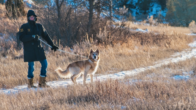
The area also includes turkeys, coyotes and elk.  There is evidence that an occasional mountain lion crosses the region.

It’s the absolute contrast to the noise of civilization, a part of North Dakota that many people don’t know about. Does that sound like something you could use in your world? Glad to give you directions if you want.


5 FREE things to do in North Dakota’s Badlands

Quick! Now that school is on break!

You’ve got a bit of time to gather the tribe of kids, family and friends to get out west and see a part of North Dakota that’s easily missed.  The best part is, the biggest cost will be your gasoline because there’s plenty to do in Western North Dakota that will build memories.  Here are five free things to finish out your summer memories.

#5 Fort Union Trading Post

Fort Union Trading post -- an authentic reproduction. Photo courtesy of Wikimedia Commons

Fort Union Trading post — an authentic reproduction. Photo courtesy of Wikimedia Commons

If you and your family like regional history or Lewis and Clark experiences, then head to the northwestern part of the state, and get right up to the Montana border.  About halfway between Sidney, Montana and Williston, North Dakota is the Fort Union Trading Post.  Late summer, it’s a fairly quiet place for you to explore.  In June the rendezvous brings the era  of the early 1800’s to life.  Decades before the Civil War, settlers, trappers, soldiers and tribes from the Northern Plains met here peacefully to trade goods.

This free stop on your late-summer tour of western North Dakota is best enjoyed by older children and adults. (But don’t worry, there are several other nearby sites such as Fort Buford and the Confluence Center that will keep the younger ones entertained. Or the best for all family members is nearby. It’s #1 in this list.)

Approaching from Sidney, take a gravel road north to the river to see how the trading post must have looked to trappers and tribes from across the river -- minus the wheat fields.

Approaching from Sidney, take a gravel road north to the river to see how the trading post must have looked to trappers and tribes from across the river — minus the wheat fields.

From inside the Fort, looking back to the other side of the river, in the trees where the shot above was taken.

From inside the Fort, looking back to the other side of the river, in the trees where the shot above was taken.

  To keep the youngest members of your group entertained, you probably won’t stay here long, but there are two more stops nearby.  Head around the bend to Fort Buford where you can camp (for a fee) or explore the Confluence Visitor Center and get three views of early Plains life.

#4 Wander Medora (but is this really free? Ice cream has a cost.)

It doesn’t cost anything to wander the streets of Medora.  There are several good places to eat.  If you’re an ice cream lover you’ll get surprisingly large servings.  Ice Cream at Medora is actually a summer goal for many families.  It’s easy to get to Medora, right off of I-94, about 25 miles from the Montana border.

If you and your family want to take advantage of the exercise opportunity, take your bicycles.  It’s free to pedal the streets and trails nearby. Many families do. There’s no cost to bicycle the town, take the East River Road south of town,  or take the recreation trail across the Little Missouri River to the west of Medora.

An option that is not free is to rent bicycles in town. Or bicycle in to the south unit of the Theodore Roosevelt National Park, you’ll have to pay the entrance fee.  Its entrance is on the edge of Medora.

A family takes advantage of the paved bicycle trails around Medora and out in the country.

A family takes advantage of the paved bicycle trails around Medora and out in the country.

Pay the entrance fee and take a bicycle ride in to the South Unit of the Theodore Roosevelt National Park. Take supplies, though. You will need to carry plenty of water.

Pay the entrance fee and take a bicycle ride in to the South Unit of the Theodore Roosevelt National Park. Take supplies, though. You will need to carry plenty of water.

North Dakota’s legendary Maah Daah Hey trail is a mountain biker’s dream. Families can get access to as much or as little of it as they want — free.  You don’t need a bicycle. Your feet go with you, right? Take them and use them.

Maps of the trail are available on-line, or buy the most comprehensive map from the U.S. Forst Service.

The U.S. Forest Service map costs about $13 and is the most valuable tool (other than your camera) that you can take.

The U.S. Forest Service map costs about $13 and is the most valuable tool (other than your camera) that you can take.

#3 Hike the Maah Daah Hey — head to the Ice Caves

Even short little hikes will keep the youngest in your family entertained if they know the destination is right down the path.  For a short hike with a rewarding destination, park at the Ice Caves Maah Daah Hey parking lot and take a half-mile hike to a cooling spot.   The Ice Caves is part of the Maah Daah Hey trail. It’s about 10 miles south of Grassy Butte on Highway 85 and then 10 miles west on a gravel road #713.  In the spring, snow run off melts in to the cave and freezes on the floor.  This time of year, there’s no ice, but it’s a great place to climb inside to cool off.

Inside the Ice Cave

Inside one of the Ice Caves

Hike around to the north of the Ice Caves to get a spectacular view of the North Dakota Badlands.

Hike around to the north of the Ice Caves to get a spectacular view of the North Dakota Badlands.  The caves are directly below where I’m sitting on the edge.

The Maah Daah Hey trail is marked with the turtle-branded sign posts, so it’s easy to follow the route.  Markers along the way give you information of different trails you can take

Hike the Maah Daah Hey to the Ice Caves. It's a short jaunt, less than a mile from the Ice Caves Parking lot. From the Magpie Campround it's about 3 miles, a full afternoon hike.

Hike the Maah Daah Hey to the Ice Caves. It’s a short jaunt, less than a mile from the Ice Caves Parking lot. From the Magpie Campround it’s about 3 miles, a full afternoon hike.

#2 North Dakota grasslands

A short hike in to the Long X Trail south of Watford City will open the valley to your family’s challenge. You can stay on the trail at the bottom of the valley, or pick a point and climb to the top.

Some of the best trails for a family are the Long X Trail south of Watford City on the southern edge of the Little Missouri River.  Near Grassy Butte are the Beicegel Trail and the Bennett Creek Trail.  Signs on Highway 85 direct you to both trails. They are easy trails, both give you a flat starting out point and provide hill-top challenges that reward you with a spectacular view.  Tall wooden markers along the trail are easy to follow.

The best views are from up on high.

The best views are from up on high.

Climbing seems is a favorite passion of children, so pick a high point that matches their skills.  Even the shortest of the tall bluffs and buttes gives kids a chance to build their muscles and their confidence.

A rest break is called for on the climb up a bluff off the trail.

A rest break is called for on the climb up a bluff off the trail.

Oliver, my grandson likes the challenge of a good climb

Oliver, my 6-year old grandson likes the challenge of a good climb

Click here to Read more about the Maah Daah Hey south of Medora

#1 Fairview Lift Bridge and the Cartwright Tunnel

North Dakota's only lift bridge was retired from service before it ever lifted for a steamboat.

An autumn shot of North Dakota’s only lift bridge was retired from service before it ever lifted for a steamboat.

This free exploration will entertain the entire family.  It’s on highway 200 at the North Dakota-Montana state line.  To the west of the Fairview lift bridge, or on the right side of this above photo is the parking log and entrance to the fenced-off walkway across the bridge.

The safety fence gives families a safe place to walk the Fairview Lift Bridge. Children love the view from high above the water.

The safety fence gives families a safe place to walk the Fairview Lift Bridge. Children love the view from high above the water.

Once you start the walk across the bridge, you’ll get a great view of the well-maintained park below where you can enjoy a picnic in the shade of the trees.

Below the Fairview Lift Bridge is a park where you can fish.

Below the Fairview Lift Bridge is a park where you can fish.

The final reward of the Fairview Lift Bridge is the Cartwright Tunnel.

Built by hand, trains passed trough this tunnel until about 1986.

Built by hand, trains passed trough this tunnel until about 1986.

Until the mid-1980’s trains passed through the tunnel across the bridge.  It’s a quarter-mile long pass through the hill and provides children with a memorable experience — but take a flashlight. It gets dark in there until you get close to the opposite end.

The Cartwright Tunnel has a slight bend in it. Flashlights illuminate the way.

The Cartwright Tunnel has a slight bend in it. Flashlights illuminate the way.

Exploring the tunnel thrills youngsters, but oldsters will be impressed with the knowledge the tunnel was built by hand by local ranchers and farmers using picks, shovels, ox or donkey carts.  It’s guaranteed that you will at some point utter one word: “wowl!”  It’s more impressive than you would think of a bridge and tunnel.

Click here to see the Facebook Page called “Beautiful Bakken” for more on the bridge and tunnel

The nearby Snowden Lift bridge is still in use. It’s downstream about 12 miles.  You can see more about it here.

Downstream (north) of the Fairview Lift Bridge is the Snowden Lift bridge. Though it no longer lifts, trains still cross the river on the Snowden bridge.

Downstream (north) of the Fairview Lift Bridge is the Snowden Lift bridge. Though it no longer lifts, trains still cross the river on the Snowden bridge.

Click here to see more about the Snowden Lift Bridge

Admittedly, these free family features are on the sparsely settled region of North Dakota. So, if you’re planning a visit, pack a picnic, or plan to stop in Sidney, Mt, Williston, ND, Medora, ND,  or Dickinson, ND for a bite to eat and a break from your day of discovery.  It’s all free, if you take a lunch, pack your bicycles if you want, and explore legendary North Dakota.