The county is larger than Washington DC, Rhode Island and Delaware. When settlers moved to the area, McKenzie County was known as an island and called the Island Empire. You cannot get to it without crossing water.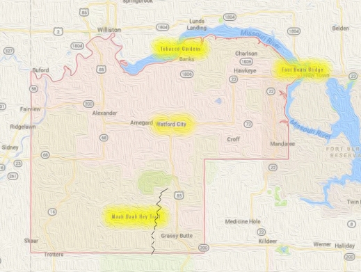
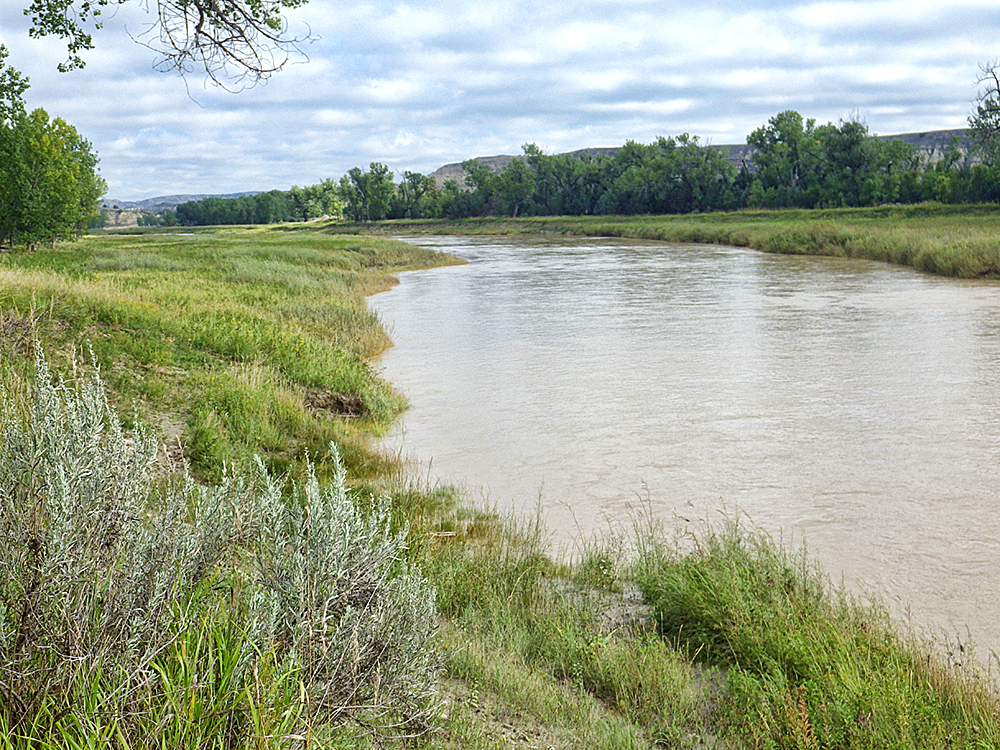
The Missouri River, Yellowstone River and Little Missouri River set the boundaries of the county. They also contribute to the world-class recognition of McKenzie County.he largest county in the state, McKenzie County has always been fascinating, going back to the Dakota Territory days.
I was first intrigued by the county thanks to the historic McKenzie County Grazing Association, a rancher group intent on maintaining the industry and the environment that supports ranching. From there, my interest and my involvement in the county’s heritage grew.
There are five world-class points in the county:
- Four Bears Bridge
- Lake Sakakawea
- Theodore Roosevelt National Park
- Maah Daah Hey trail
- Rough Rider Event Center
Sure, you can take a day trip to buzz through all six locations, but why would you? We put this together so you can take advantage of vacation days, weekends or holidays through the year to explore the adventures, get insight and history of America. It’s yours to enjoy. Each site is free or very low cost.
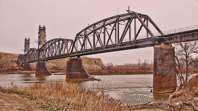
Four Bears Bridge
The mile-long Four Bears Bridge spans the Missouri River and Lake Sakakawea
This mile-long bridge is the latest effort to overcome the continental division of the Missouri River. During four construction seasons, 2003-2007, a new $55 million dollar bridge was built using context sensitive design. It won several international design contests and is recognized as a model for designing a modern structure that seamlessly fits in the cultural, natural, social and economic environment of the area.
Each sweeping arch is designed to transfer the load in to the piers and the rock bed 90 feet below the water. The chopped off cones at the base of the piers are designed to stand up to ice floes coming downstream.

Each arched span directs the weight of the bridge in to the piers
Walk the bridge to see artwork detailing the history of the Three Affiliated Tribes of the Fort Berthold Indian Reservation, the MHA Nation. The stories of the Mandan, Hidatsa and Arikara nations are on storyboards on both ends of the bridge.
Here’s what you can do here next to an internationally recognized engineering feat (and it’s free!):
- Walk across,
- Walk under
- Follow the recreation trail,
- Learn history
- Have a picnic.
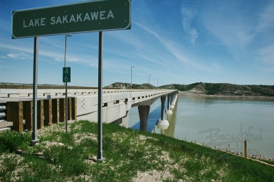
Lake Sakakawea

Lake Sakakawea is 180 miles long, providing public shoreline access from which sunrises and sunsets can be viewed.
Damming the Missouri River at Garrison with Garrison Dam, created a magnificent 180-mile long lake with 1,530 miles of PUBLIC shoreline. The Army Corps of Engineers says the lake covers 382,000 surface acres making it the largest manmade lake in North America where the entire shoreline is open to the public.

Pontoons and other boats take full access of the 300,000-acre lake.
It is world famous for its recreation, walleye fishing and its paddlefish snagging.
Here’s what you can do here next to this world-famous lake:
- Hike the shoreline
- Watch sunset/sunrise
- Visit the parks
- Learn history
- Have a picnic
- Fish
- Boat (fishing, sail, jet ski)
- Scuba Dive
- Camp
- Swim
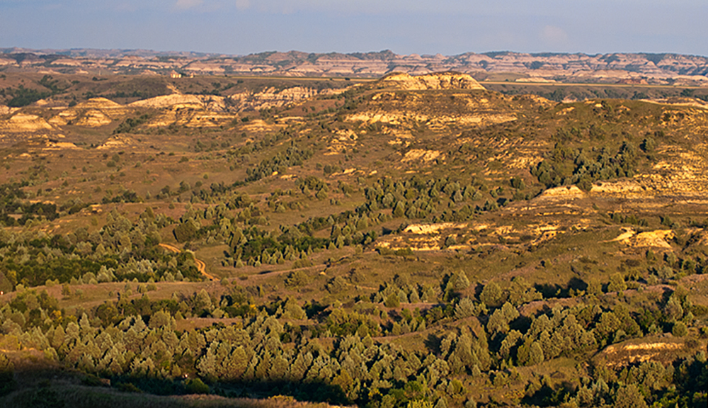
Theodore Roosevelt National Park
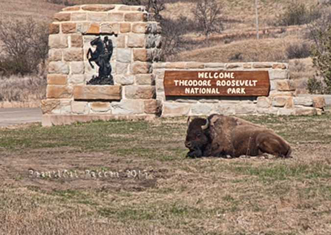
Bison roam freely at the Theodore Roosevelt National Park. They are not domesticated, so give them plenty of space.
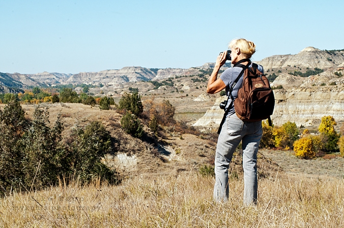
Undersold and over delivering as a National Park, the North Unit of the Theodore Roosevelt National Park (TNRP) is on the south edge of McKenzie County. It is a rugged wilderness with a variety of trails through the park to suit all types of hikers. The roadway through the park takes visitors to the Riverbend Overlook cabin above the Little Missouri River. Along the drive, it’s likely you will see a collection of bison or other species such as mule deer.
When Theodore Roosevelt came to Dakota Territory to hunt bison in 1885, he was a skinny, young, spectacled dude from New York. He could not have imagined how his adventure in this remote and unfamiliar place would forever alter the course of the nation. The rugged landscape and strenuous life that TR experienced here would help shape a conservation policy that we still benefit from today.
–National Park System publication on the TRNP

On the Achenbach Trail, the views of the Little Missouri River Valley are outstanding.
It would seem a great number of visitors view the park through their windshield. They’re missing out. There are several trails in the park to accommodate all levels of fitness. One of the most challenging is the Achenbach Trail. It is 18 miles long and you can extend it into a two-day hike. (Anyone intending to camp in the backcountry must obtain a free backcountry permit prior to their trip. Permits are issued at the South Unit and North Unit visitor centers.)
Here’s what you can do here next to this National Park:
- Hike
- Picnic
- Photograph
- scout wildlife
- access the river
- research, browse books
- drive
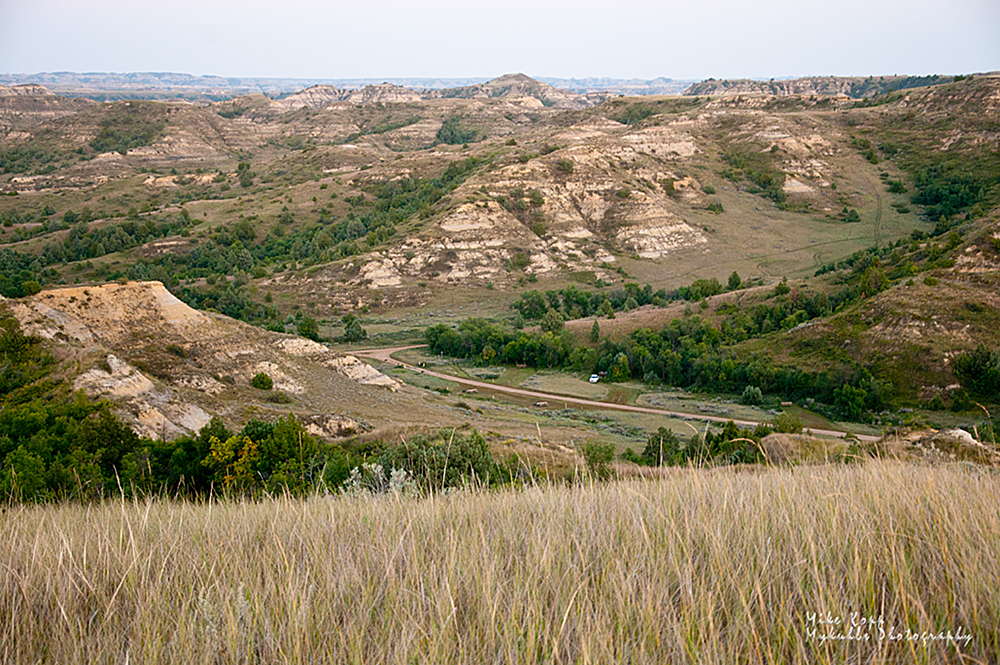
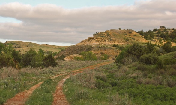
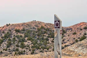
Maah Daah Hey trail (Otherwise knowns as the “lasting a long time” trail)

The world-class 125-mile long Maah Daah Hey trail attracts riders from all over the United States and many European nations.
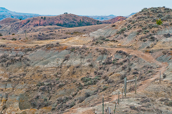
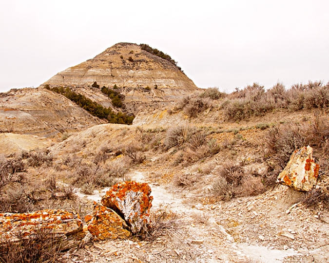
Imagine a 125-mile trek through Badlands wilderness on a mountain bike, horse or on foot. Mule and whitetail deer, antelope, wild turkeys, beaver, prairie dogs, and coyotes are often sighted, while an occasional golden eagle, red-tail hawk, or prairie falcon may be spotted soaring above. Bighorn sheep and elk have been reintroduced into the area and can be spotted by keen observers.

On rare occasions, you can catch a glimpse of the Big Horn sheep.

Wildflowers such as this crocus adorn the trail.
The single-track mountain bike trail has attracted world riders to visit with their $4,000 bikes. You can rent mountain bikes on the south end of the Maah Daah Hey trail at Medora.
The dream was to connect the two units of the Theodore Roosevelt National Park. The actual planning and building took about 14 years. It’s a difficult trail to maintain through the erosive and wild Badlands. In recent years, your tax dollars have not been spent to keep it up. Locals including the Save the Maah Daah Hey trail group sculpt and mow the trail. The group hosts the annual Maah Daah Hey 100 mountain bike ride: 100-miles in one day. The winning time is just minutes under 10 hours.
There is no time of year that is a bad time to strike out on the trail. Of course, North Dakota’s legendary afternoon and evening thunderstorms can make the trail very challenging even for the most experienced adventurer. 
Don’t be scared off by the massive challenge the Maah Daah Hey can present. There are plenty of short-access hikes, here’s where you can get on the trail to get in to the Badlands:
- CCC Campground
- Summit Campground
- Bennet Creek
- Beicegel Creek
- Highway 50 West of Grassy Butte
Rough Rider Event Center
 Imagine a $100-million indoor swimming pool with a few extra features. That’s a silly way to describe the Rough Rider Event Center. It is an auditorium, arena, gymnasium, and indoor water park, swimming pool, walking track, two ice hockey rinks, convention center, coffee shop and restaurant. Concerts, conventions, hockey and basketball tournaments draw thousands of people to the Rough Rider Event Center.
Architect’s specs:
- 22,000-square-foot multi-use field house
- Three basketball courts
- Removable artificial turf
- 1,000-seat hockey arena
- Separate practice hockey rink
- 3,000-seat arena for sporting events and concerts
- Eight executive suites
- 12,000-square-foot gymnastics club
- 10,000 square feet of convention space
- Continuous elevated running track.

Watford City visitors can use the facility for a surprisingly low fee. For $7.00 visitors can enjoy daily use of any open activities, including swimming.
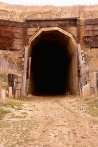
Just because these are the six world-class sites in McKenzie does not mean there are no more incredible places such as the Long X Museum and Visitor Center, art galleries and coffee houses in Watford City, Fairview Lift Bridge, the Cartwright Tunnel, Grassy Butte and its post office, the Frontier Village, the museum at Alexander.
There’s a lot more to these five world-class sites. Type the word “McKenzie” in the subject line of the contact form to know:
-
more about each one
-
how to get to each one
-
recommendations activities at each site
-
the history of each site
It’s free!
We’ll send you a 20-page travelogue for free just because we think McKenzie County is worth bragging about and you will too. So, have a good time.
Oh, and click to subscribe to this blog to learn more of events, locations, activities each week. Pictures, information, and helps each week are posted here.


 The area also includes turkeys, coyotes and elk. There is evidence that an occasional mountain lion crosses the region.


 Go back to the first Hidatsa scout, Sakakawea (Hidatsa pronunciation suh-CAG-a-wee-uh). She and her husband Charbonneau helped the Corps of Discovery find its way west and back again.

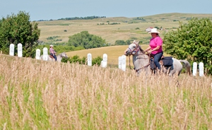

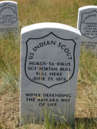


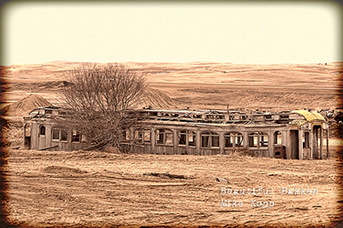
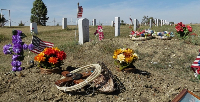
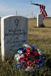
 Have you taken the scenic drive past Garrison, up to Parshall on 1804? Did you see the Old Scouts Cemetery?


 Along the way we saw several signs that spring is here, that there is new life after a long cold winter. Like some people celebrate the first robins, ranchers and prairie folk celebrate the first crocuses of spring.


 The environment picks up that warm golden glow. Across the river the sun drops behind Oliver and Mercer Counties.