
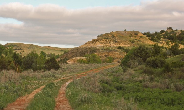
Labor Day weekend is a great weekend to get away from your neighborhood without spending a lot of money.
Ready for some freedom? This is the weekend! It’s a 3-day weekend for you to rest from your labors, and here are opportunities for you to get out and get away!
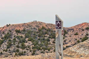
Free – The added bonus for the weekend is for families who’ve spent a ton on school supplies. It’s free educational support for geography, geology, history, math, engineering, physics and geometry.

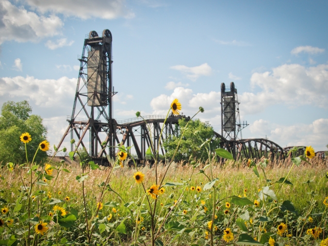
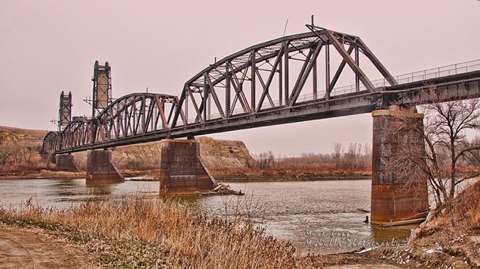
Fairview Lift Bridge is so impressive that by the time you get across the bridge and through the tunnel, you will say “Wow” at least once.
1 Fairview Lift Bridge and Tunnel
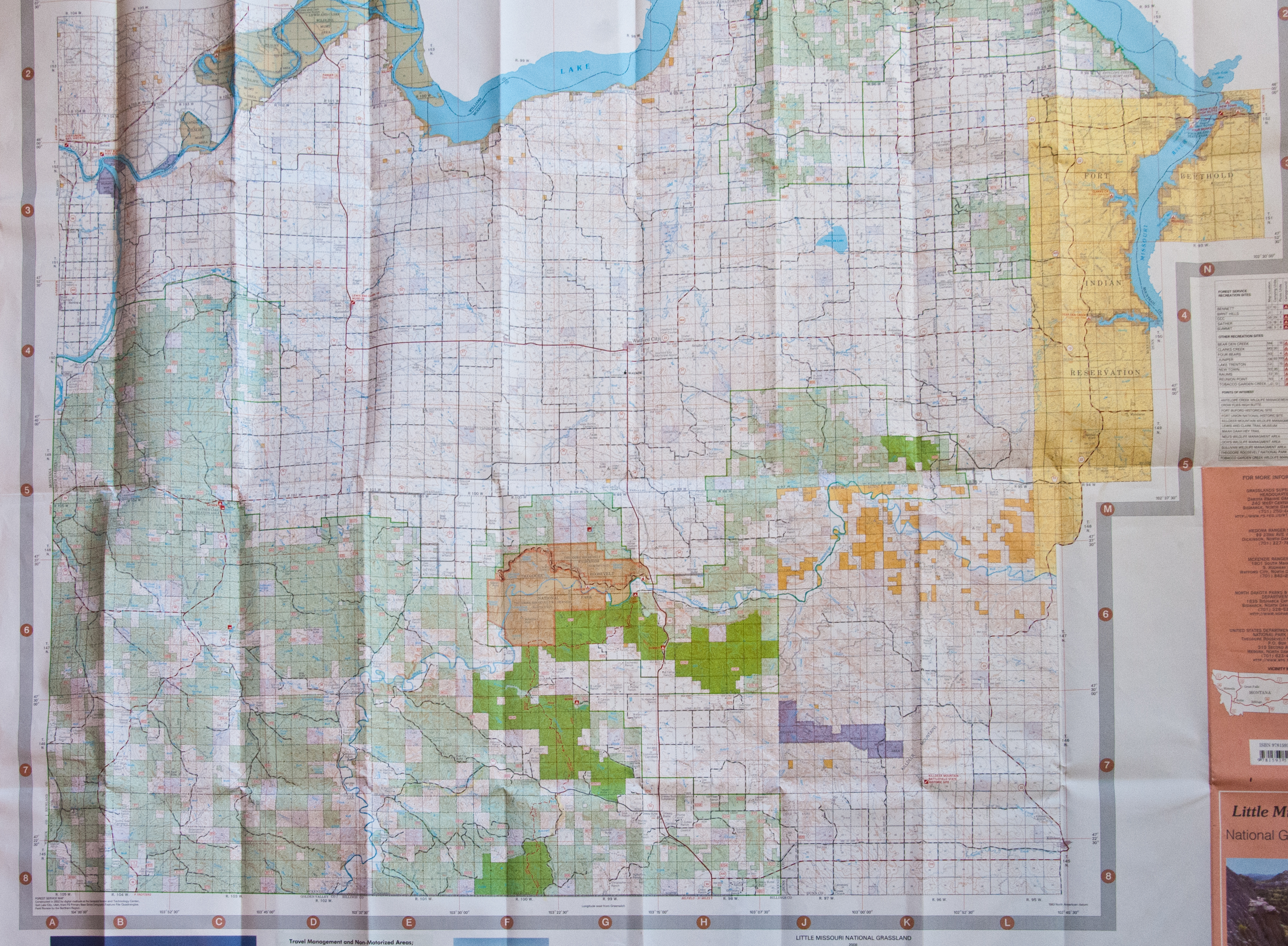
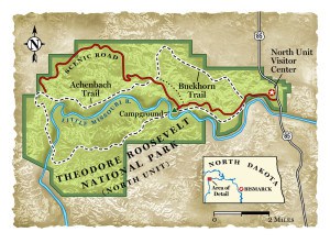
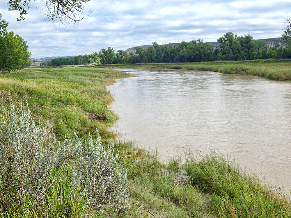
While the day is cool and everyone has enough energy for the walk you will want to take, head out on Highway 200 west of Watford City to the state line at Cartwright and Fairview.

Main Street Cartwright offers clean, cool well water for thirsty people — and their horses.
Once you get to Cartwright, stop on main street for a memorable cool drink of water, from the town pump that’s been there since the last century. You can’t miss it, but you better because those are pretty strong guard rails around it. It sits right in the middle of what would be “Main Street.”
 As soon as you cross the Highway 200 bridge turn south in to the Sundheim public park on the west bank of the Yellowstone. Drive up the ramp to the parking area and take a hike. It’s safe, secure, handicap accessible and above all, you don’t have to worry about meeting a train like travelers worried about 30 years ago. Both the bridge and tunnel are closed to all traffic except pedestrians.
There was almost no steamboat traffic on the Yellowstone when the bridge was built, but it was still considered a navigable waterway. So, the U.S. Government required one span over the channel to be lifted for steamboats. The machinery was installed to raise the 1.14 million pound lift section of the bridge.

Overhead, the 300-ton counterweight still sits ready to be used.
It operated only once, as a test, and was never used for commercial river traffic.
When it was built, with the required, but unnecessary lift section, there was not enough money to also build a highway bridge, so this bridge was modified to include vehicles as well as trains by adding planks across the bridge. Traffic was controlled by a watchman who make sure there were no trains coming when a car or truck wanted to cross. The bridge owner, Great Northern Railroad charged a toll. Late in the 30’s the North Dakota Highway Commission took over the bridge and the toll was dropped.
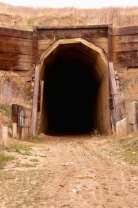
While you’re at the Fairview Lift Bridge go ahead and walk on in to the Cartwright Tunnel. It’s bout 1500 feet long with a slight bend in the middle so that you cannot see one end from the other.
It’s a wooden-planked tunnel large enough for trains to pass through, and most importantly, it was built by hand. Sure, they used dynamite to blast the rock, and horse-drawn carts to carry out the rubble, but the labor was provided by local farmers and ranchers who needed a job in 1913.
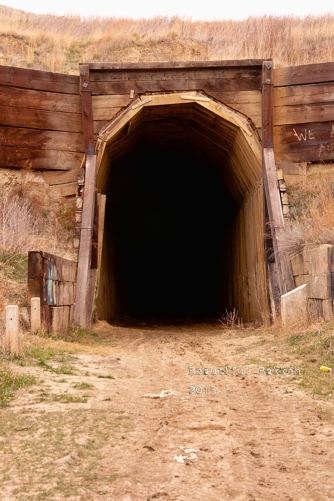
Built by hand, trains passed trough this tunnel until about 1986.
During the years of shared use with cars, trains took the tunnel while cars drove overhead and down to the bridge.

State Historical Society of North Dakota, William E. (Bill) Shemorry Collection (1-44-12-29)
There are no lights in the tunnel, so be prepared for dark. Most cell phones have a flashlight feature to use. Or take that one from your glove compartment. You do carry a flashlight, don’t you?

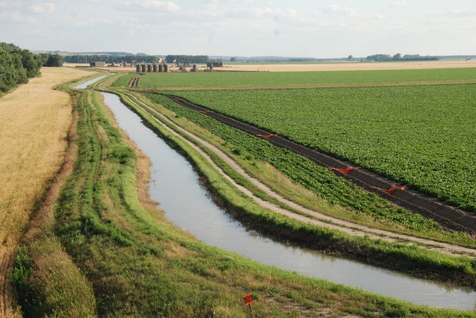
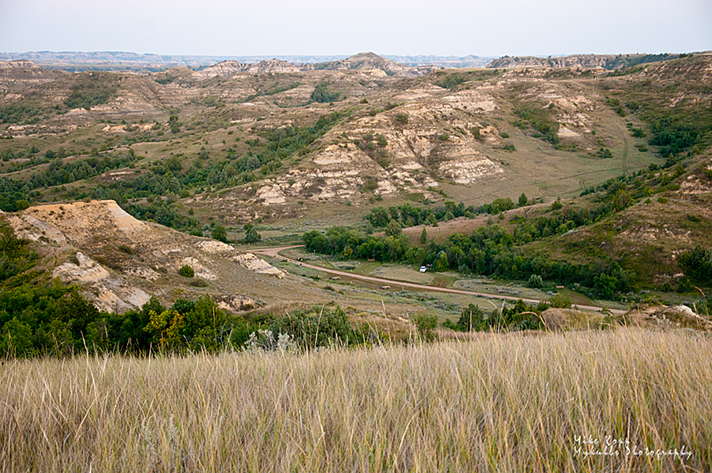
Your next stop is just 20 minutes down the road and is another free educational moment – agriculture. As you travel along the Yellowstone River, you’ll see irrigation farming that uses more than one techniques such as traditional overhead irrigation sprayers, or ditches and tubes.
1 (alternate B) if you want to expand your lift bridge experience, head north up highway 58 and then highway 147 to the twin of the Fairview Lift Bridge to the Snowden Bridge in Montana. It’s about 20 minutes up the road, and is still in use. It too once carried automobile traffic until the mid-1980s.
In addition to, or instead of the Snowden Bridge, stay on highway 58 and head to Missouri-Yellowstone Confluence Interpretive Center and the Fort Buford historic site. You can picnic here, if you skipped Sundheim Park.
2. Missouri-Yellowstone Confluence Center 
When you stand here, you stand in a place of significance that goes way back before the wild west of cowboys, even back before there was a United States of America.
Your educational opportunities here include geography and history as you trace the flow of the water from south and west to this location. The museum also includes the rich history of trappers and traders who passed through here in the late 1700’s and early 1800’s as well as the Corps of Discovery’s mission through here.The Confluence Center has a gift shop and a museum.
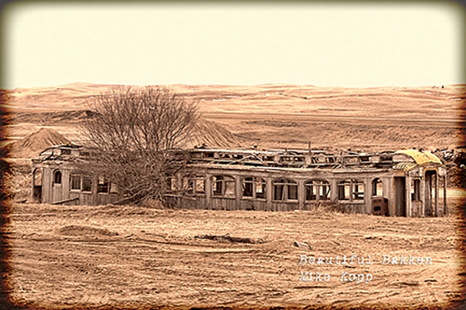
Take a moment to check out the large images of the Fairview and Snowden bridges, bison from the region, views of the Badlands, and of Fort Union Trading Post, all from the Beautiful Bakken Collection of Mary Tastad’s photos and mine.
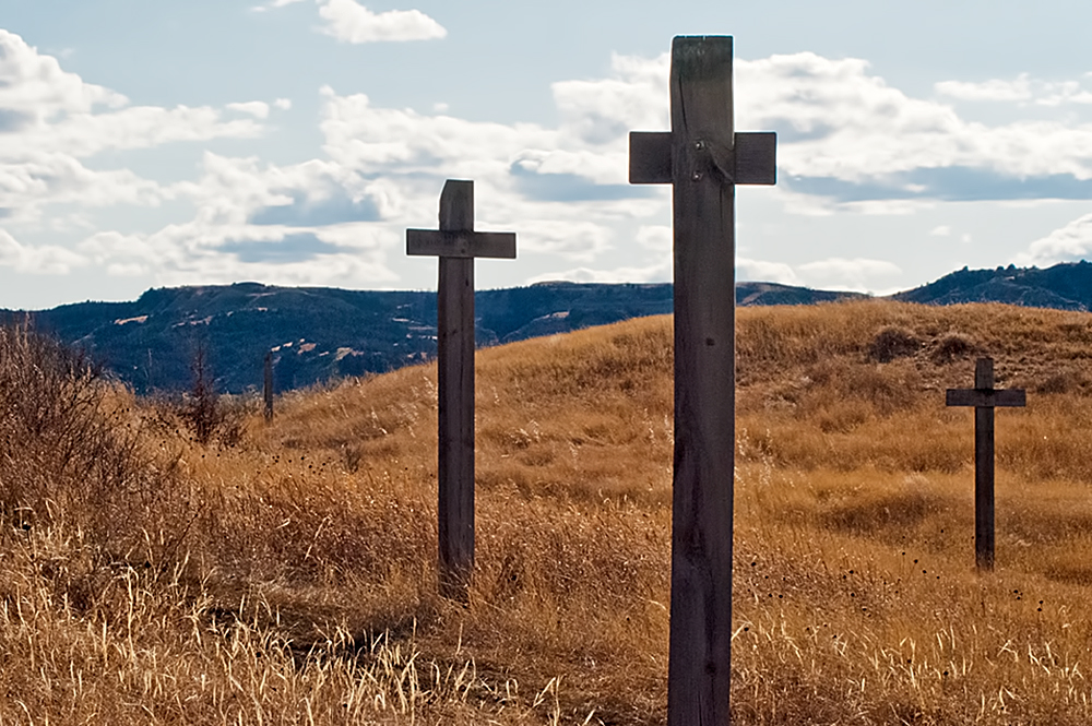
 Walk the 6-block long blacktop trail from the Confluence center down toward historic Fort Buford where an actual cemetery with
 less-than-actual headstones inform you about how tough it was living here 150 years ago.

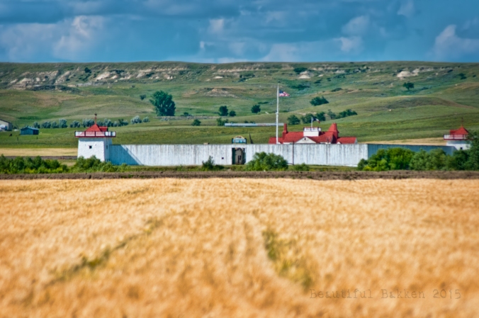
Fort Buford had a military mission, but it is probably best remembered as the place where the famous Sioux leader, Sitting Bull, surrendered in 1881. When the fort was first under construction, the first or second day, Sitting Bull attacked the Fort, killing one soldier. Not one to give up easily Sitting Bull and his warriors kept up their attacks on soldiers and wood cutters who were passing through the region. Civilians, soldiers and Sioux warriors were killed.
You can walk past the Fort Buford site for free. To go inside, you’ll have to pay a $5.00 fee for adults, less for children.
3. Fort Union Trading Post
Finally, plan your day trip to end at the Fort Union Trading Post. It about 10 minutes away. An interesting factoid is that to get in to the Trading Post, you actually drive in to Montana for a few feet on Highway 1804, then back in to North Dakota.

Plan to arrive bout 5:30, but make sure you stay until just before sundown, about 8:00. (Sundown is about 8:45). That’s the last Bell Tour. This is the pinnacle of your day’s free educational events. This Labor Day weekend, is also the Living History Weekend where you’ll see how things were done 150 years ago, including a shooting demonstration. Costumed re-enactors will help you visualized how life was lived before statehood.

Labor Day weekend is “Living History” weekend at the Fort Union Trading Post.
The Fort Union Trading Post was not a military or government institution. It was a privately owned facility to provide a shipping point of furs and pelts out of the region to points east, including Europe. As many as 200 people were employed here. As a business enterprise, it is estimated that each year, more than $100,000 worth of business was done here. (Imagine how much money that would be in 2016 terms!)


The buffalo hides, beaver pelts and other furs were carried over long distances to reach the Trading Post. In what are now the states of Wyoming, Montana South Dakota nad North Dakota, trappers and traders would rendezvous back here to make their exchanges. In exchange trappers and traders could get necessities such as rifles, cookware, coffee and food stuffs. At least five indigenous tribes (Assiniboine, Crow, Cree, Ojibway, Blackfoot, Hidatsa, Mandan) traded buffalo robes and other furs for trade goods such as beads, guns, blankets, knives, cookware, and cloth, including the Assiniboine who are said to have requested the American Fur Company establish this “shopping center.” The Assiniboine tribe also protected the Trading Post from less friendly tribes.


The folks at the Fort Union Trading Post shared this about the Last Bell Tour:
During the tour, participants will discover why the summer of 1832 defined Fort Union’s future importance in the western fur trade. They’ll hear from the first artist to visit Fort Union, find out what industrial advancements revolutionized how Fort Union was re-supplied, and observe the effect a new trade partner, one formerly loyal to the British Hudson’s Bay Company, had on the peaceful coexistence between Fort Union’s traders and its visiting tribes.
The family-oriented tours will begin in the parking lot closest to the fort. Departing at 15-minute intervals, each guided tour will include 20–25 people who will be lead through a series of five inter-related scenes portraying events from the summer of 1832. Refreshments for participants will be available at the registration table in the parking lot. During the tours, the only illumination will be provided by candlelight, lanterns, and lit fireplaces.
Click here to learn more about visiting the Fort Union Trading Post
At the end of the day, you are just 30 minutes from fine eating at Sidney, Montana or Williston, North Dakota. We’ll tell you more about fine dining, family dining and night life in those two communities another time.
Until then, enjoy your free educational tour of Western North Dakota.


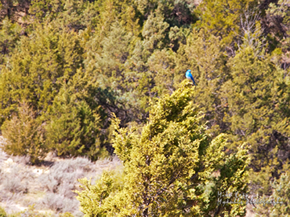


 Along the way we saw several signs that spring is here, that there is new life after a long cold winter. Like some people celebrate the first robins, ranchers and prairie folk celebrate the first crocuses of spring.


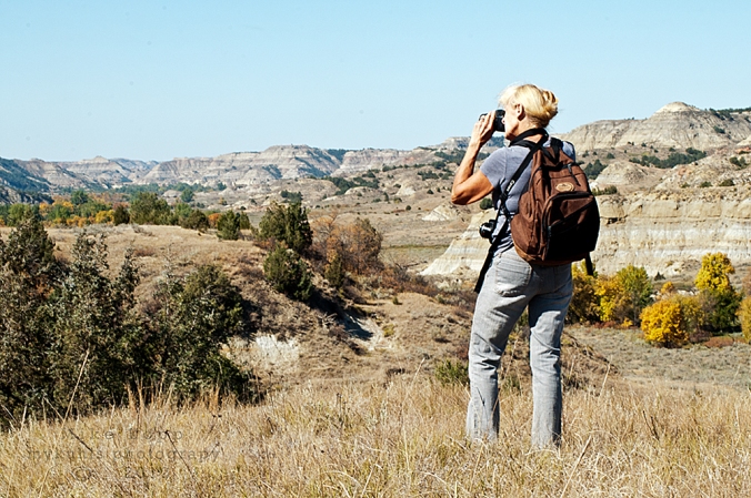
 Our mission was to photograph a seasonal transition, capturing the change from early spring’s dormant brown to the more lively green. A few hints of spring met us along the slope such as the wildflowers sprouting ahead of the green grass.
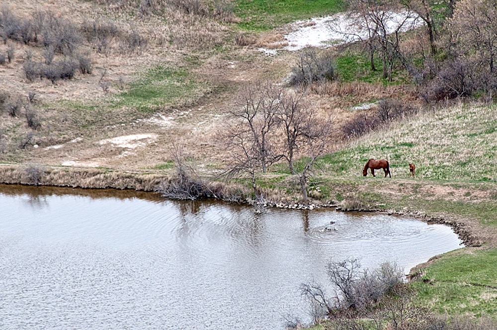

 We stopped to see if the white mare and black cold would get closer. We were between them and the water — their apparent goal. Mom
  protected her babe, so they skirted around us. We stopped, watched and photographed their patient easy stroll past us. They disappeared over the hill.

 We’d met our goal. We’d captured signs of spring in the beautiful Bakken region of North Dakota where nature underground is yielding a harvest of plenty and where nature above the ground displays the beauty we’ve come to see.


